RIO BRAVO CONSERVATION & MANAGEMENT AREA
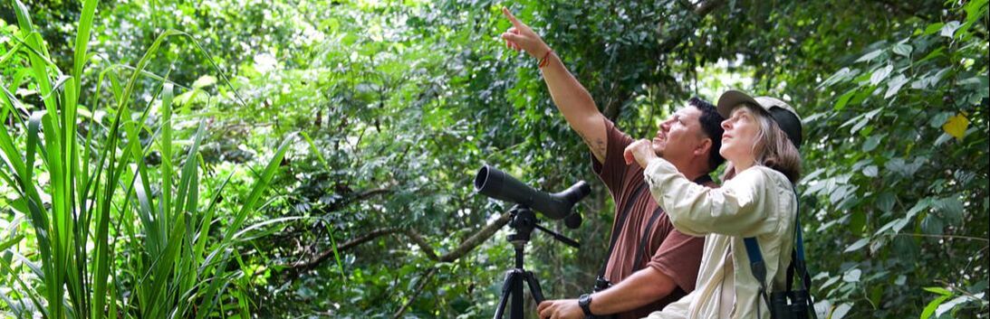
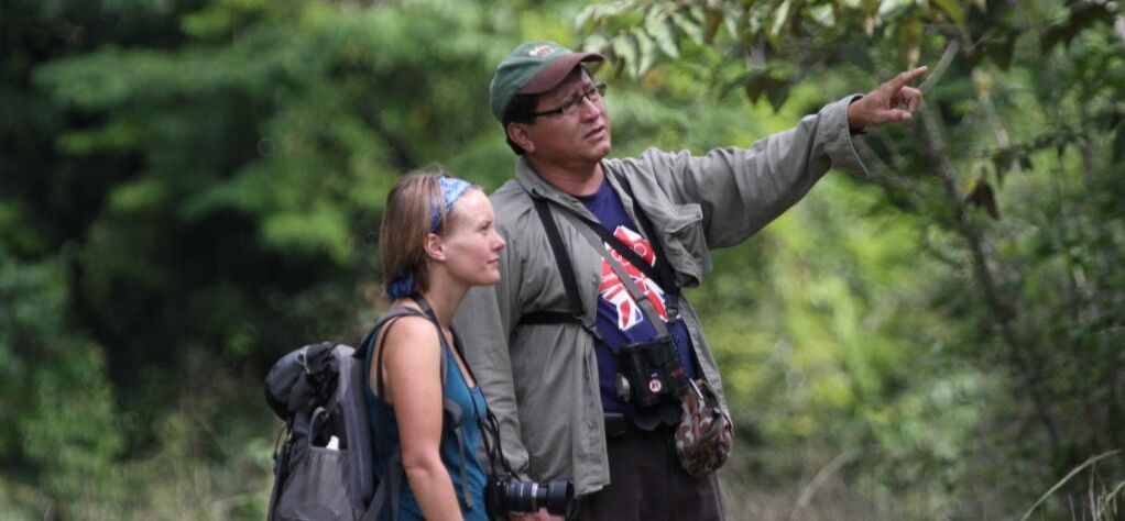
Why Should I Consider Visiting the Rio Bravo Conservation & Management Area?
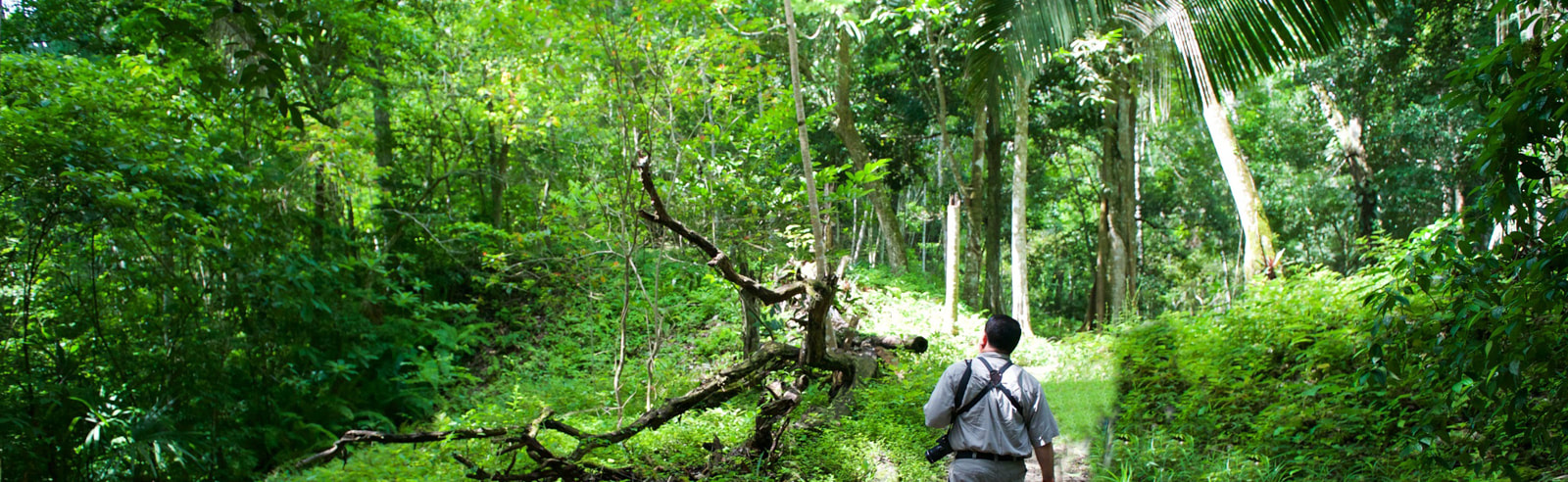
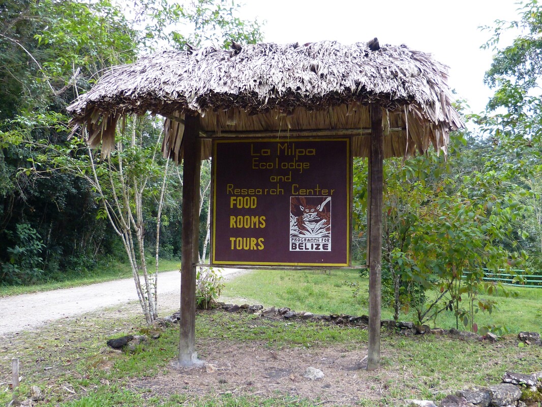
Though not open to the general public (specifically for qualified research personnel), Program of Belize (Rio Bravo Conservation & Management) is a task force set to researching the La Milpa Archaeological Site, seeking to learn more about how the ancient Maya civilization evolved, was organized and sustained, and why most of its centers eventually collapsed throughout the region. The site offers accommodations for those qualified and interested in donating and volunterring, to help further the research on the area.
The Rio Bravo Conservation & Management Area (110,44 acres) was originally purchased in 1988 by Gallon Jug and the Programme for Belize. Additional donations came from the Coco-Cola Foods, Inc. and the area under protection has since now grown (as of 2016) to 254,000 acres. Their mission is to conserve the biodiversity and promote the sustainable development of Belize through proper management of the Rio Bravo Conservation and Management Area. Programme for Belize is tasked with protecting the 240 species of trees, 70 species of animals, 400 species of birds, and 12 endangered animal species including the jaguar, the black howler monkey, and Belize’s national animal, the tapir.
Mission - Programme for Belize
(PfB) was established in 1988 with the mission to Conserve the Biodiversity and Promote the Sustainable Development of Belize through the proper management of the Rio Bravo Conservation and Management area (RBCMA). Therefore, PfB’s flagship project is the RBCMA
Achievements - The major achievement by Programme for Belize since 1988 has been the establishment of the Rio Bravo Conservation and Management Area (RBCMA) beginning in 1989 as a private reserve to conserve forested land and other natural ecosystems in north-western Belize threatened with deforestation and fragmentation. The total area under protection in 2016 is 254,000 acres.
Other Achievements
- Establishing the La Milpa Lodge and Research Center
- Establishment of Hill Bank Field Station
- Development of 6 generations of Management Plans
- Maintaining permanent Management and Protection presence in all sectors of the RBCMA.
Topography - Research Facilities
The Rio Bravo Conservation and Management Area has two facilities at Hill Bank and La Milpa, serving as centers for field based conservation initiatives. It has propelled Programme for Belize towards remarkable success and put Belize at the forefront of scientific research and conservation.
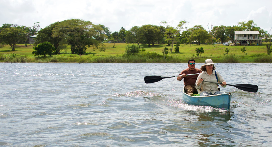
The Hill Bank Field Station, situated on the banks of the New River Lagoon, facilitates research activities to ensure the protection and wise management of the forest. It hosts primary projects such as the Forest Rehabilitation Programme and the newly established Freshwater/Aquatic Programme.
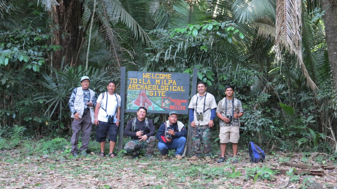
Located only three miles from the third largest archaeological site in Belize, the La Milpa Ecolodge and Research Center facilitates archaeological research though agreements with the University of Texas and Boston University. Through research carried on at and around the La Milpa Archaeological Site, Programme for Belize expects to learn more about how the ancient Maya civilization evolved, was organized and sustained, and why most of its centers eventually collapsed throughout the region.
Research within the borders of the Rio Bravo serves also to support a Contingency Planning Programme by clarifying the implications and potential impacts of economic development projects on the site. A planned road upgrade and test drilling for oil in the general area, for example, have the potential to increase pressure on Rio Bravo’s ecosystem. The degree to which they do so is highly dependent upon how they are implemented. In preparation for these potential scenarios, Programme for Belize must be in a position to help integrate developmental and environmental interests.
Chicle Production - Horticulture
The land of the RBCMA has historically been used by chicleros, who harvested the gummy sap of the sapodilla tree, commonly known as Chicle, for sale to the international chewing gum producers. Initially, trees had approximately 15 years to rest before a chiclero returned to harvest it. As the demand for Chicle grew, chicleros returned more frequently to the trees and over-harvesting eventually diminished the population of sapodilla trees. It is widely believed that this lack of sustainability was a primary factor in the decline of the market and the substitution of Chicle by other gums, both natural and artificial.
In its land use plan, PFB had mapped out blocks of forest for Chicle harvesting. Some of these plots were dedicated to research to monitor the effects of harvesting on the sapodilla tree population and to determine an optimum rest period between harvests. On the production plots, PFB expected to achieve a sustainable yield of approximately 2.5 – 5 tons of Chicle per annum. The pilot project began in October 1993 and was completed in February 1994. The Chicle produced was analyzed and determined to be of a high quality. Market conditions however did not allow for the continuation of this project.
Generally speaking the entire area forms part of the Yucatan Platform and is underlain by massive beds of limestone. Faulting on a NE-SW alignment has created a series of blocks that are slipping downwards to the east, resulting in a series of escarpments across the landscape – Lalucha, Rio Bravo, Booth’s River and New River within the RBCMA with the sequence continuing eastwards to the outer cayes. The Booth’s River escarpment divides the RBCMA be- tween two land regions each with a number of land systems, briefly described below:
The Bravo Hills – the upland (20-300 m asl) region west of the Booth’s River, underlain by hard limestone.
The Northern Coastal Plain – the lowland (0-20 m asl) region east of Booth’s River, mainly underlain by softer limestone and covered with leached Pleistocene alluvia over extensive areas. The land systems can be divided into three basic types:
The Rio Bravo Conservation and Management Area has two facilities at Hill Bank and La Milpa, serving as centers for field based conservation initiatives. It has propelled Programme for Belize towards remarkable success and put Belize at the forefront of scientific research and conservation.
The Hill Bank Field Station, situated on the banks of the New River Lagoon, facilitates research activities to ensure the protection and wise management of the forest. It hosts primary projects such as the Forest Rehabilitation Programme and the newly established Freshwater/Aquatic Programme.
Located only three miles from the third largest archaeological site in Belize, the La Milpa Ecolodge and Research Center facilitates archaeological research though agreements with the University of Texas and Boston University. Through research carried on at and around the La Milpa Archaeological Site, Programme for Belize expects to learn more about how the ancient Maya civilization evolved, was organized and sustained, and why most of its centers eventually collapsed throughout the region.
Research within the borders of the Rio Bravo serves also to support a Contingency Planning Programme by clarifying the implications and potential impacts of economic development projects on the site. A planned road upgrade and test drilling for oil in the general area, for example, have the potential to increase pressure on Rio Bravo’s ecosystem. The degree to which they do so is highly dependent upon how they are implemented. In preparation for these potential scenarios, Programme for Belize must be in a position to help integrate developmental and environmental interests.
Chicle Production - Horticulture
The land of the RBCMA has historically been used by chicleros, who harvested the gummy sap of the sapodilla tree, commonly known as Chicle, for sale to the international chewing gum producers. Initially, trees had approximately 15 years to rest before a chiclero returned to harvest it. As the demand for Chicle grew, chicleros returned more frequently to the trees and over-harvesting eventually diminished the population of sapodilla trees. It is widely believed that this lack of sustainability was a primary factor in the decline of the market and the substitution of Chicle by other gums, both natural and artificial.
In its land use plan, PFB had mapped out blocks of forest for Chicle harvesting. Some of these plots were dedicated to research to monitor the effects of harvesting on the sapodilla tree population and to determine an optimum rest period between harvests. On the production plots, PFB expected to achieve a sustainable yield of approximately 2.5 – 5 tons of Chicle per annum. The pilot project began in October 1993 and was completed in February 1994. The Chicle produced was analyzed and determined to be of a high quality. Market conditions however did not allow for the continuation of this project.
Generally speaking the entire area forms part of the Yucatan Platform and is underlain by massive beds of limestone. Faulting on a NE-SW alignment has created a series of blocks that are slipping downwards to the east, resulting in a series of escarpments across the landscape – Lalucha, Rio Bravo, Booth’s River and New River within the RBCMA with the sequence continuing eastwards to the outer cayes. The Booth’s River escarpment divides the RBCMA be- tween two land regions each with a number of land systems, briefly described below:
The Bravo Hills – the upland (20-300 m asl) region west of the Booth’s River, underlain by hard limestone.
The Northern Coastal Plain – the lowland (0-20 m asl) region east of Booth’s River, mainly underlain by softer limestone and covered with leached Pleistocene alluvia over extensive areas. The land systems can be divided into three basic types:
- Broad-leaf forest areas – typically over limestone with neutral to alkaline clay soils.
- Pine savannah areas – forming over leached Pleistocene alluvia, with nutrient-poor acid soils.
- Swamps – permanently waterlogged with organic mud over sand or clay.
FIELD STUDY ACCOMMODATIONS


|
WHERE TO STAY
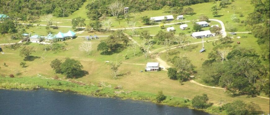
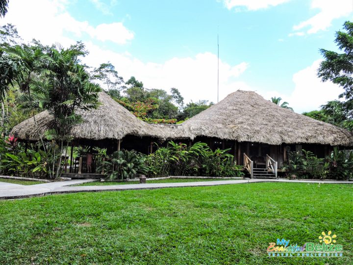
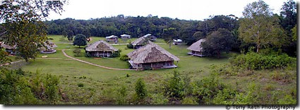
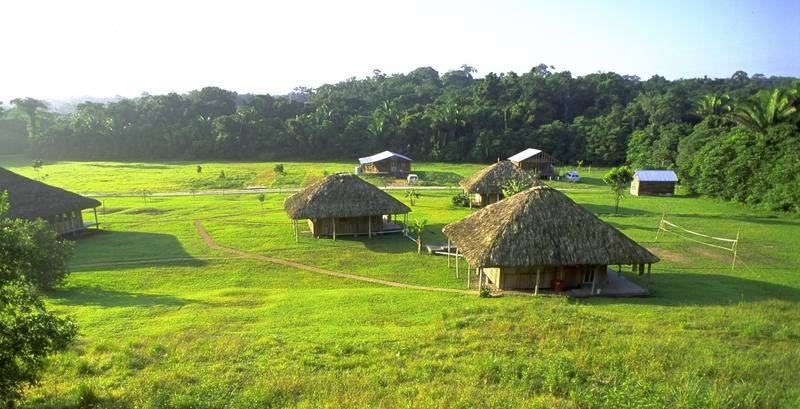
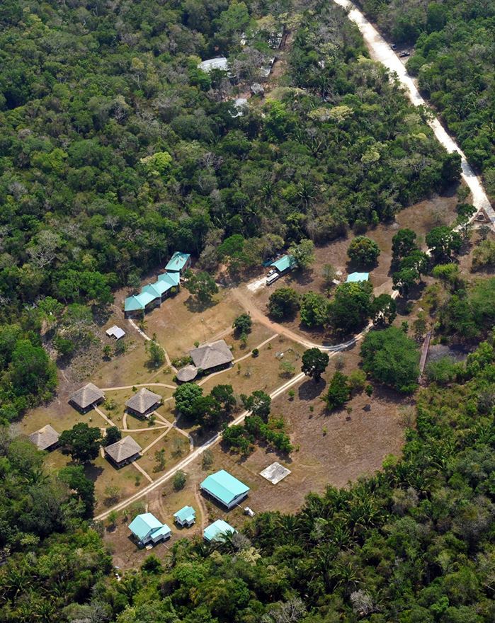
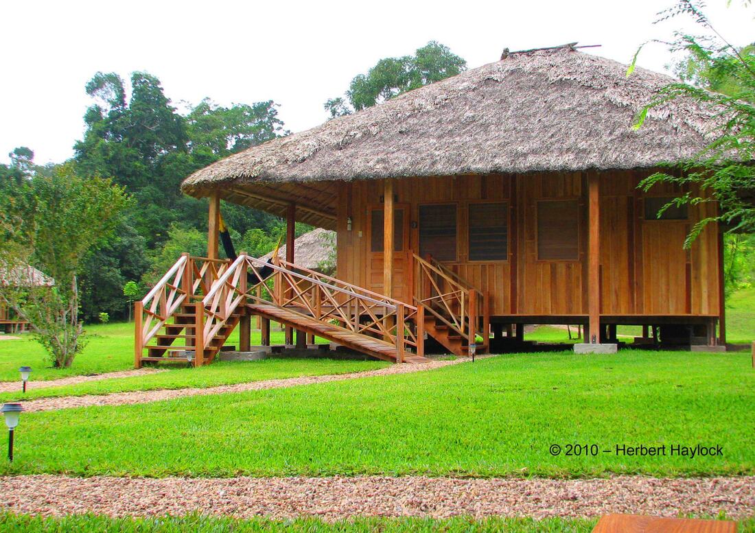
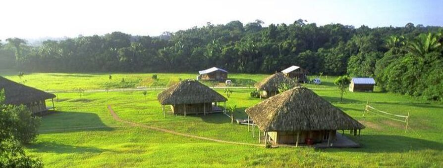
Hill Bank Field Station
Welcom to the Hill Bank Field Station, home of the Morelet Crocodile and Yellow- Headed Parrot. Hill Bank Field Station was established in 1995 and is one of two facilities located on the Rio Bravo Conservation and Management Area (RBCMA), managed by Programme for Belize. Once inhabited by the ancient Mayan, Hill Bank Field Station also served as a logging camp. Established as far back as the 1700s by British buccaneers and African slaves, Hill Bank acted as a centre for Mahogany harvesting for over 300 years. Trees were pulled from the forest to the lagoon, initially by oxen and later by train where they were off loaded, chained together and floated downstream to Belize City for processing. In the 1950s it is estimated that approximately 400 men, women and children lived at Hill Bank. By 1982 the mahogany supply was depleted and Hill Bank was abandoned. Today, Hill Bank is a working conservation field station, committed to managing the conservation of Belize’s natural heritage. With a workforce of up to 30 individuals, Hill Bank is home to a diverse crew of rangers, forestry personnel and a host of others committed to rain forest protection, research and development. At Hill Bank Field Station, visitors are welcome to explore the beauty of the New River Lagoon, the pristine rain forest and the indigenous wildlife on the RBCMA. Guests can enjoy day visits or overnight stay in either private cabanas with private bath or dormitory rooms with shared bath. During your stay at Hill Bank Field Station you will become immerse with your surroundings as you learn and participate directly in rain forest conservation activities. Your stay is very important to us as all revenues generated are directly implemented into the protection and conservation of the Rio Bravo Conservation and Management Area. |
WHERE TO STAY
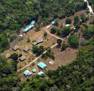
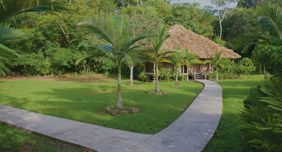
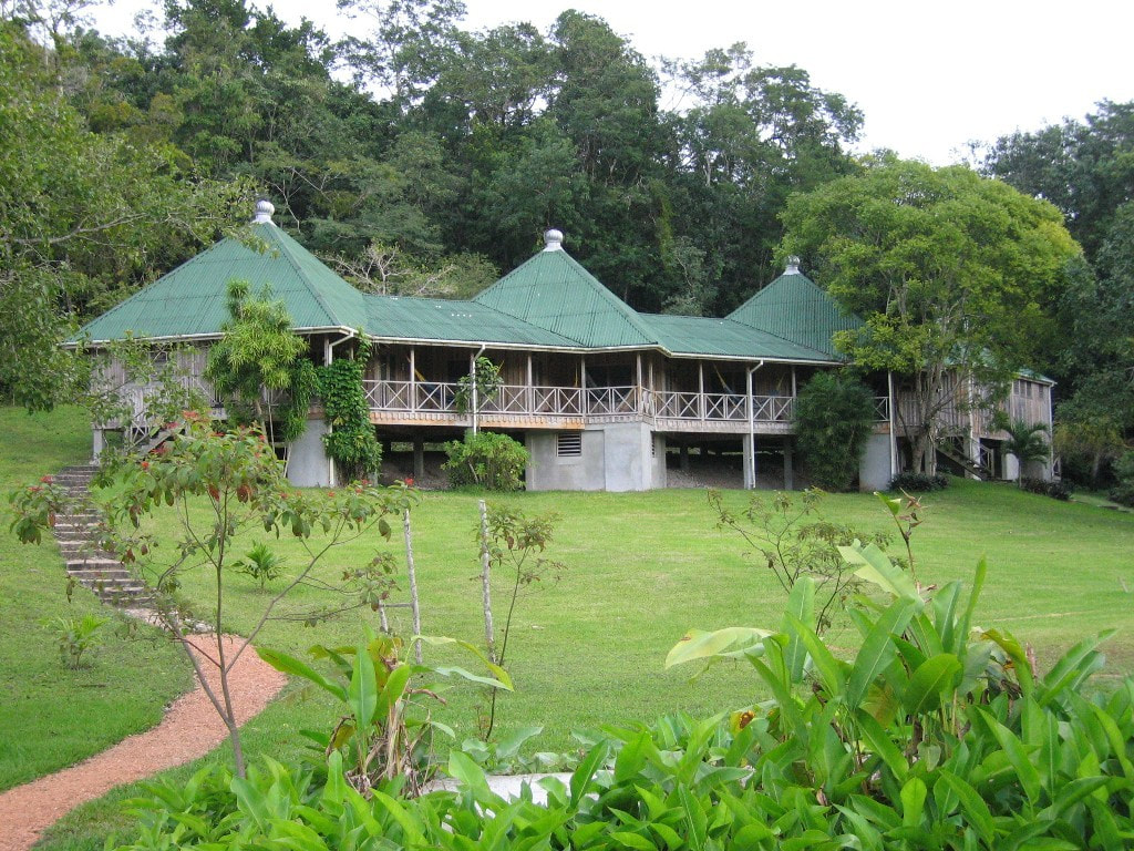
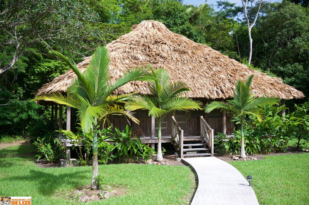
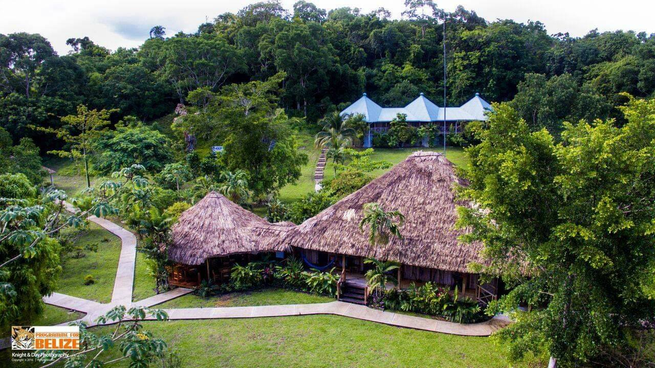
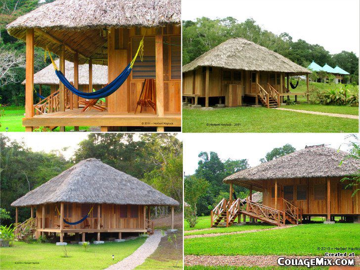
La Milpa Eco-Lodge
The La Milpa Lodge lies nestled deep in the forests of northwestern Belize. It is located only three miles from the third largest archaeological site in Belize. The La Milpa Archaeological Site is only one of at least sixty other archaeological sites found on the Rio Bravo. Serving as a base for two long-term archaeological projects, La Milpa has evolved as the center of archaeological research on the Rio Bravo. Guests visiting the La Milpa Lodge experience firsthand the rich history of the Maya Civilization.Welcome to La Milpa Lodge! La Milpa is nestled deep in the forests of northwestern Belize and is known for the third largest archaeological site in Belize which is located three miles away from the Lodge. The La Milpa Archaeological Site is only one of at least sixty other archaeological sites found on the Rio Bravo. Serving as a base for two long-term archaeological projects, La Milpa Archaeological Site has evolved as the center of archaeological research. Guests visiting the La Milpa Lodge experience firsthand the rich history of the Maya Civilization and in 1996, the site received international recognition when a royal Maya tomb was found and a male skeleton adorned with a jeweled necklace was unearthed on its grounds. The La Milpa site is only one of 60 Mayan sites found in the Rio Bravo Conservation and Management Area. Guests can choose between our private thatched- roof cabanas with private baths or a comfortable and tastefully decorated dormitory featuring state-of-the-art ‘green’ technology with shared baths. Hiking nature trails, jungle trekking and birding are the order of the day at La Milpa. Spend a day in the nearby Mestizo and Mennonite villages for a taste of Belizean culture. Tour breathtaking and majestic ancient Maya sites. Avid birders can compile a list of more than 150 species during a three day trip to our La Milpa venue. There are 8 cabana rooms which can sleep a total of 16 based on double occupancy. All cabana rooms carry an additional loft area which can accommodate a 3rd person. The dorm has a total of 6 rooms each capable of sleeping 5 persons. |
Our Lodges - Explore the Rio Bravo
Our lodges are located off the National Electrical Grid system and therefore we have to provide for the generation of our own electrical demand. Both operate on 110 volts supplied by a three-way system. Our system uses a combination and a battery bank unit in conjunction with a small generator that is turned on for approximately three hours in the early morning and in the evenings for about four hours. Both lodges operate with 100% SOLAR ENERGY. We are proud of our alternative “green” power source and we encourage guests to conserve power when- ever possible. We also encourage all guests to bring water bottles to refill.
We remain committed to remain in harmony with nature in a sustainable and balanced way. We encourage the use of fans instead of Air Conditioning. Our Dormitory Accommodation at both lodges offer state of the art green facility which features separate male and female shared bath units. Additionally, the facility features Clivus Multrum composting toilets which are self contained, waterless and odourless. In addi- tion, the shared baths also use natural light-ing where possible. We also practice rain- water collection systems and promote gray water storage and recycle systems.
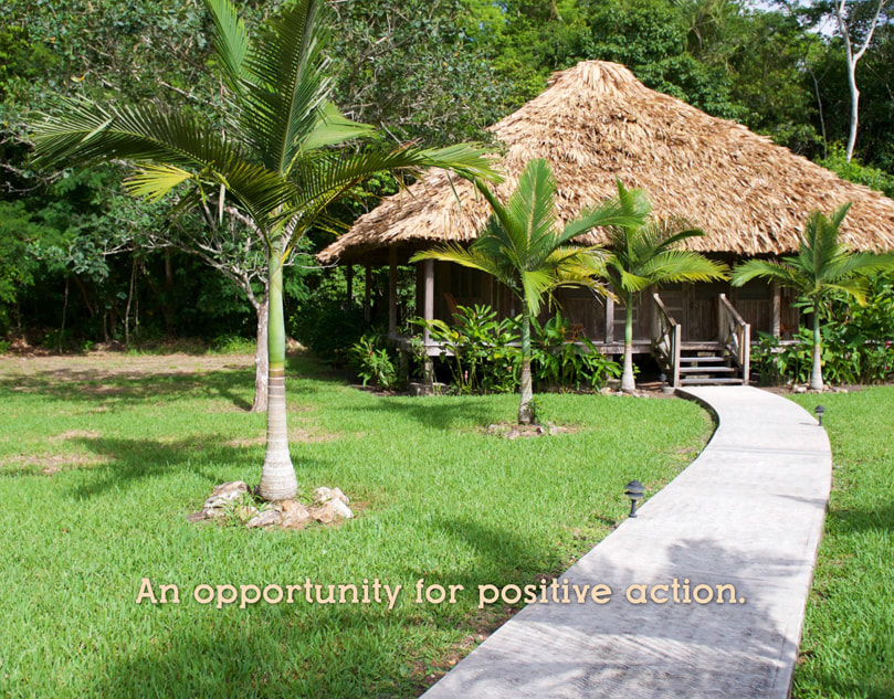
We also encourage guests to be a part of an opportunity for positive action by promoting our Yellow-Headed Parrot Programme which includes extra protection of nesting sites and public awareness programs. The RBCMA is home to a wide cross section of biodiversity possibly not found as con- centrated anywhere else in the country of Belize. The uniqueness of this area serves as a model for other protected areas.
Our lodges are located off the National Electrical Grid system and therefore we have to provide for the generation of our own electrical demand. Both operate on 110 volts supplied by a three-way system. Our system uses a combination and a battery bank unit in conjunction with a small generator that is turned on for approximately three hours in the early morning and in the evenings for about four hours. Both lodges operate with 100% SOLAR ENERGY. We are proud of our alternative “green” power source and we encourage guests to conserve power when- ever possible. We also encourage all guests to bring water bottles to refill.
We remain committed to remain in harmony with nature in a sustainable and balanced way. We encourage the use of fans instead of Air Conditioning. Our Dormitory Accommodation at both lodges offer state of the art green facility which features separate male and female shared bath units. Additionally, the facility features Clivus Multrum composting toilets which are self contained, waterless and odourless. In addi- tion, the shared baths also use natural light-ing where possible. We also practice rain- water collection systems and promote gray water storage and recycle systems.
We also encourage guests to be a part of an opportunity for positive action by promoting our Yellow-Headed Parrot Programme which includes extra protection of nesting sites and public awareness programs. The RBCMA is home to a wide cross section of biodiversity possibly not found as con- centrated anywhere else in the country of Belize. The uniqueness of this area serves as a model for other protected areas.
Physical Features & Climate
The entire area is a continuation of the Yucatan Platform, underlain by limestones and marls deposited from the Cretaceous to the early Pleistocene. Alluvial sands have been deposited over the limestones over extensive areas during the Pleistocene. The principal topographical features are a series of escarpments aligned southwest-northeast, which also guide the drainage of the Rio Bravo, Booth's River and New River systems. The "Bravo Hills" land system on the western part of the site is relatively elevated with rolling, often rugged, relief and no permanent surface drainage.
The Rio Bravo escarpment, with cast-facing slopes rising up by 525ft above sea level, is the most marked topographical feature. The eastern part of the site lies in the "Northern Coastal Plain' land system. This is an area of subdued relief rarely rising above 130ft elevation, with permanent surface drainage and extensive wetlands. The New River Lagoon is the largest inland water body in the country. 6 sod suites have been identified, subdivided into 17 subsuites. These range in qualities from fertile to very infertile and from waterlogged to seasonal droughtiness.
The area is subject to a 3-month dry season between February and April and a 2-peaked wet season with highest rainfall in June and October There are wide variations from this basic pattern between years. Annual rainfall is approximately 61-63 inches per year. The coolest period is from November to January, with an average temperature range from 21-26.5C; the warmest period is April- May when average maximum temperatures rise to 31.5C. Extreme recorded temperatures range from 9C to 38C. Coldest conditions occur during the northern winter when cold air flows associated with anticyclonic weather systems cross the country. They are characterized by storms, rain, and cool, dank, overcast weather.
Although only persisting for a few days, several "northers" may be expected in any year. The area is also subject to occasional tropical storms and hurricanes. Although only one hurricane is known. to have passed directly over the site over the past century virtually all larger trees show evidence of repeated storm damage. Overall elevation of the site ranges from 13-790ft.
Visitor Facilities
The La Milpa Field Station provides board and lodging for up to 30 visitors. There is also a trail system and station staff serve as guides. Visitor levels are roughly 1,200 per year, of whom approximately 50% are Belizean nationals. These figures include day visitors coming to the site through the Education and Outreach Programme. Courses for foreign and local students on tropical forest ecology are also ran from the La Milpa Field Station. Visitor levels are rising and upgraded visitor and interpretation facilities are being built on the site. A similar facility is planned for the Hill Bank Field Station while upmarket tourist facilities are also under consideration. Use of "green technologies" - solar and wind power, composting toilets - are being maximized in the new visitor buildings.
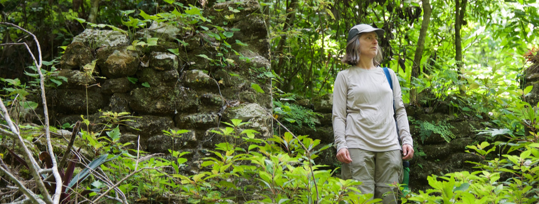
Cultural Features
The cultural heritage of the area is extraordinarily rich. Over 60 Mayan sites have so far been located, ranging from major ceremonial centres, and elite dwellings, to field and terrace systems, to industrial sites producing stone tools. House mounds are almost ubiquitous. La Milpa, on the western part of the site, is considered the third largest ceremonial centre in Belize while Dos Hombres, an elite "palace", approaches La Milpa in extent. Most of the visible architecture dates from the Late Classic (8th - 9th century AD), when it is believed that all available resources were exploited to the maximum, but the archaeological record extends from pre-ceramic to the European contact period. During the 19th and 20th century the area formed the principal mahogany forest of the Belize Estate and Produce Company, an important influence on the economic and social development of British Honduras/Belize, and many relics remain. Colonial land use has not yet been examined in detail but the physical evidence, when taken with the documentary record, promises to give valuable insights into the period.
The entire area is a continuation of the Yucatan Platform, underlain by limestones and marls deposited from the Cretaceous to the early Pleistocene. Alluvial sands have been deposited over the limestones over extensive areas during the Pleistocene. The principal topographical features are a series of escarpments aligned southwest-northeast, which also guide the drainage of the Rio Bravo, Booth's River and New River systems. The "Bravo Hills" land system on the western part of the site is relatively elevated with rolling, often rugged, relief and no permanent surface drainage.
The Rio Bravo escarpment, with cast-facing slopes rising up by 525ft above sea level, is the most marked topographical feature. The eastern part of the site lies in the "Northern Coastal Plain' land system. This is an area of subdued relief rarely rising above 130ft elevation, with permanent surface drainage and extensive wetlands. The New River Lagoon is the largest inland water body in the country. 6 sod suites have been identified, subdivided into 17 subsuites. These range in qualities from fertile to very infertile and from waterlogged to seasonal droughtiness.
The area is subject to a 3-month dry season between February and April and a 2-peaked wet season with highest rainfall in June and October There are wide variations from this basic pattern between years. Annual rainfall is approximately 61-63 inches per year. The coolest period is from November to January, with an average temperature range from 21-26.5C; the warmest period is April- May when average maximum temperatures rise to 31.5C. Extreme recorded temperatures range from 9C to 38C. Coldest conditions occur during the northern winter when cold air flows associated with anticyclonic weather systems cross the country. They are characterized by storms, rain, and cool, dank, overcast weather.
Although only persisting for a few days, several "northers" may be expected in any year. The area is also subject to occasional tropical storms and hurricanes. Although only one hurricane is known. to have passed directly over the site over the past century virtually all larger trees show evidence of repeated storm damage. Overall elevation of the site ranges from 13-790ft.
Visitor Facilities
The La Milpa Field Station provides board and lodging for up to 30 visitors. There is also a trail system and station staff serve as guides. Visitor levels are roughly 1,200 per year, of whom approximately 50% are Belizean nationals. These figures include day visitors coming to the site through the Education and Outreach Programme. Courses for foreign and local students on tropical forest ecology are also ran from the La Milpa Field Station. Visitor levels are rising and upgraded visitor and interpretation facilities are being built on the site. A similar facility is planned for the Hill Bank Field Station while upmarket tourist facilities are also under consideration. Use of "green technologies" - solar and wind power, composting toilets - are being maximized in the new visitor buildings.
Cultural Features
The cultural heritage of the area is extraordinarily rich. Over 60 Mayan sites have so far been located, ranging from major ceremonial centres, and elite dwellings, to field and terrace systems, to industrial sites producing stone tools. House mounds are almost ubiquitous. La Milpa, on the western part of the site, is considered the third largest ceremonial centre in Belize while Dos Hombres, an elite "palace", approaches La Milpa in extent. Most of the visible architecture dates from the Late Classic (8th - 9th century AD), when it is believed that all available resources were exploited to the maximum, but the archaeological record extends from pre-ceramic to the European contact period. During the 19th and 20th century the area formed the principal mahogany forest of the Belize Estate and Produce Company, an important influence on the economic and social development of British Honduras/Belize, and many relics remain. Colonial land use has not yet been examined in detail but the physical evidence, when taken with the documentary record, promises to give valuable insights into the period.
Establishment History
Created in 1988 by a purchase agreement between Gallon Jug Agroindustries and Programme for Belize for 110,044 acres of land comprising the northern section of the Gallon Jug property. Subsequently enlarged by the donation of 42,007 acres by Coca-Cola Foods Inc. in 1990, a further donation by Coca-Cola Foods Inc. of 52,015 acres in 1992, purchase from New River Enterprises Ltd. of 14,011 in 1994 and the signing of a purchase agreement with New River Enterprises Ltd. for an additional 12,798 acres also in 1994.
All outstanding payments under the purchase agreements were completed by December 1995. Management responsibility was assumed on signing each purchase agreement. Programme for Belize is a Belizean NGO constituted as a nonprofit company and holds the land in trust for the people of Belize under the terms of a formal Memorandum of Agreement with the Government of Belize. The Memorandum of Agreement also provides for continuity of conservation management, stating that the land must be passed to another organization of similar aims if PFB must relinquish ownership.
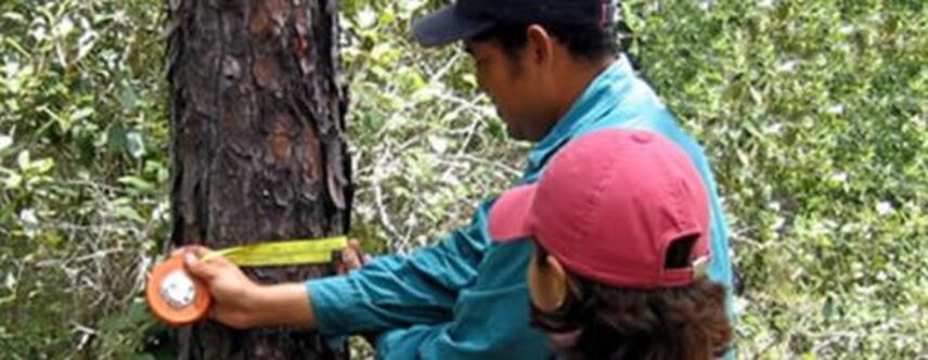
Forest Management Programme
The Forest Management Programme is one way in which Programme for Belize cares for and cultivates Rio Bravo’s forest. There has been on-going research in proper management and resource use in Rio Bravo’s hardwood forests. For example, there is on-going exploration on the impact of different intensive treatments on the regeneration of mahogany and other shade-tolerant tree specie, and in modifications to the widely used selective harvesting system.
Timber operations revenue helps to support core management staff in the head office in addition to maintaining technical field staff. It also supports the maintenance of the Hill Bank Field Station by contributing to its operational costs as well as supporting other conservation programmes.
This programme has been pursued since 1994 developed from an experimental phase between 1994 and 2003 and transitioned into a full operational form in 2004. This process is detailed in the Hardwood Timber Business Plan (Wilson, 2004) and the RBCMA Forest Management Plan (2011-2015). The objective of this programme is to demonstrate that good forest management that meets high international standards can contribute to the local economy, while safeguarding social, environmental and economic benefits of the area.
Apart from becoming the second revenue-generating activity, this programme makes a strong demonstration of good forest management highly pertinent to improving current practice throughout the country. As the most reliable source of high quality timber in the area, it also substantially strengthens the contribution made by the RBCMA to the local economy. It forms part of the carbon sequestration pilot project by providing income to maintain protection/monitoring and by promoting high mahogany stocking. Furthermore, aspects of the planned silvicultural programme lend themselves to direct community participation such as seed collection and enrichment planning. The plot re-measurements, though included within this programme, are strongly linked with the research and monitoring work that is on-going in this programme. Non Traditional Forest Products (NTFPs) are also covered under this programme.
Savannah Management ProgrammeMeanwhile, The Savannah Management Programme is aimed at improving conservation of Rio Bravo’s vast pine savannah ecosystem. This area is exposed to constant burning from fires lit by hunters and farmers in adjacent properties and also dry season wildfires. This has resulted in seriously eroded pine stocks in some areas and a decrease in young pine regeneration as seeds are unable to withstand the high temperature of the fires. Another potential threat is the loss of habitat for two endangered bird specie: the Yellow-Headed Parrot and the Jabiru Stork.
Pine savannah covers approximately 10,000 ha of the RBCMA, in two separate areas of approximately equal extent – the ‘Rancho Dolores Savannah’ covering most of the area between the East Gate and The New River escarpment and the ‘San Felipe Savannah’ in the northern part of the RBCMA between Duck Ridge and the Booth’s River marshes. Both form the southern part of extensive bands of pine savannah habitat extending north-eastwards across the northern coastal plain.
The San Felipe Savannah covers 3,394 ha and is very open, with some 90% covered by short-grass savannah with scattered pine. The remaining area consists of pine or pine-oak woodland and the wetter savannah fringe includes several poorly described swamp or riparian woodlands. The San Felipe savannah has always been a problem area for hunting and other illicit activity and burns frequently (estimated at c. 1,000 ha p.a.). PfB has continued to step up patrolling efforts in this area with its available resources in an effort to reduce these threats.
In contrast, the Rancho Dolores Savannah is more wooded, with 87% of its 5,531 ha area under open pine-oak or pine woodland with some patches now tending towards closed canopy forest. This is partly due to terrain, with better-drained rises covering a larger part of the area supporting pine stands that were regularly logged over until 1995, but is also due to better management. Fire control to encourage pine regeneration is an important component of the Rio Bravo Carbon Sequestration Pilot Project and has been applied here. Essentially, crews trained and equipped under the project were able to suppress eleven out of fourteen fires set between 1996 and 2003 while controlled burns associated with fire management training (in concert with The Nature Conservancy) have been maintained over 1,000 ha in the Big Pond and ‘Tillett and Potts’ areas – i.e. along the East Gate-Ramgoat Creek road. Although unmeasured, this has produced considerable growth with well-grown stands and abundant though patchy regeneration over the past decade. While research is always on-going in the Rio Bravo, to maintain balance; approximately 50% of its land is managed as a strict reserve for the protection of its biodiversity and natural habitats.
Wildlife
Inventories have been undertaken for all vertebrate groups with the exception of the fishes. Invertebrate inventories are limited to the lepidoptera and some coleopteran groups.
The area displays a complex mosaic of vegetation types created by strong relationship between vegetation type and local topography, and 22 vegetation types are currently recognized for mapping purposes. In general terms, the most extensive vegetation cover consists of variants of broadleaf forest. These are traditionally believed to contain the richest Mahogany resource in Belize, and have been logged for over 150 years. They are also noted for their stocks of Sapodilla, from which chicle is tapped.
Seasonally waterlogged forests are also extensive, as are open pine woodlands, savanna and herbaceous swamp formations. The site is considered to carry the most diversity in vegetation communities of any protected area in the country and makes an important contribution to protected area coverage for 6 of them. Some 230 tree species have been recorded to date and the total woody flora is estimated at 250-300 species. Comprehensive inventory of the non-woody flora has not yet been undertaken. As an extension of the Peten, a recognized centre of plant biodiversity, the level of regional endemicity is relatively high.
Inventories have been undertaken for all vertebrate groups with the exception of the fishes. Invertebrate inventories are limited to the lepidoptera and some coleopteran groups.
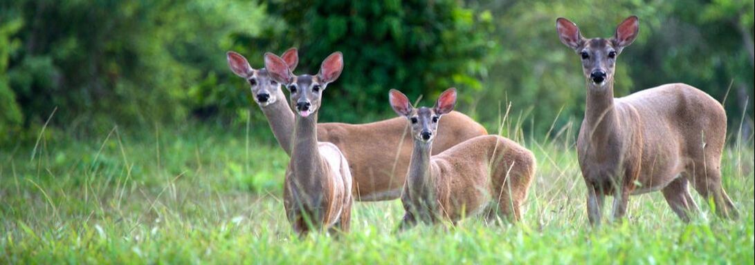
- Over 70 mammal species (of which over 50% are bats) have been recorded.
- Over 390 bird species have been recorded, of which over 25% are nearctic migrants. These also include a number of species of special concern, and the Yellow-headed Parrot, an endemic vulnerable to the local pet trade, deserves special mention.
- Game birds are also conspicuous on the site, where populations appear to be responding to unproved hunting control.
- Morelet's Crocodile, a regional endemic, is common in all the water bodies and the Central American River Turtle, a regional endemic threatened throughout its range, is common in the deeper lagoons and rivers.
- The principal feature of the site is that it carries healthy populations of all the characteristic species in the community including the full complement of top predators.
The area displays a complex mosaic of vegetation types created by strong relationship between vegetation type and local topography, and 22 vegetation types are currently recognized for mapping purposes. In general terms, the most extensive vegetation cover consists of variants of broadleaf forest. These are traditionally believed to contain the richest Mahogany resource in Belize, and have been logged for over 150 years. They are also noted for their stocks of Sapodilla, from which chicle is tapped.
Seasonally waterlogged forests are also extensive, as are open pine woodlands, savanna and herbaceous swamp formations. The site is considered to carry the most diversity in vegetation communities of any protected area in the country and makes an important contribution to protected area coverage for 6 of them. Some 230 tree species have been recorded to date and the total woody flora is estimated at 250-300 species. Comprehensive inventory of the non-woody flora has not yet been undertaken. As an extension of the Peten, a recognized centre of plant biodiversity, the level of regional endemicity is relatively high.
Conservation - Special Appeal
With a mission to conserve the biodiversity and promote the sustainable development of Belize through proper management of the Rio Bravo Conservation and Management Area, Programme for Belize is tasked with protecting the 240 species of trees, 70 species of animals, 400 species of birds, and 12 endangered animal species including the jaguar, the black howler monkey, and Belize’s national animal, the tapir.
This healthy sample of biodiversity requires financial resources to maintain constant monitoring to prevent illicit activities within its boundaries. The vigilance of our forest rangers determines Programme for Belize’s success in protecting Rio Bravo’s biodiversity. These highly trained rangers conduct extensive patrols, maintaining their presence at hotspots and vulnerable access routes in an effort to prevent illegal logging and hunting. Working in collaboration with the local police and defense force, the rangers also function as special constables empowered with the ability to detain individuals caught illegally on the property poaching, logging, and conducting illicit farming activities.
One species at high risk from poaching in the Rio Bravo is the Yellow-Headed Parrot. Endemic to Belize, these creatures are highly sought as pets because of their ability to imitate sounds and voices. Poachers prey on the chicks, going so far as cutting down trees in the pine savannahs where they nest to capture the chicks. Because they can only reproduce in the wild and bear only two to three chicks a year, their stock has been so severely depleted that they are facing a very high risk of extinction and have been placed under endangered status on the list of protected species. In light of this, Programme for Belize has since developed a Yellow-headed Parrot Recovery Programme, which includes extra protection of nesting sites during the breeding months of March to July and a public awareness programme to reduce the demand for these parrots as pets. However due to funding, the
Outreach Program has not been implemented.
|
|
|
|
|
|