BELIZE'S DISTRICT DESTINATIONS
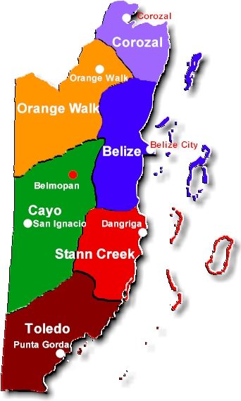
There are six (6) districts located in the country of Belize. Each district has many unique and wonderful things to see and do in it. Each district has been broken down, as to area descriptions and highlights. Please take a moment to find the area of the country that most interests you.
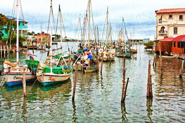
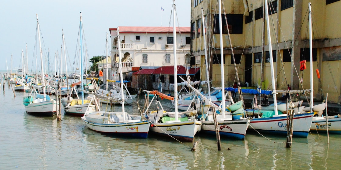
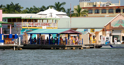
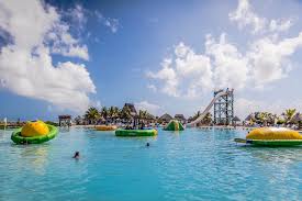
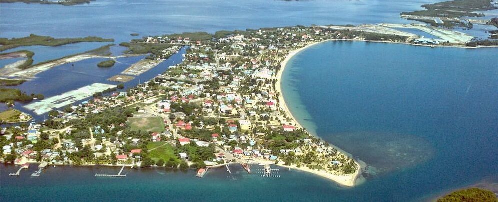
The most popular vacationing spots in Belize are 1) Ambergris Caye, 2) Caye Caulker, 3) Placencia, 4) Cayo District. Please keep in mind, that there are many wonderful small islands and atolls located off the Belize mainland. Here you will find small fishing villages/lodges, which cater to snorkeling & diving surrounded by solitude and serene beauty.
Belize Population according to a 2019 census was: 408,487 people.
1. Corozol District - Purple
2. Orange Walk District - Orange
3. Belize District - Blue
4. Cayo District - Green
5. Stann Creek District - Red
6. Toledo District - Brown
Geography of Belize
Belizean geology consists largely of varieties of limestone, with the notable exception of the Maya Mountains, a large uplifted block of intrusive Paleozoic granite and sediments running northeast to southwest across the south-central part of the country. Several major faults rive these highlands, but much of Belize lies outside the tectonically active zone that underlies most of Central America. During the Cretaceous Period, what is now the western part of the Maya Mountains stood above sea level, creating the oldest land surface in Central America, the Mountain Pine Ridge plateau.
The hilly regions surrounding the Maya Mountains are formed from Cretaceous limestone. These areas are characterized by a karst topography that is typified by numerous sinkholes, caverns, and underground streams. In contrast to the Mountain Pine Ridge, some of the soils in these regions are quite fertile and have been cultivated during at least the past 4,000 years.
Much of the northern half of Belize lies on the Yucatán Platform, a tectonically stable region. Although mostly level, this part of the country also has occasional areas of hilly, karst terrain, such as the Yalbac Hills along the western border with Guatemala and the Manatee Hills between Belize City and Dangriga. Alluvial deposits of varying fertility cover the relatively flat landscapes of the coastal plains.
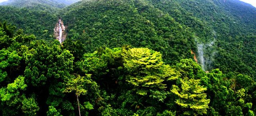
Physical featuresTopographical feature divide the Belizean landscape into two main physiographic regions. The most visually striking of these regions is distinguished by the Maya Mountains and the associated basins and plateaus that dominate all but the narrow coastal plain in the southern half of the country. The mountains rise to heights of about 1,100 metres, with the highest point being Doyle's Delight (1,124 m) in the Cockscomb Range, a spur of the Maya Mountains in Western Belize. Covered with shallow, highly erodible soils of low fertility, these heavily forested highlands are very sparsely inhabited.
The second region comprises the northern lowlands, along with the southern coastal plain. Eighteen major rivers and many perennial streams drain these low-lying areas. The coastline is flat and swampy, with many lagoons, especially in the northern and central parts of the country. Westward from the northern coastal areas, the terrain changes from mangrove swamp to tropical pine savanna and hardwood forest.
Map of Belize's exclusive economic zoneBelize claims an exclusive economic zone of 35,351 km2 (13,649 sq mi) with 200 nautical miles (370.4 km; 230.2 mi) and a territorial sea of 12 nautical miles (22.2 km; 13.8 mi). From the mouth of the Sarstoon River to Ranguana Cay, Belize's territorial sea is 3 nmi (5.6 km; 3.5 mi); according to Belize's Maritime Areas Act, 1992, the purpose of this limitation is to provide a framework for the negotiation of a definitive agreement on territorial differences with Guatemala.
Belize is the only country in Central America without a coastline on the North Pacific Ocean.
Rivers
The interlocking networks of rivers, creeks, and lagoons have played a key role in the historical geography of Belize. The largest and most historically important river is the Belize River, which drains more than one-quarter of the country as it winds along the northern edge of the Maya Mountains across the center of the country to the sea near Belize City. Also known as the Old River, the Belize River is navigable up to the Guatemalan border and served as the main artery of commerce and communication between the interior and the coast until well into the twentieth century.
Other historically important rivers include the Sibun River, which drains the northeastern edge of the Maya Mountains, and the New River, which flows through the northern sugar-growing areas before emptying into Chetumal Bay. Both of these river valleys possess fertile alluvial soils and have supported considerable cultivation and human settlement.
Climate
Köppen climate classification zones of Belize.Belize has a tropical climate with pronounced wet and dry seasons, although there are significant variations in weather patterns by region. Temperatures vary according to elevation, proximity to the coast, and the moderating effects of the northeast trade winds off the Caribbean. Average temperatures in the coastal regions range from 24 °C (75 °F) in January to 27 °C (81 °F) in July. Temperatures are slightly higher inland, except for the southern highland plateaus, such as the Mountain Pine Ridge, where it is noticeably cooler year round. Overall, the seasons are marked more by differences in humidity and rainfall than in temperature.
Average rainfall varies considerably, ranging from 1,350 millimeters (53.1 in) in the north and west to over 4,500 millimeters (177.2 in) in the extreme south. Seasonal differences in rainfall are greatest in the northern and central regions of the country where, between January and April or May, fewer than 100 millimeters (3.9 in) of rain fall per month. The dry season is shorter in the south, normally only lasting from February to April. A shorter, less rainy period, known locally as the "little dry," usually occurs in late July or August, after the initial onset of the rainy season.
The most popular vacationing spots in Belize are 1) Ambergris Caye, 2) Caye Caulker, 3) Placencia, 4) Cayo District. Please keep in mind, that there are many wonderful small islands and atolls located off the Belize mainland. Here you will find small fishing villages/lodges, which cater to snorkeling & diving surrounded by solitude and serene beauty.
Belize Population according to a 2019 census was: 408,487 people.
1. Corozol District - Purple
2. Orange Walk District - Orange
3. Belize District - Blue
4. Cayo District - Green
5. Stann Creek District - Red
6. Toledo District - Brown
Geography of Belize
Belizean geology consists largely of varieties of limestone, with the notable exception of the Maya Mountains, a large uplifted block of intrusive Paleozoic granite and sediments running northeast to southwest across the south-central part of the country. Several major faults rive these highlands, but much of Belize lies outside the tectonically active zone that underlies most of Central America. During the Cretaceous Period, what is now the western part of the Maya Mountains stood above sea level, creating the oldest land surface in Central America, the Mountain Pine Ridge plateau.
The hilly regions surrounding the Maya Mountains are formed from Cretaceous limestone. These areas are characterized by a karst topography that is typified by numerous sinkholes, caverns, and underground streams. In contrast to the Mountain Pine Ridge, some of the soils in these regions are quite fertile and have been cultivated during at least the past 4,000 years.
Much of the northern half of Belize lies on the Yucatán Platform, a tectonically stable region. Although mostly level, this part of the country also has occasional areas of hilly, karst terrain, such as the Yalbac Hills along the western border with Guatemala and the Manatee Hills between Belize City and Dangriga. Alluvial deposits of varying fertility cover the relatively flat landscapes of the coastal plains.
Physical featuresTopographical feature divide the Belizean landscape into two main physiographic regions. The most visually striking of these regions is distinguished by the Maya Mountains and the associated basins and plateaus that dominate all but the narrow coastal plain in the southern half of the country. The mountains rise to heights of about 1,100 metres, with the highest point being Doyle's Delight (1,124 m) in the Cockscomb Range, a spur of the Maya Mountains in Western Belize. Covered with shallow, highly erodible soils of low fertility, these heavily forested highlands are very sparsely inhabited.
The second region comprises the northern lowlands, along with the southern coastal plain. Eighteen major rivers and many perennial streams drain these low-lying areas. The coastline is flat and swampy, with many lagoons, especially in the northern and central parts of the country. Westward from the northern coastal areas, the terrain changes from mangrove swamp to tropical pine savanna and hardwood forest.
Map of Belize's exclusive economic zoneBelize claims an exclusive economic zone of 35,351 km2 (13,649 sq mi) with 200 nautical miles (370.4 km; 230.2 mi) and a territorial sea of 12 nautical miles (22.2 km; 13.8 mi). From the mouth of the Sarstoon River to Ranguana Cay, Belize's territorial sea is 3 nmi (5.6 km; 3.5 mi); according to Belize's Maritime Areas Act, 1992, the purpose of this limitation is to provide a framework for the negotiation of a definitive agreement on territorial differences with Guatemala.
Belize is the only country in Central America without a coastline on the North Pacific Ocean.
Rivers
The interlocking networks of rivers, creeks, and lagoons have played a key role in the historical geography of Belize. The largest and most historically important river is the Belize River, which drains more than one-quarter of the country as it winds along the northern edge of the Maya Mountains across the center of the country to the sea near Belize City. Also known as the Old River, the Belize River is navigable up to the Guatemalan border and served as the main artery of commerce and communication between the interior and the coast until well into the twentieth century.
Other historically important rivers include the Sibun River, which drains the northeastern edge of the Maya Mountains, and the New River, which flows through the northern sugar-growing areas before emptying into Chetumal Bay. Both of these river valleys possess fertile alluvial soils and have supported considerable cultivation and human settlement.
Climate
Köppen climate classification zones of Belize.Belize has a tropical climate with pronounced wet and dry seasons, although there are significant variations in weather patterns by region. Temperatures vary according to elevation, proximity to the coast, and the moderating effects of the northeast trade winds off the Caribbean. Average temperatures in the coastal regions range from 24 °C (75 °F) in January to 27 °C (81 °F) in July. Temperatures are slightly higher inland, except for the southern highland plateaus, such as the Mountain Pine Ridge, where it is noticeably cooler year round. Overall, the seasons are marked more by differences in humidity and rainfall than in temperature.
Average rainfall varies considerably, ranging from 1,350 millimeters (53.1 in) in the north and west to over 4,500 millimeters (177.2 in) in the extreme south. Seasonal differences in rainfall are greatest in the northern and central regions of the country where, between January and April or May, fewer than 100 millimeters (3.9 in) of rain fall per month. The dry season is shorter in the south, normally only lasting from February to April. A shorter, less rainy period, known locally as the "little dry," usually occurs in late July or August, after the initial onset of the rainy season.
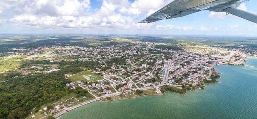
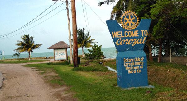
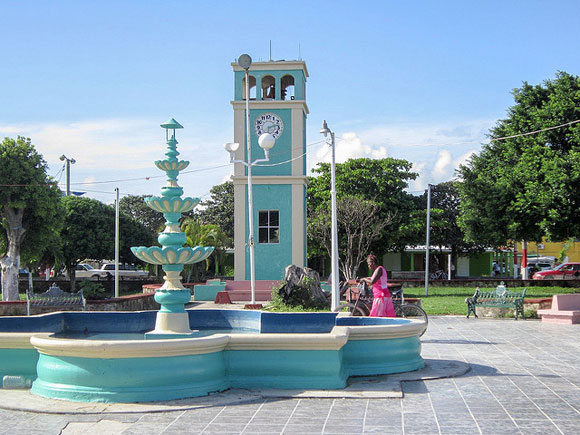
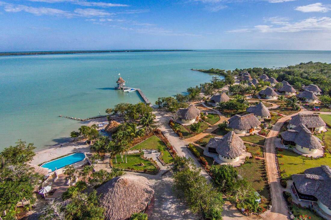
COROZAL DISTRICT - Overview
Settlements - Corozal District
Corozal District is the northernmost district of the nation of Belize. Population (2000): 33,335. District capital: Corozal Town. Also in Corozal District are the towns and villages of Buena Vista, Calcutta, Caledonia, Carolina, Chan Chen, Chunox, Concepcion, Consejo, Copper Bank, Cristo Rey, Estrella, Libertad, Little Belize, Louisville, Paraiso, Patchacan, Progresso, Ranchito, San Andres, San Antonio, San Joaquin, San Narciso, San Roman, San Victor, San Pedro, Santa Clara, Sarteneja, Xaibe, and Yo Chen. In addition, the island of Ambergris Caye is geographically closer to Corozal District than the district in which it is administrated, Belize District. While the island of Ambergris Caye may geographically be closest to Corozal District, it is actually a part of Belize District.
History - Corozal District
Corozal, the northmost town in Belize, was founded in 1848 by refugees from the Maya Indian uprising against the Spanish in neighboring Yucatan. This uprising, known as the War of the Castes (from the Spanish "castas" or race), began as a war against the Spaniards, but it eventually became a war against the Mestizos. The Mestizos, half Spanish and half Indian, had proved to be formidable allies of the Spaniards, and were thus mortal enemies of the Maya Indians.
A massacre at Bacalar, Mexico — a Mestizo stronghold about thirty miles noth of Corozal Town — finally led to the exodus of thousands of Mestizos from Bacalar and the surrounding area. Between 1848 and 1856 more than 10,000 refugees crossed the Rio Hondo, the river that now serves as a boundary between Belize and Mexico. These immigrants sought refuge in northern Belize, and increased the population of Corozal Town to 4500. Mr. James Blake, a magistrate, let them settle on lands in the Corozal District and helped them to establish the new crop — sugar cane.
The Mestizo refugees were far from safe in Corozal Town as the Maya Indians from the Mexican base in Santa Cruz Bravo — today Carrillo Puerto — made several incursions in Corozal Town. In defense, Corozal became a garrison town and Fort Barlee was built here in 1870. Today, the brick corner supports of the fort surround the post office complex of the buildings across from the central town square.
The immigrants brought with them Mestizo culture: Spanish and Yucatec Maya language, Catholicism and Maya folklore, the use of alcalde, their family structure and way of life. Soon, there emerged a local replication of the society of the Yucatan within the boundaries of a country ruled by English expatriates.
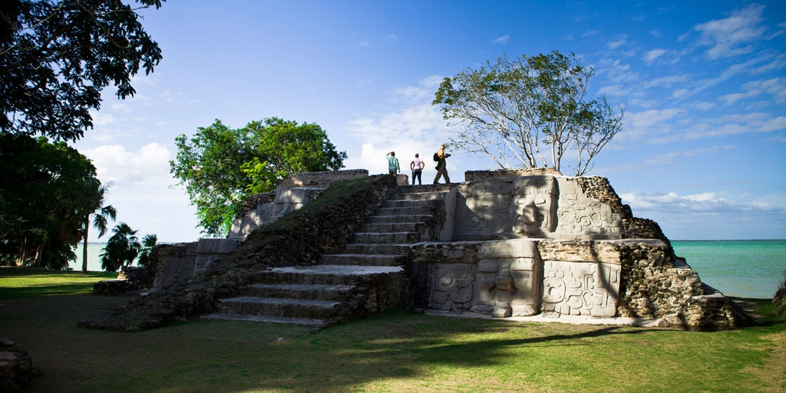
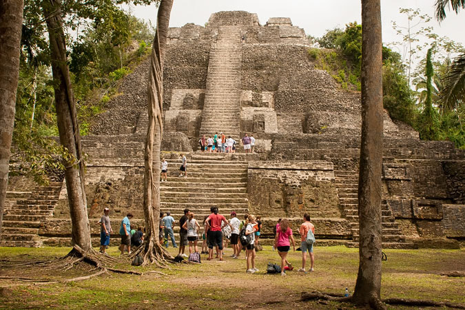
Across the bay from Corozal Town are the mounds of Cerros, the first Maya coastal trading center. Cerros is considered one of the most important late preclassic Maya sites because it represented the first experiment with kingship in the Maya world. The remains include a number of temples, plazas, ballcourts, canals, and minor structures. The most interesting artifacts so far discovered are the five jade head pendants.
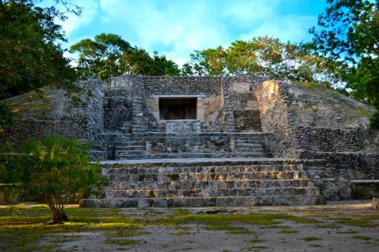
Within Corozal istself can be found another Maya ruin from the fourteenth centry AD. Known as Santa Rita, the pyramid site sits atop the remains of a Maya city that dominated the area for more than 2000 years. Burial sites rich in jewelry and artifacts have recently been unearthed here. Santa Rita was probably part of ancient Chactumal, the Maya capital of the area at the time of the first Spanish attempt to conquer the Yucatec Mayas in the early 16th century.
A sight worth seeing is the vibrant mural in the Town Hall. Painted by the Belizean-Mexican artist Manual Villamore, it surrealistically depicts the rich history of Corozal. Pictured to the right is just a portion of the mural.
Next door to the Town Hall, the Corozal Library houses an unusual collection of books on Belize from past to present. The Library’s cultural, educational and recreational activities are supported by the Friends of Corozal Library. For a small donation, you can obtain a map of Corozal that provides a Self-Guided Nature Walk around town, describing trees and birds. This section on the History of Corozal is taken directly from the map, with permission of the Friends of the Corozal Library.
Economy - Corozal District
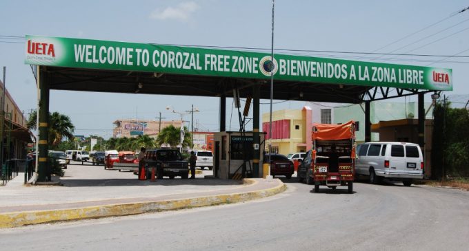
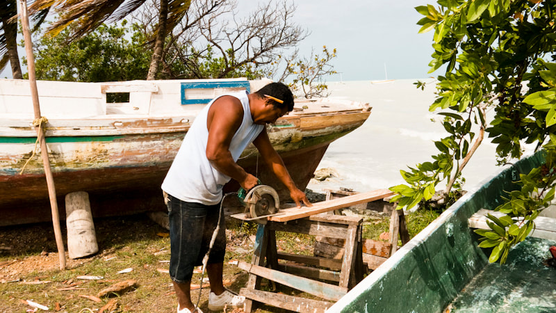
While Corozal District depended for many years on the sugar industry, at one time having its own sugar factory in Libertad Village, today the economy is more diversified. Sugar production and other agricultural crops such as papaya are still central to the way of life of many rural Corozalenos, but occupations in the tourism industry are slowly becoming more prominent. Now almost 65% of Corozalenos depend on the Commercial Free Zone for employment. The Zone is located on the border of Belize and Mexico. Contraband is the biggest source of growing income in Corozal since it is adjacent to Mexico, and includes such things as vegetables, fruits, liquors, cigarettes, and gasoline.
Population - Corozal District
Population - According to the 2019 census for the Corozal District, the population was 49,446.
Corozal District is the northernmost district of the nation of Belize. Population (2000): 33,335. District capital: Corozal Town. Also in Corozal District are the towns and villages of Buena Vista, Calcutta, Caledonia, Carolina, Chan Chen, Chunox, Concepcion, Consejo, Copper Bank, Cristo Rey, Estrella, Libertad, Little Belize, Louisville, Paraiso, Patchacan, Progresso, Ranchito, San Andres, San Antonio, San Joaquin, San Narciso, San Roman, San Victor, San Pedro, Santa Clara, Sarteneja, Xaibe, and Yo Chen. In addition, the island of Ambergris Caye is geographically closer to Corozal District than the district in which it is administrated, Belize District. While the island of Ambergris Caye may geographically be closest to Corozal District, it is actually a part of Belize District.
History - Corozal District
Corozal, the northmost town in Belize, was founded in 1848 by refugees from the Maya Indian uprising against the Spanish in neighboring Yucatan. This uprising, known as the War of the Castes (from the Spanish "castas" or race), began as a war against the Spaniards, but it eventually became a war against the Mestizos. The Mestizos, half Spanish and half Indian, had proved to be formidable allies of the Spaniards, and were thus mortal enemies of the Maya Indians.
A massacre at Bacalar, Mexico — a Mestizo stronghold about thirty miles noth of Corozal Town — finally led to the exodus of thousands of Mestizos from Bacalar and the surrounding area. Between 1848 and 1856 more than 10,000 refugees crossed the Rio Hondo, the river that now serves as a boundary between Belize and Mexico. These immigrants sought refuge in northern Belize, and increased the population of Corozal Town to 4500. Mr. James Blake, a magistrate, let them settle on lands in the Corozal District and helped them to establish the new crop — sugar cane.
The Mestizo refugees were far from safe in Corozal Town as the Maya Indians from the Mexican base in Santa Cruz Bravo — today Carrillo Puerto — made several incursions in Corozal Town. In defense, Corozal became a garrison town and Fort Barlee was built here in 1870. Today, the brick corner supports of the fort surround the post office complex of the buildings across from the central town square.
The immigrants brought with them Mestizo culture: Spanish and Yucatec Maya language, Catholicism and Maya folklore, the use of alcalde, their family structure and way of life. Soon, there emerged a local replication of the society of the Yucatan within the boundaries of a country ruled by English expatriates.
Across the bay from Corozal Town are the mounds of Cerros, the first Maya coastal trading center. Cerros is considered one of the most important late preclassic Maya sites because it represented the first experiment with kingship in the Maya world. The remains include a number of temples, plazas, ballcourts, canals, and minor structures. The most interesting artifacts so far discovered are the five jade head pendants.
Within Corozal istself can be found another Maya ruin from the fourteenth centry AD. Known as Santa Rita, the pyramid site sits atop the remains of a Maya city that dominated the area for more than 2000 years. Burial sites rich in jewelry and artifacts have recently been unearthed here. Santa Rita was probably part of ancient Chactumal, the Maya capital of the area at the time of the first Spanish attempt to conquer the Yucatec Mayas in the early 16th century.
A sight worth seeing is the vibrant mural in the Town Hall. Painted by the Belizean-Mexican artist Manual Villamore, it surrealistically depicts the rich history of Corozal. Pictured to the right is just a portion of the mural.
Next door to the Town Hall, the Corozal Library houses an unusual collection of books on Belize from past to present. The Library’s cultural, educational and recreational activities are supported by the Friends of Corozal Library. For a small donation, you can obtain a map of Corozal that provides a Self-Guided Nature Walk around town, describing trees and birds. This section on the History of Corozal is taken directly from the map, with permission of the Friends of the Corozal Library.
Economy - Corozal District
While Corozal District depended for many years on the sugar industry, at one time having its own sugar factory in Libertad Village, today the economy is more diversified. Sugar production and other agricultural crops such as papaya are still central to the way of life of many rural Corozalenos, but occupations in the tourism industry are slowly becoming more prominent. Now almost 65% of Corozalenos depend on the Commercial Free Zone for employment. The Zone is located on the border of Belize and Mexico. Contraband is the biggest source of growing income in Corozal since it is adjacent to Mexico, and includes such things as vegetables, fruits, liquors, cigarettes, and gasoline.
Population - Corozal District
Population - According to the 2019 census for the Corozal District, the population was 49,446.
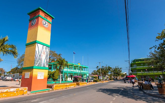
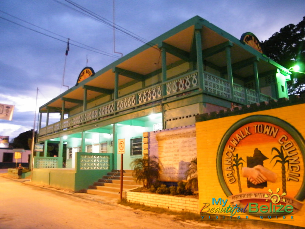
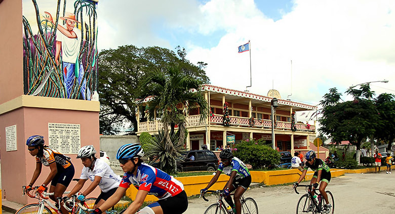
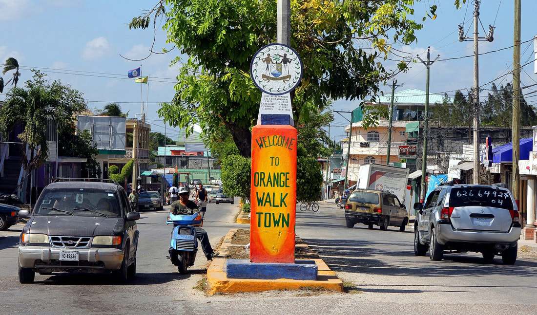
ORANGE WALK DISTRICT - Overview
Settlements - Orange Walk
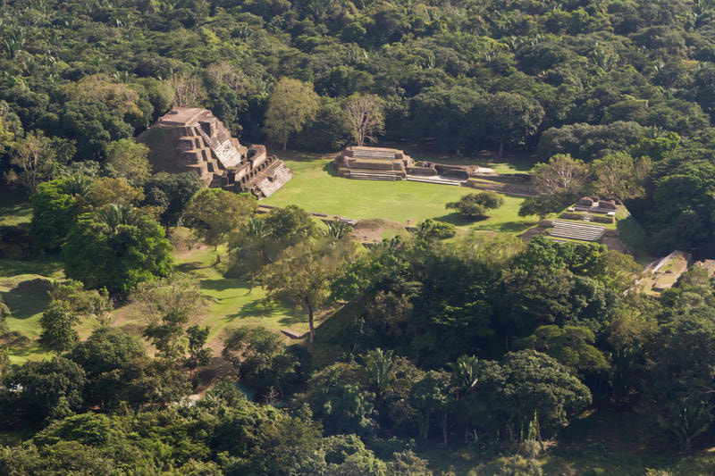
Orange Walk District is a district in the northwest of the nation of Belize, with its district capital in Orange Walk Town. Other towns and significant villages in Orange Walk District include: August Pine Ridge, Blue Creek, Carmelita, Chan Pine Ridge, Doughlas, Indian Church, Guinea Grass, San Antonio, San Carlos, San Estevan, San Felipe, San Jose, San Jose Palmar, Nuevo San Juan, San Lazaro, San Luis, San Pablo, San Roman, Santa Cruz, Santa Martha, Shipyard, Trial Farm, Trinidad and Yo Creek. Other settlements with smaller numbers of inhabitants may also be found, as well as ancient Mayan sites such as Cuello, Lamanai, Noh Mul and Chan Chich.
History - Orange Walk
Industry in Orange Walk was previously dominated by logging for over a hundred years until the refugees of the Caste War arrived in the late 19th century. At the time of logging, all the timber was floated down the New River into the Corozal Bay, then to Belize City and shipped abroad. At the time of the arrival of the Caste War refugees, the logging industry was in decline and eventually the sugar industry was established. There has been evidence that some Yucatec Maya were still living in a remote area of Yalbac hills of the district when the British arrived in the Orange walk District.
Although the Orange Walk District has no coast because it is locked inland, it boasts the remains of two forts, Forts Mundy and Cairns, built by soldiers of the British Honduras West India Regiment. The forts were built in the 19th century after battles between earlier Mayan inhabitants of the district, most notably Marcus Canul and his Icaiche Indians, and settlers.
Economy - Orange Walk
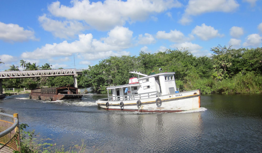
The capital of the district is Orange Walk Town, with an estimated population of 13,400. The district is home to mostly Maya Mestizo descendants of Mexican refugees who fled from the 1840 Caste War. The district's main economic base is drawn from agriculture, with sugar cane being the primary crop. This is slowly being replaced by a combination of alternative crops such potatoes, onions and soy beans. Orange Walk is also important for its production of dairy products, citrus fruits, beef and rum production. Another emerging industry is tourism due to healthy populations of tropical wildlife and the rich archaeological sites now coming to light. There are over 400 recorded bird species in the district, making Orange Walk a birdwatcher's paradise. Several settlements in the district are also home to German speaking Amish Mennonites. The district is also the home of two rivers, the Rio Hondo, which also forms part of the border with Mexico, and the New River, which has as its source Belize's largest body of water, the New River Lagoon.
Population - Orange Walk
Population - According to the 2019 census for the Orange Walk District, the population was 52,550.
Orange Walk District is a district in the northwest of the nation of Belize, with its district capital in Orange Walk Town. Other towns and significant villages in Orange Walk District include: August Pine Ridge, Blue Creek, Carmelita, Chan Pine Ridge, Doughlas, Indian Church, Guinea Grass, San Antonio, San Carlos, San Estevan, San Felipe, San Jose, San Jose Palmar, Nuevo San Juan, San Lazaro, San Luis, San Pablo, San Roman, Santa Cruz, Santa Martha, Shipyard, Trial Farm, Trinidad and Yo Creek. Other settlements with smaller numbers of inhabitants may also be found, as well as ancient Mayan sites such as Cuello, Lamanai, Noh Mul and Chan Chich.
History - Orange Walk
Industry in Orange Walk was previously dominated by logging for over a hundred years until the refugees of the Caste War arrived in the late 19th century. At the time of logging, all the timber was floated down the New River into the Corozal Bay, then to Belize City and shipped abroad. At the time of the arrival of the Caste War refugees, the logging industry was in decline and eventually the sugar industry was established. There has been evidence that some Yucatec Maya were still living in a remote area of Yalbac hills of the district when the British arrived in the Orange walk District.
Although the Orange Walk District has no coast because it is locked inland, it boasts the remains of two forts, Forts Mundy and Cairns, built by soldiers of the British Honduras West India Regiment. The forts were built in the 19th century after battles between earlier Mayan inhabitants of the district, most notably Marcus Canul and his Icaiche Indians, and settlers.
Economy - Orange Walk
The capital of the district is Orange Walk Town, with an estimated population of 13,400. The district is home to mostly Maya Mestizo descendants of Mexican refugees who fled from the 1840 Caste War. The district's main economic base is drawn from agriculture, with sugar cane being the primary crop. This is slowly being replaced by a combination of alternative crops such potatoes, onions and soy beans. Orange Walk is also important for its production of dairy products, citrus fruits, beef and rum production. Another emerging industry is tourism due to healthy populations of tropical wildlife and the rich archaeological sites now coming to light. There are over 400 recorded bird species in the district, making Orange Walk a birdwatcher's paradise. Several settlements in the district are also home to German speaking Amish Mennonites. The district is also the home of two rivers, the Rio Hondo, which also forms part of the border with Mexico, and the New River, which has as its source Belize's largest body of water, the New River Lagoon.
Population - Orange Walk
Population - According to the 2019 census for the Orange Walk District, the population was 52,550.

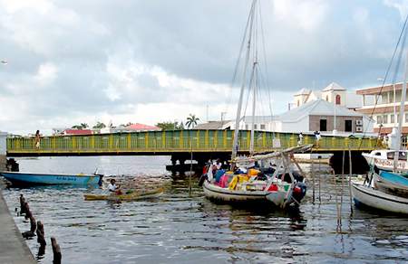
BELIZE DISTRICT - Overview
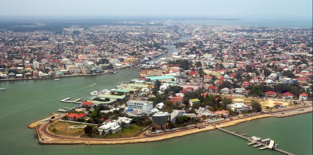
Settlements - Belize District
Belize District is a district of the nation of Belize, with its district capital in the nation's largest city, Belize City. Also in Belize District are the towns of: Maskall, Bomba, Corozalito, Santa, Lucky Strike, Rockstone Pond, Boston, Crooked Tree, Biscayne, May Pen, Gardenia, Grace Ban, Sand Hill, Lord's Bank, Ladyville, Burrel Boom, Buttercup, Schotland Halfmoon, Flowers Bank, Bermudian Landing, Isabella Bank, Double Head Cabbage, Willows Ban, Saint Paul's Bank, Big Falls, Rancho Dolores, Hattieville, Freetown Sibun, Gracie Rock, La Deomocracia, and Gales Point are all mainland villages in the Belize District. San Pedro Town, which is situated on the island of Ambergris Caye, is also in the Belize District. Caye Caulker and St. George's Caye are also island villages in this district.
History - Belize District
The Belize District was the area first settled by Europeans. They developed estates along the rivers and creeks; because these waterways were their transportation highways. Many of the estates were referred to as the owner's 'bank'(as in the banks of a river). Therefore, Mr. Lord's estate on the bank of the Belize River became Lord's Bank and Mr. Flowers' home place on this same river became Flowers Bank. Many of these old estates have grown into villages; while other places on our map such as Baker, Bob Eiley, Bocotora, Butcher Burns, Lime Walk, More Force, Nago Bank, Washing Tree, Cedar Bank, Churchyard, Egypt, Watters Bank,and White Hill are old estates which did not become villages. Some places like Davis Bank and Tropical Park have now become parts of larger communities.
Population - Belize District
Population - According to the 2019 census for the Belize District, the population was 124,096.


CAYO DISTRICT - Overview
Settlements - Cayo District
Cayo District is a district in the west of the nation of Belize. The District capital is the town of San Ignacio Cayo. Also in the Cayo District are the Belizean national capital of Belmopan, the town of Benque Viejo del Carmen, the villages of San Antonio Cayo Valeey of Peach, St. Margret's, Teakettle, Roaring Creek, Albania, twin towns of San Ignacio and Santa Elena, Seven Miles (El Progreso), Armenia, San Jose Succotz, Arenal, Buena Vista, Bullet Tree Falls, Calla Creek, Esperanza, Cristo Rey, Georgeville, Unitedville, Blackman Eddy, Ontario, Camalote, Los Tambos, and Spanish Lookout.
Also in the Cayo District are the Belizean national capital of Belmopan, the town of Benque Viejo del Carmen, the villages of San Antonio Cayo Valley of Peace, St. Margret's, Teakettle, Roaring Creek, Albaina, and Spanish Lookout.
Economy & Infrastructure - Cayo District
Cayo District is primarily an agricultural district, with the chief crops being citrus fruit (more specifically, oranges, grapefruit, and tangerine), as well as bananas. Recently, oil was found in Spanish Lookout and it is now in production.
There are two major highways in the District, the George Price Highway, that runs from Belize City to the Guatemalan border, and the Hummingbird Highway which starts in Belmopan and ends at the juncture of the Coastal Road and the Southern Highway that ends in the Stann Creek District. In addition to the ruins listed above there are several other important nature reserves including two National Parks, Blue Hole and Guanacaste National Park. Ecotourism is also an integral part of the region's economy.
Population - Cayo District
Population - According to the 2019 census for the Cayo District, the population was 99,118.
STANN CREEK DISTRICT - Overview
Settlements - Stann Creek District
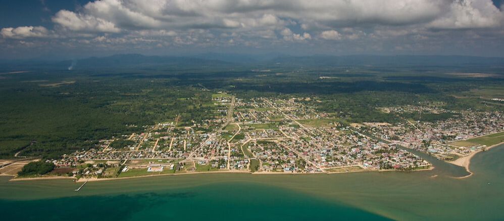
Stann Creek District is a district in the south east region of Belize. Its capital is the city of Dangriga, formerly known as "Stann Creek Town." Located within the district are the port of Big Creek (the main port of Belize's banana industry), the peninsula and village of Placencia (a popular tourist resort), the villages of Santa Cruz, Alta Vista, Commerce Bight, Dancing Pool, Georgetown, Guana Church Bank, High Sand, Independence and Mango Creek, Kendal, Lagarto Bank, Maya Mopan, Middle Bank, Middlesex, Mullins River, New Home, Pomona, Quarry Hill, Rancho Grande, Red Bank, Regalia, Sarawee, Silver Creek Camp, Silk Grass, San Roman, Sittee River and the Garifuna village of Hopkins.
History - Stann Creek DistrictThe Maya began settling the Belize River Valley of the Cayo some 5,000 years ago. At the height of the Maya civilization, AD 300 to 900, Caracol, El Pilar, Xunantunich, Cahal Pech, and other cities and ceremonial centers in what is now the Cayo were likely home to several hundred thousand people, several times the population of the district today.
Spanish missionaries first arrived in the area in the early 17th century, but they had a difficult time converting the independent-minded Maya, some of whom were forcibly removed to the Petén in Guatemala. The first significant Spanish and British settlements were logwood and mahogany logging camps. The town of San Ignacio and its adjoining sister town, Santa Elena, were established later in the 1860s. Though only about 70 miles (115 km) from Belize City, San Ignacio remained fairly isolated until recent times, because getting to the coast by horseback through the bush or by boat could take three days or longer. What was then the Western Highway was paved in the 1980s, making it easier to get here. The first jungle lodges began operation, and tourism now vies with agriculture as the main industry.
Economy - Stann Creek District
The Stann Creek District is the second smallest district in Belize at 986 square miles but it is poweer packed with agro-industries and other income generating opportunities. The North Stann Creek Valley have since the middle 1800's provided an immeasurable contribution to the dvelopment of Belize with the exports of its produce and natural resources.
The citrus industry is the oldest and most significatn agro-industry in Belize. Belize is 8,867 square miles which approximates to 5.4 million acres. The total area dedicated to production of citrus is estimated to be 48,000 acres. This is almost 1% of the country's land mass. The [rincipal crops are Valencia orange (80%), grapefruits (20%), with small amounts of early oranges, limes, tangerines and lemons grown. These are planted out in the Toledo, Stann Creek, Cayo. Belize districts and one farm in the Orange Walk district. It is also the country's second largest earner of foreigh exchange.
Citrus makes a significant contribution to the gross domestic product (GDP) or the value of goods and services of the nation. It earned more than $98.5 million (BZD) for the country in 2015/2016 crop year. Although Belize's production is tiny compared to the citrus giants (Brazil & USA).
There were approximately 1,000 registered citrus growers in the year 2000, the industry supported the livelihoods of these farm families and approximately 10,000 citrus industry workers. By 2010 the number of gresistered growers had reduced to 492. The decline was attributed to various reasons, among them the fall in prices, unbearable debts, the sale of farms and young person's not wanting to continue caring for family farms.
Population - Stann Creek District
Population - According to the 2019 census for the Stann Creek District, the population was 44,720.
TOLEDO DISTRICT - Overview
Settlements - Toledo District
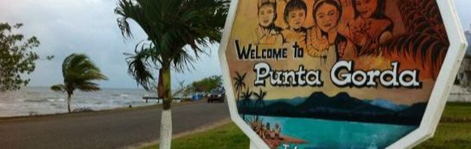
Toledo District is the southernmost district in the nation of Belize, with the district capital in the town of Punta Gorda, Belize. The district has many villages, including Monkey River Town, and the Toledo Settlement; the Mayan villages of San Pedro Columbia, Blue Creek, Indian Creek, Snata Cruz, San Antonio, San Jose, San Felipe, and the Garifuna village of Barranco.
Economy - Toledo District
Please help improve this section by adding citations to reliable sources. Unsourced material may be challenged and removed. (January 2015) (Learn how and when to remove this template message)The economy of Toledo relies heavily upon agriculture: crops grown include beans and corn, as well as rice which is sold to the Big Falls Rice Mill. Cacao is grown organically and sold via the Toledo Cacao Growers Association to Green & Black's for their renowned Maya Gold chocolate, as well as to chocolatiers within Belize. The District's ancient and modern-day links with chocolate are celebrated annually in May (Commonwealth Day Holiday weekend) at the Toledo Cacao Festival. Farmers grow additional crops such as coffee, yams, sweet potato, hot chili peppers, avocado, oranges and plantain for sale at the market in Punta Gorda, held each Monday, Wednesday, Friday, and Saturday.
Fishermen practice small-scale fishing from their dug-out canoes, as well as diving for lobster and conch during open season. The Port Honduras Marine Reserve just north of Punta Gorda Town is a protected area, and Toledo's waters are regarded as the permit capital of Belize. Many traditional fishermen have now trained as fly-fishing guides through the alternative livelihood projects offered by local conservation groups.
Tourism is an important, and relatively new, industry for Toledo. Once regarded as an area only for the hardy and adventurous, the opening of new tourist accommodation and the development of tours, as well as a growing awareness of the district's high proportion of protected areas, wildlife, excellent birding and the offshore cayes, have resulted in Toledo being recognized as an important ‘emerging destination’.
Population - Toledo District
Population - According to the 2019 census for the Toledo District, the population was 38,557.
Indian Reservations
- Aguacate Indian Reservation, Toledo
- Black Creek Indian Reservation, Toledo
- Blue Creek Indian Reservation, Toledo
- Crique Sarco Indian Reservation, Toledo
- Graham Creek Indian Reservation, Toledo
- Hinchasones Indian Reservation, Toledo
- Machaca Indian Reservation, Toledo
- Xpicilha Indian Reservation, Toledo