MAYAN TEMPLE ADVENTURES
Why should I consider visiting some Mayan Ruin sites on my Belize Vacation?
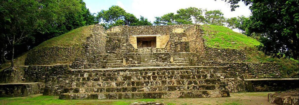
Altun Ha Mayan Temple
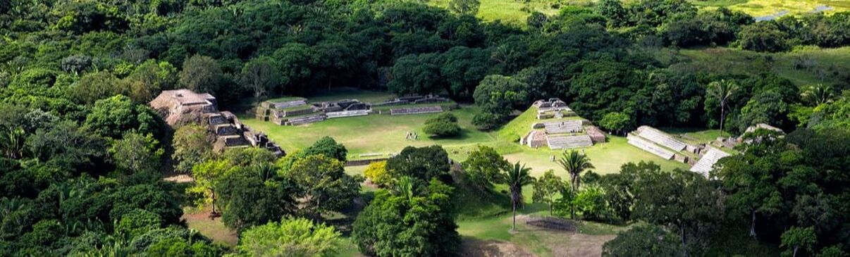
ALTUN HA MAYAN TEMPLE
Altun Ha is the name given to the ruins of an ancient Mayan city in Belize, located in the Belize District about 31 miles north of Belize City and 6.2 miles west of the shore of the Caribbean Sea. The site covers an area of about 3.1 square miles.
Stones from the ruins of the ancient structures were reused for residential construction of the agricultural village of Rockstone Pond in modern times, but the ancient site did not come to the attention of archeologists until 1963. The Old Northern Highway connects Altun Ha to Belize's Northern Highway, and the site is accessible for tourism. The largest of Altun Ha's temple-pyramids, the "Temple of the Masonry Altars", is 52 feet high. A drawing of this structure is the logo of Belize's leading brand of beer, "Belikin".
Cahal Pech Mayan Temple
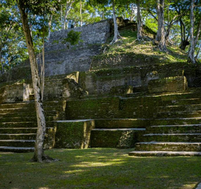
CAHAL PECH MAYAN TEMPLE
Cahal Pech is a Maya site located near the town of San Ignacio in the Cayo District of Belize. The site was a palatial, hilltop home for an elite Maya family, and though most major construction dates to the Classic period, evidence of continuous habitation has been dated to as far back as 1200 BCE during the Early Middle Formative period (Early Middle Preclassic), making Cahal Pech one of the oldest recognizably Maya sites in Western Belize.
Cahal Pech is a Maya site located near the town of San Ignacio in the Cayo District of Belize. The site was a palatial, hilltop home for an elite Maya family, and though most major construction dates to the Classic period, evidence of continuous habitation has been dated to as far back as 1200 BCE during the Early Middle Formative period (Early Middle Preclassic), making Cahal Pech one of the oldest recognizably Maya sites in Western Belize.
Caracol Mayan Temple
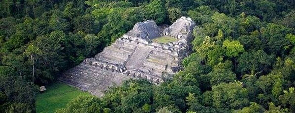
CARACOL MAYAN TEMPLE
Caracol is the name given to a large ancient Maya archaeological site, located in what is now the Cayo District of Belize. It is situated approximately 40 kilometres south of Xunantunich and the town of San Ignacio Cayo, and 15 kilometers away from the Macal River. It rests on the Vaca Plateau at an elevation of 500 meters above sea-level, in the foothills of the Maya Mountains. Long thought to be a tertiary center, it is now known that the site was one of the most important regional political centers of the Maya Lowlands during the Classic Period. Caracol covered approximately 200 square kilometers, covering an area much larger than present-day Belize City (the largest metropolitan area in the country) and supported more than twice the modern city's population.
Caracol is the name given to a large ancient Maya archaeological site, located in what is now the Cayo District of Belize. It is situated approximately 40 kilometres south of Xunantunich and the town of San Ignacio Cayo, and 15 kilometers away from the Macal River. It rests on the Vaca Plateau at an elevation of 500 meters above sea-level, in the foothills of the Maya Mountains. Long thought to be a tertiary center, it is now known that the site was one of the most important regional political centers of the Maya Lowlands during the Classic Period. Caracol covered approximately 200 square kilometers, covering an area much larger than present-day Belize City (the largest metropolitan area in the country) and supported more than twice the modern city's population.
Cerros Mayan Temple
CERROS MAYAN TEMPLE
Cerros is an Eastern Lowland Maya archaeological site in northern Belize that functioned from the Late Preclassic to the Postclassic period. The site reached its apogee during the Mesoamerica Late Preclassic and at its peak, it held a population of approximately 1,089 people. The site is strategically located on a peninsula at the mouth of the New River where it empties into Chetumal Bay on the Caribbean coast. As such, the site had access to and served as an intermediary link between the coastal trade route that circumnavigated the Yucatan Peninsula and inland communities. The inhabitants of Cerros constructed an extensive canal system and utilized raised0field agriculture.
Cerros is an Eastern Lowland Maya archaeological site in northern Belize that functioned from the Late Preclassic to the Postclassic period. The site reached its apogee during the Mesoamerica Late Preclassic and at its peak, it held a population of approximately 1,089 people. The site is strategically located on a peninsula at the mouth of the New River where it empties into Chetumal Bay on the Caribbean coast. As such, the site had access to and served as an intermediary link between the coastal trade route that circumnavigated the Yucatan Peninsula and inland communities. The inhabitants of Cerros constructed an extensive canal system and utilized raised0field agriculture.
El Pilar Mayan Temple
EL PILAR MAYAN TEMPLE
El Pilar is an ancient Maya city center located on the Belize-Guatemala border. The site is located 7.5 miles north of San Ignacio, Belize and can be accessed through the San Ignacio and Bullet Tree Falls on the Belize River. The name "El Pilar" is Spanish for "watering basin", reflecting the abundance of streams around the site and below its escarpment, which is rare in the Maya area.
The monuments of El Pilar are at the center of a 5,000 acres protected area known as El Pilar Archeological Reserve for Maya Flora and Fauna, declared a cultural monument in both Belize and Guatemala in 1998. El Pilar is the largest Maya site in the Belize River area with over 25 plazas and hundreds of other major buildings, covering about 120 acres.
Lamanai Mayan Temple

LAMANAI MAYAN TEMPLE
Lamanai (from Lama'anayin, "submerged crocodile" in Yucatec Maya) is a Mesoamerican archaeological site, once a major city of the Mayan civilization, located in the north of Belize, in Orange Walk District. The site's name is pre-Columbian, recorded by early Spanish missionaries, and documented over a millennium earlier in Maya inscriptions as Lam'an'ain. Lamanai is renowned for its exceptionally long occupation spanning three millennia, beginning in the Early Preclassic Maya period and continuing through the Spanish and British Colonial periods, into the 20th century. Unlike most Classic-period sites in the southern Maya lowlands, Lamanai was not abandoned at the end of the 10th century AD.
Lamanai (from Lama'anayin, "submerged crocodile" in Yucatec Maya) is a Mesoamerican archaeological site, once a major city of the Mayan civilization, located in the north of Belize, in Orange Walk District. The site's name is pre-Columbian, recorded by early Spanish missionaries, and documented over a millennium earlier in Maya inscriptions as Lam'an'ain. Lamanai is renowned for its exceptionally long occupation spanning three millennia, beginning in the Early Preclassic Maya period and continuing through the Spanish and British Colonial periods, into the 20th century. Unlike most Classic-period sites in the southern Maya lowlands, Lamanai was not abandoned at the end of the 10th century AD.
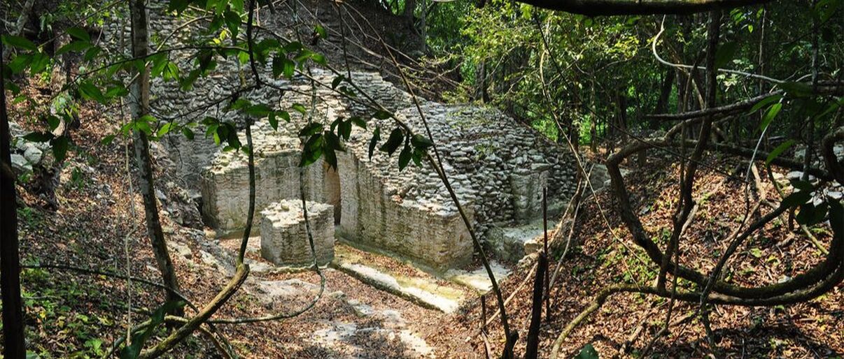
Lubaantun Mayan Temple
LUBAANTUN MAYAN TEMPLE
Lubaantun (pronounced luba-n-tun) is a pre-Columbian ruined city of the Maya civilization in southern Belize,
Central America. Lubaantun is in Belize's Toledo District, about 26 miles northwest of Punta Gorda, and approximately 2 miles from the village of San Pedro Columbia, at an elevation of 200 feet above mean sea level. One of the most distinguishing features of Lubaantun is the large collection of miniature cermaic objects found on site; these detailed constructs are thought to have been charmstones or ritual-accompanying accoutrements. Structures are mostly built of large stone blocks laid with no mortar.
The city dates from the Maya Classic era, flourishing from the AD 730s to the 890s, and seems to have been completely abandoned soon after. The architecture is somewhat unusual from typical Classical central lowlands Maya sites. Lubaantun's structures are mostly built of large stone blocks laid with no mortar, primarily black slate rather than the limestone typical of the region. Several structures have distinctive "in-and-out masonry"; each tier is built with a batter, every second course projecting slightly beyond the course below it. Corners of the step-pyramids are usually rounded, and lack stone structures atop the pyramids; presumably some had structures of perishable materials in ancient times.The centre of the site is on a large artificially raised platform between two small rivers; it has often been noted that the situation is well-suited to military defense. The ancient name of the site is currently unknown; "Lubaantun" is a modern Maya name meaning "place of fallen stones".
Nim Li Punit Mayan Temple
NIM LI PUNIT MAYAN TEMPLE
Nim Li Punit is a Maya Classic Period site in the Toledo District of the nation of Belize, located 40 kilometres north of the town of Punta Gorda, at 16° 19' N, 88° 47' 60W. Nim Li Punit is sometimes known as Big Hat or Top Hat; the name is Kekchi Maya for "Big Hat", referring to the large elaborate head-dress on a stela scuplture found on site depicting one of the site's ancient kings.
Nim Li Punit is a medium-sized site from the Maya Classic Period, flourishing from the 5th century AD through the 8th century AD. It consists of structures around three plazas, including several step-pyramids, the tallest being 12.2 meters high. The site has a number of carved stelae illustrating the ancient city's rulers. Several stelae are in an unfinished state, suggesting a sudden halt to work. The site is near Belize's Southern Highway and is open to visitors subject to an admission charge.
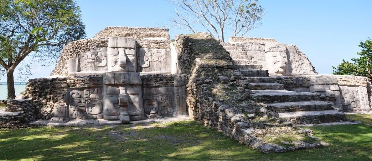
Santa Rita Mayan Temple
SANTA RITA MAYAN TEMPLE
Santa Rita ruins is a Mayan ruin and an archaeological reserve on the outskirts of Corozal, Belize. Historical evidence suggests that it was probably the ancient and important Maya city known as Chetumal.
Santa Rita ruins is a Mayan ruin and an archaeological reserve on the outskirts of Corozal, Belize. Historical evidence suggests that it was probably the ancient and important Maya city known as Chetumal.
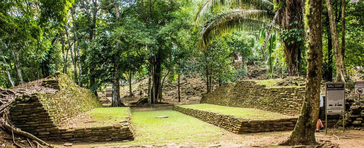
Xunantunich Mayan Temple
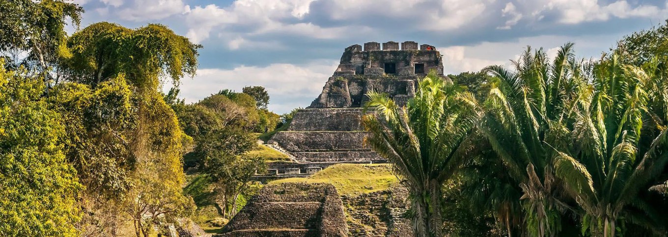
XUNANTUNICH MAYAN TEMPLE
Xunantunich (Mayan pronunciation: shu-nan-tunich) is an Ancient Maya archaeolgical site in western Belize, about 70 miles west of Belize City, in the Cayo District. Xunantunich is located atop a ridge above the Mopan River, well within sight of the Guatemala border – which is a mere 0.6 miles to the west. It served as a Maya civic ceremonial center in the Late and Terminal Classic periods to the Belize Valley region. At this time, when the region was at its peak, nearly 200,000 people lived in Belize.
Xunantunich's name means "Sculpture of Lady" in the Maya language (Mopan and Yucatec) combination name Xunaan(Noble lady) Tuunich (stone for sculpture)), and, like many names given to Maya archaeological sites, is a modern name; the ancient name is currently unknown. The "Stone Woman" refers to the ghost of a woman claimed by several people to inhabit the site, beginning in 1892. She is dressed completely in white, and has fire-red glowing eyes. She generally appears in front of "El Castillo", ascends the stone stairs, and disappears into a stone wall.
The first modern explorations of the site were conducted by Thomas Gann in the mid-1890s. Gann moved from Britain and served as the district surgeon and district commissioner of Cayo, British Honduras, starting in 1892. He chose this area to settle in because he had an interest in Mayan archaeology, and he wished to be able to explore the (at the time) unknown wonders of the indigenous people. Gann's successor, Sir J. Eric S. Thompson, implemented a more methodical approach, and was able to establish the region's first ceramic chronology. The main recent archaeological teams to work at Xunantunich and the surrounding region are the Xunantunich Archaeological Project (XAP) and the Xunantunich Settlement Survey (XSS).
In 1959–60, the Cambridge Expedition to British Honduras arrived in the colony and its archaeologist member, Euan Mackie, carried out several months of excavation at Xunantunich. He excavated the upper building on Structure A-11 in Group B and a newly discovered residential structure, A-15, just outside the main complex. Using the European method of detailed recording of the stratigraphy of the superficial deposits (the masonry structures themselves were not extensively cut into) he was able to infer that both buildings had been shattered by a sudden disaster which marked the end of the Classic period occupation. An earthquake was tentatively proposed as the cause; it is inferred purely on the basis of the excavated evidence, and also on the very damaged state of the top building of Structure A-6 ('El Castillo'). He was also able to confirm the later part of the pottery sequence constructed by Thompson. The detailed report by MacKie is "Excavations at Xunantunich and Pomona, Belize, in 1959–60". British Archaeological Reports (Int. series), 251, 1985: Oxford.
Farmers that fed the people living in Xunantunich typically lived in small villages, divided into kin-based residential groups. The farms were spread out widely over the landscape, though the center of Xunantunich itself is rather small in comparison. These villages were economically self-sufficient, which may be the reason why Xunantunich lasted as long as they did; they were not dependent on the city to provide for them. Settlement density was relative to soil quality, proximity to rivers, and localized political histories. Since the farmers were long established on their plots of land, they would not want to be involved with a polity that was under constant upheaval due to invading forces and more. Other nearby Maya archaeological sites include Chaa Creek and Cahal Pech, Buenavista del Cayo, and Naranjo.
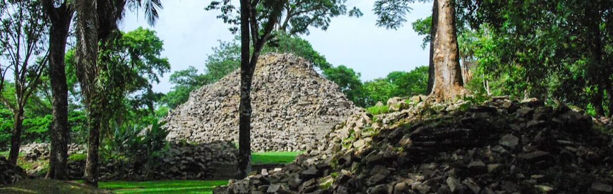
Tikal Mayan Temple
Guatemala Overnight
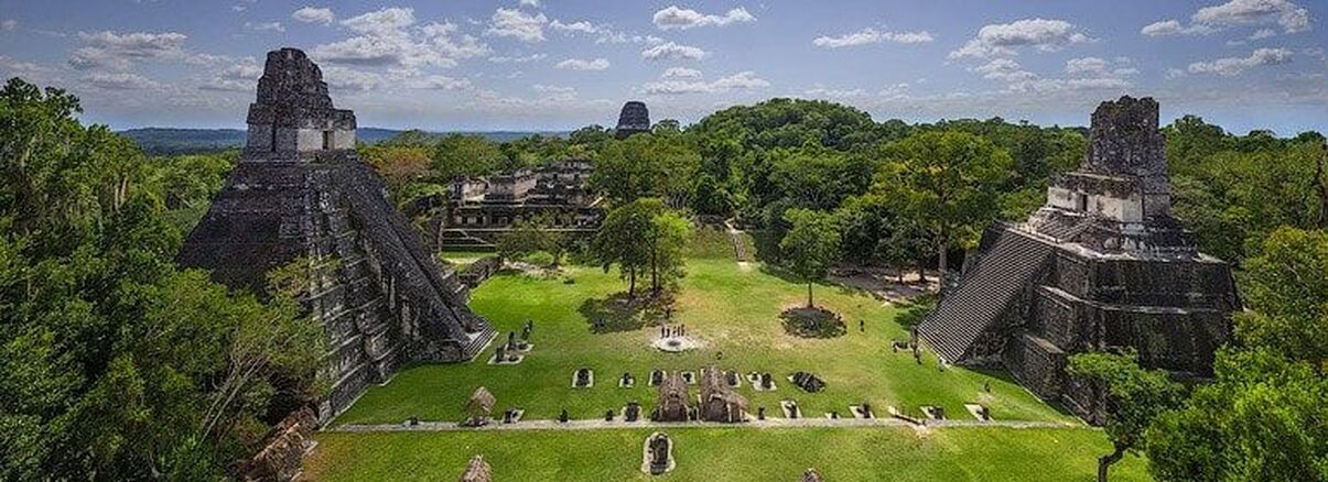
TIKAL (GUATEMALA) MAYAN TEMPLE
Tikal (Tik’al in modern Mayan orthography) is the ruin of an ancient city, which was likely to have been called Yax Mutal, found in a rainforest in Guatemala. It is one of the largest archaeological sites and urban centers of the pre-Columbian Maya civilization. It is located in the archaeological region of the Peten Basin in what is now northern Guatemala. Situated in the department of El Peten, the site is part of Guatemala's Tikal National Park and in 1979 it was declared a UNESCO World Heritage Site.
Tikal was the capital of a conquest state that became one of the most powerful kingdoms of the ancient Maya. Though monumental architecture at the site dates back as far as the 4th century BC, Tikal reached its apogee during the Classic Period, c. 200 to 900 AD. During this time, the city dominated much of the Maya region politically, economically, and militarily, while interacting with areas throughout Mesoamerica such as the great metropolis of Teotihuacan in the distant Valley of Mexico. There is evidence that Tikal was conquered by Teotihuacan in the 4th century CE. Following the end of the Late Classic Period, no new major monuments were built at Tikal and there is evidence that elite palaces were burned. These events were coupled with a gradual population decline, culminating with the site’s abandonment by the end of the 10th century.
Tikal is the best understood of any of the large lowland Maya cities, with a long dynastic ruler list, the discovery of the tombs of many of the rulers on this list and the investigation of their monuments, temples and palaces.