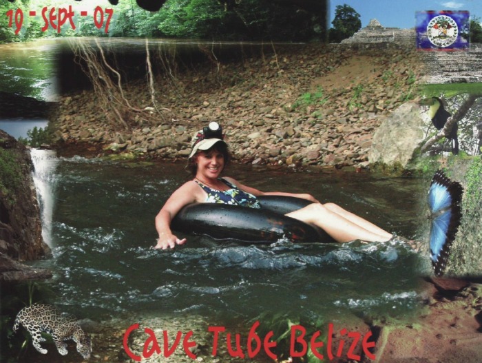
Cave Branch River - Cave Tubing
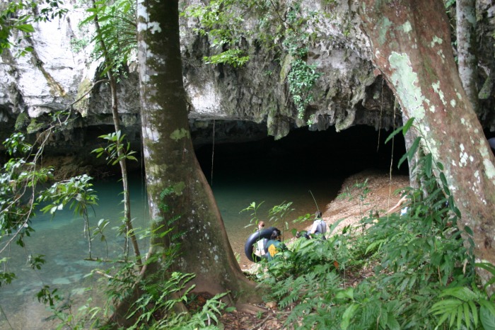
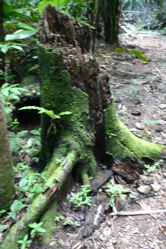
The Caves Branch River winds through a porous limestone landscape that is riddled with holes like a piece of Swiss cheese. Water flows through the jungle and then into caves before disappearing into underground passages only to later emerge again in some remote jungle stream. A few brave cave divers have ventured deep into pitch dark underground waterways but have only begun to map this intricate maze of water and rock.
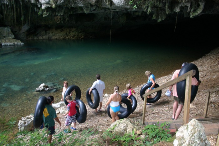
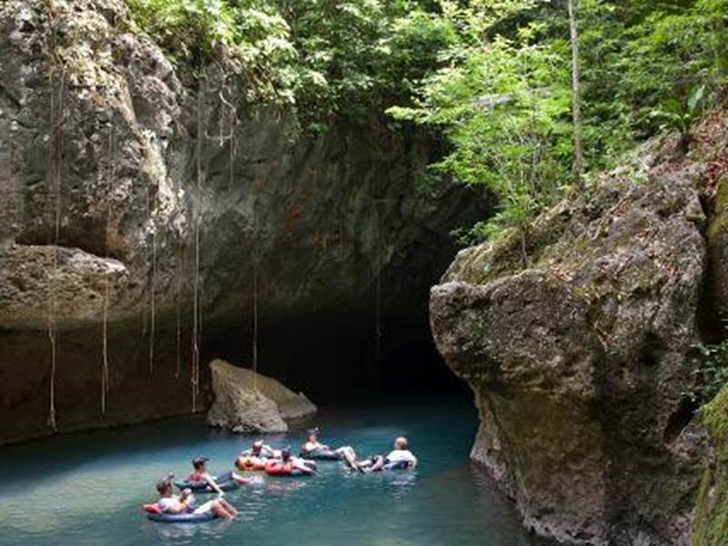
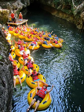
When you hear about Cave Tubing in Belize it refers to a small part of the vast Caves Branch River Cave System. Specifically, it refers to a segment of the Caves Branch River that flows continuously through 5 different caves. The river flows unbroken through each cave tunnel, like a freeway you drive through. Except instead of a car, you’re on an inner tube floating along the river through long cathedral like caves. There are other river-caves in Belize that you can float on an inner tube in, although only this series of five caves, can you continually float through all caves in an unbroken channel.
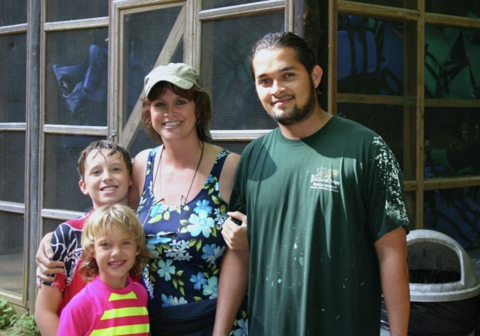
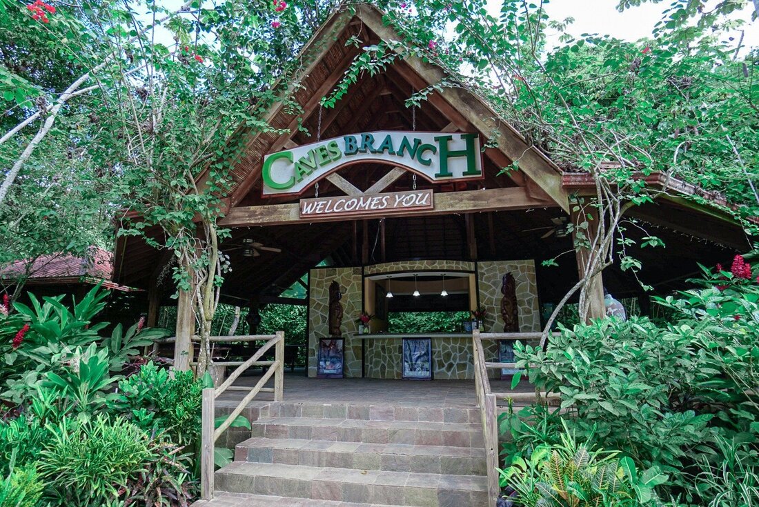
This unique river-cave system is called Nohoch Che’en Caves Branch Archaeological Reserve and it is managed by the Institute of Archeology which is a part of the National Institute of Culture & History. Whether you’re visiting on a cruise ship and doing a cave tubing cruise shore excursion or are staying in a nearby resort doing a cave tubing tour, you’re in for a memorable experience. It’s a very easy and accessible tour that anyone can do. Over the years both young and old, as well as everyone in between, has gone cave tubing! The river gets a bit low or high during the dry and wet seasons respectively, but the tour can be done year round. It’s only after a big rainstorm when the river overflows that it’s not possible to do this tour.
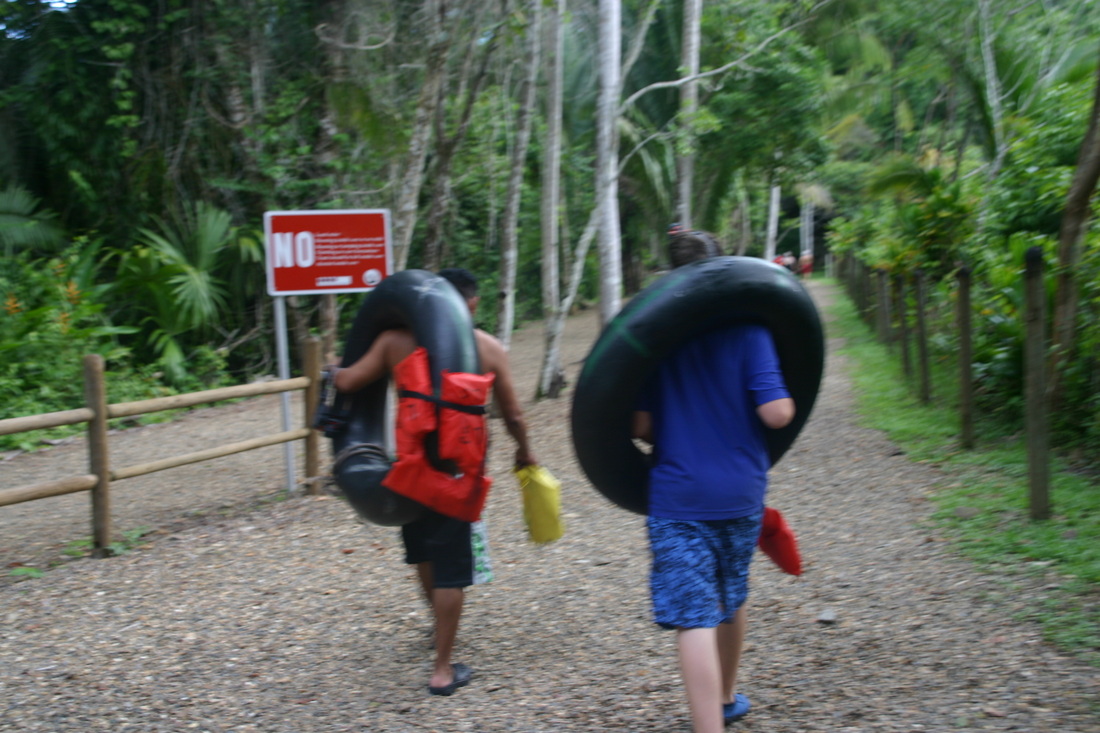
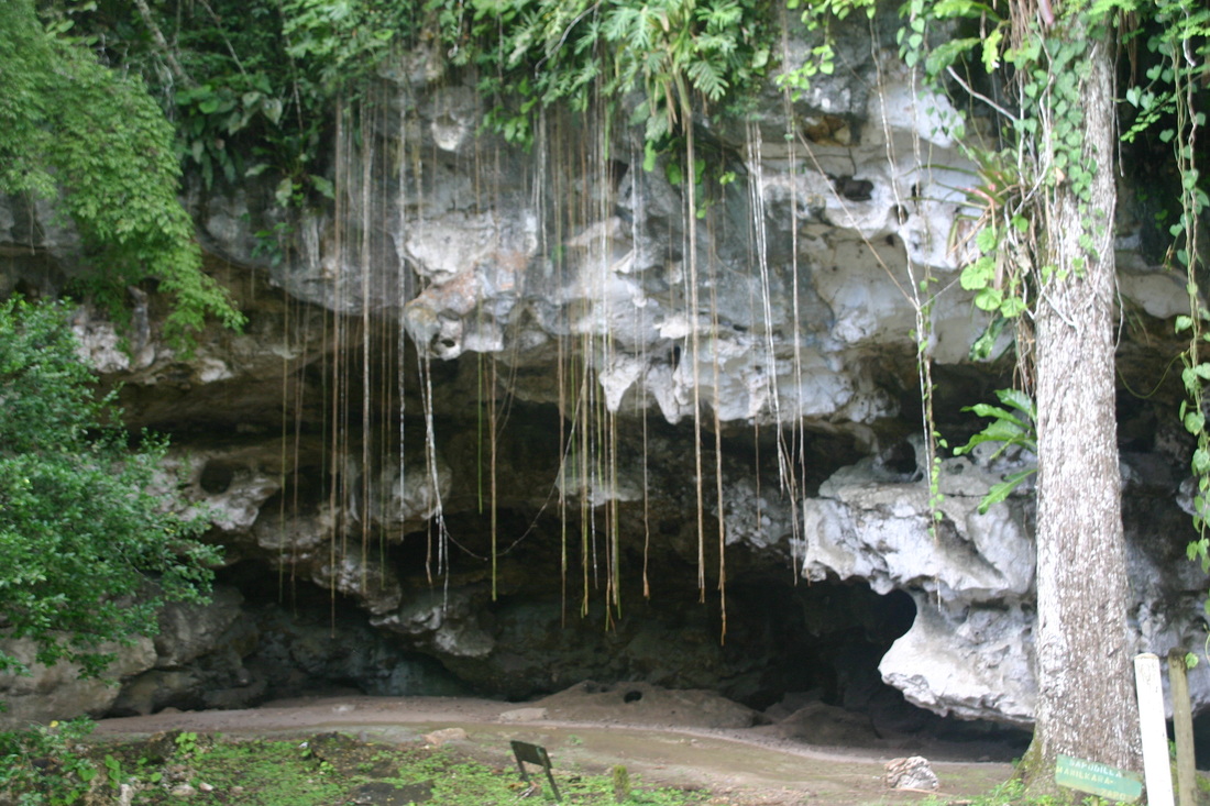
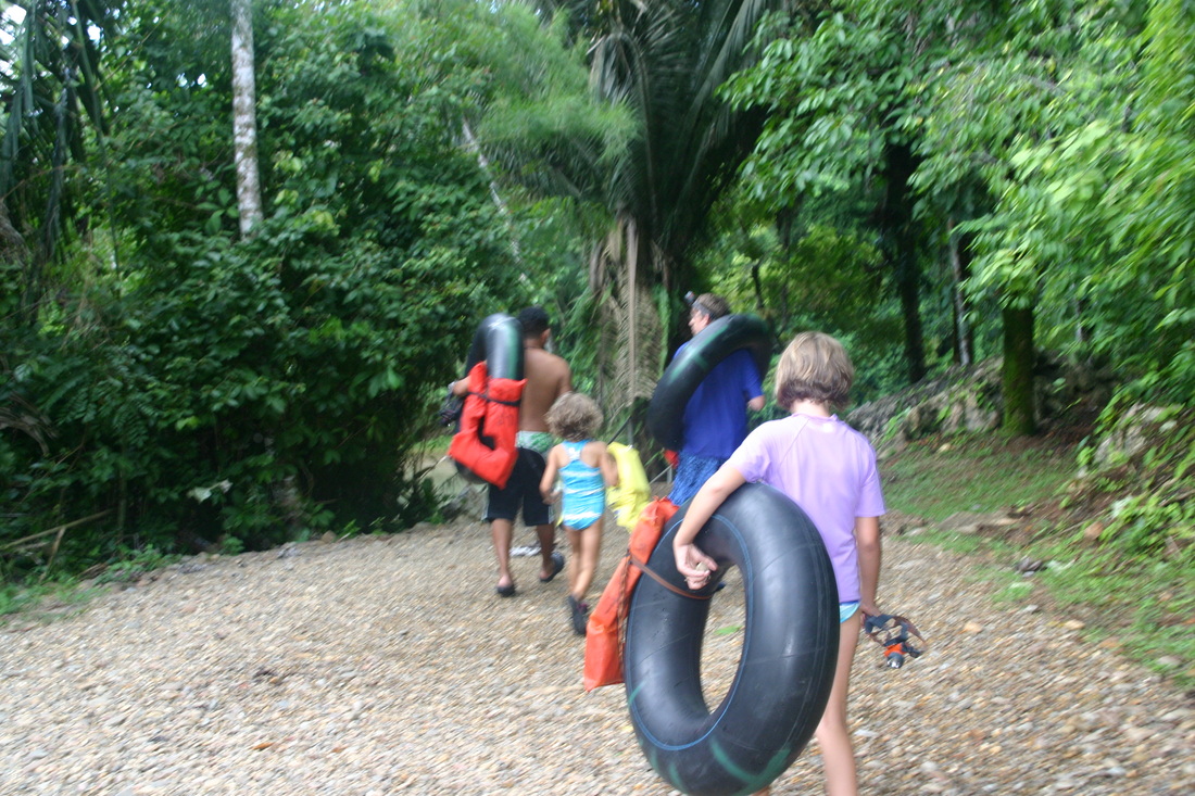
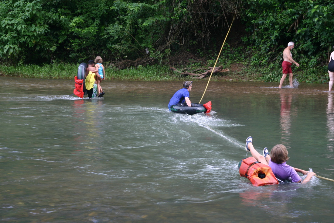
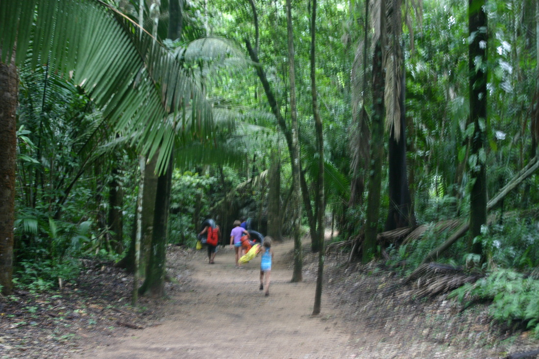
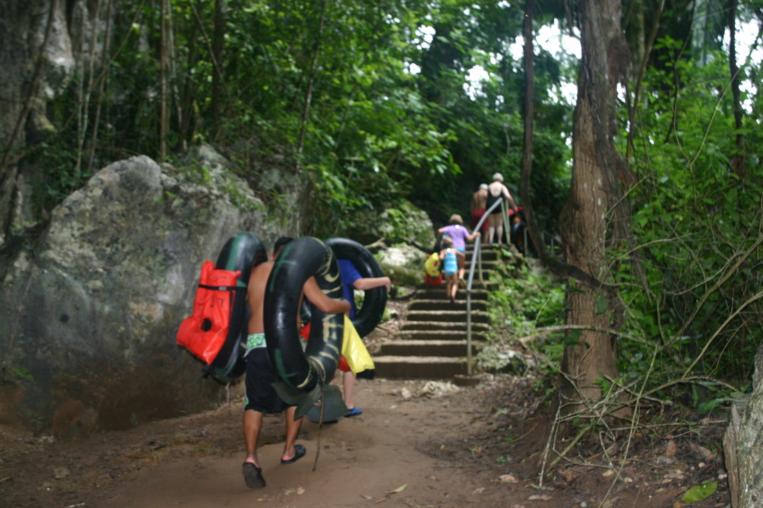
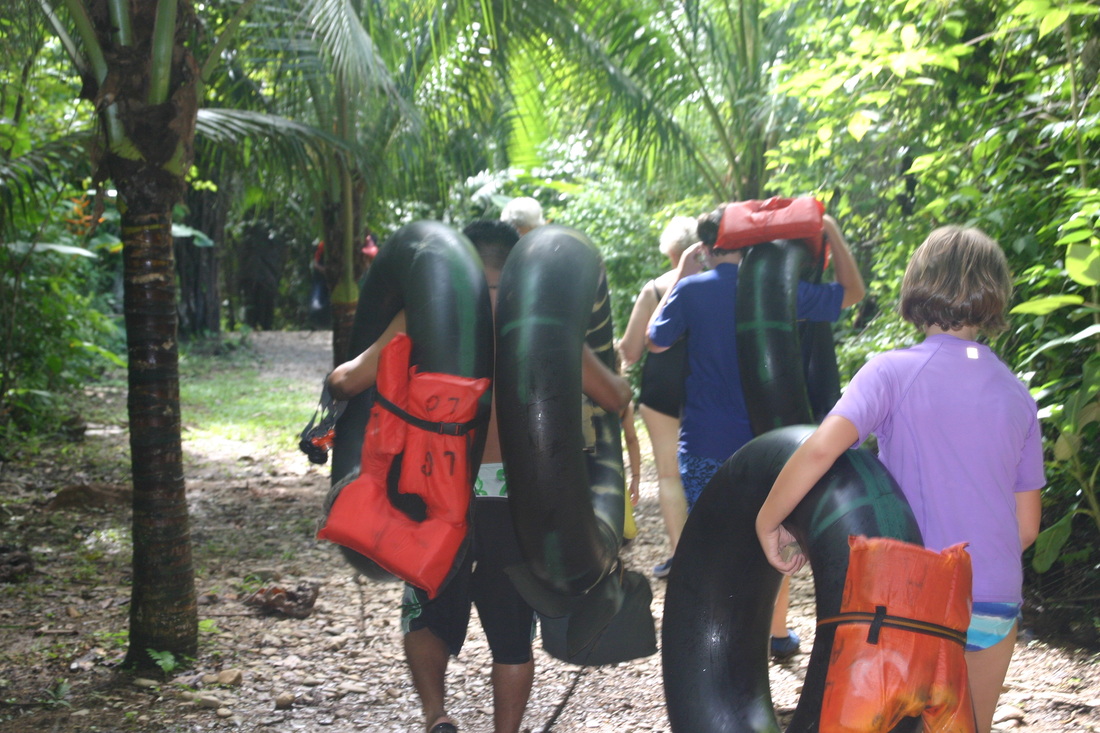
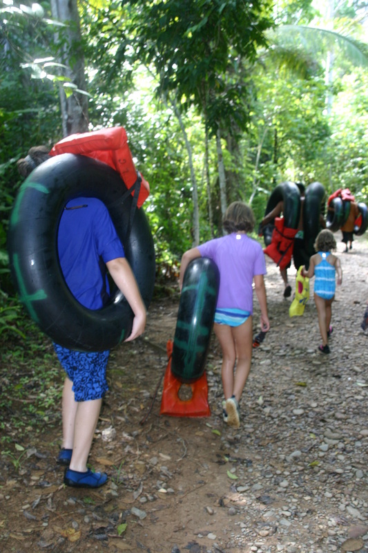
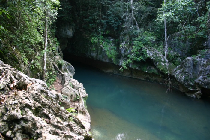
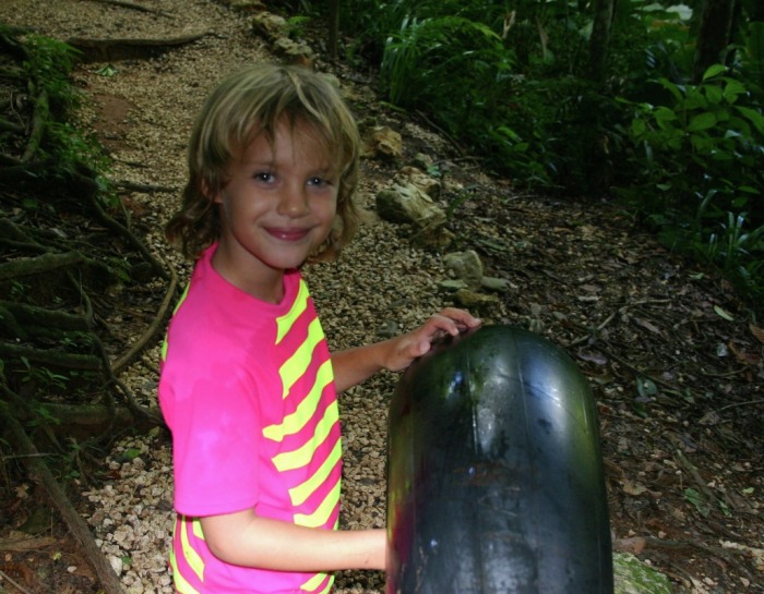
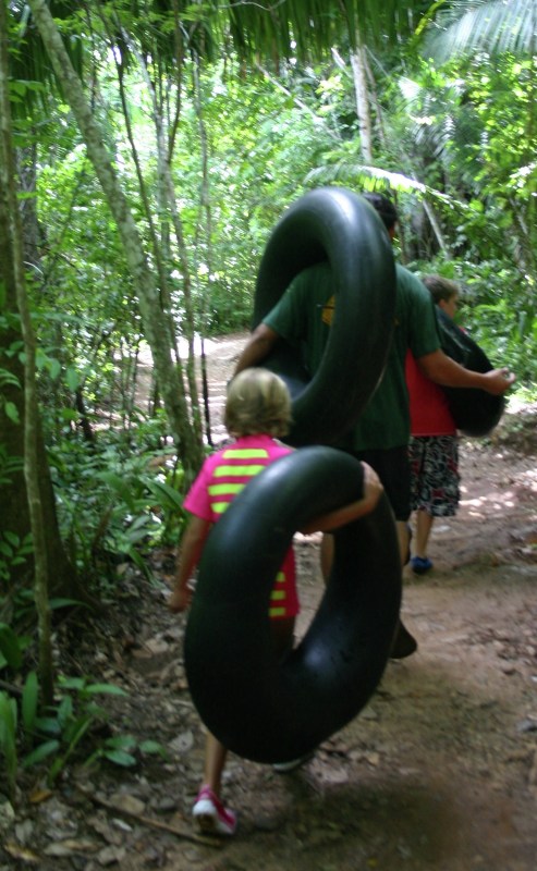
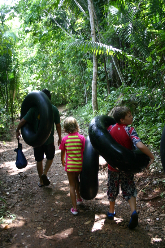
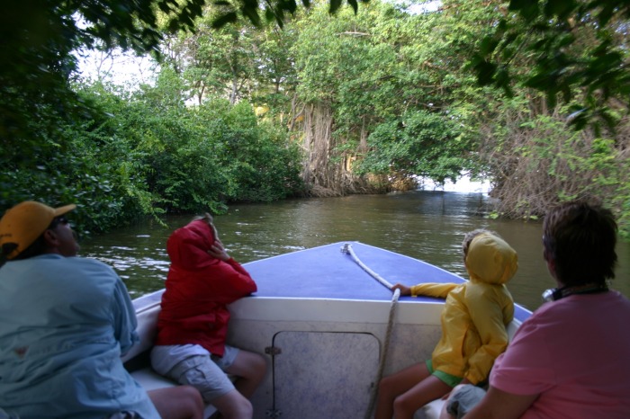
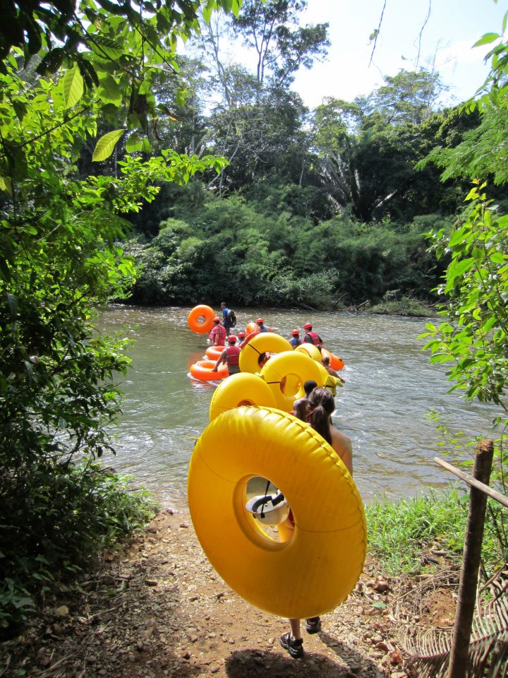
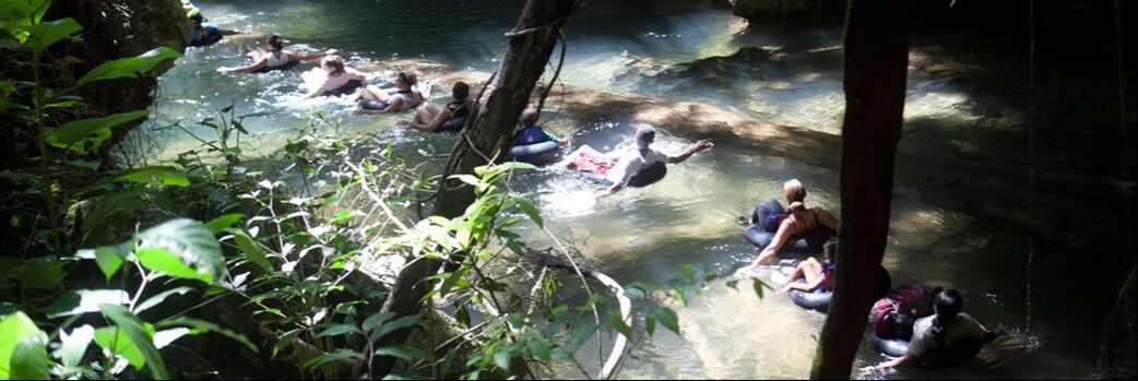
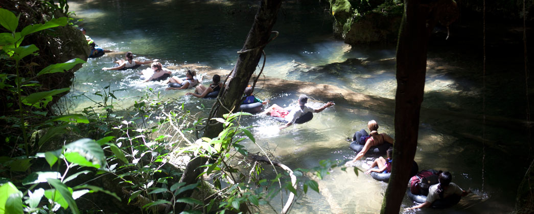
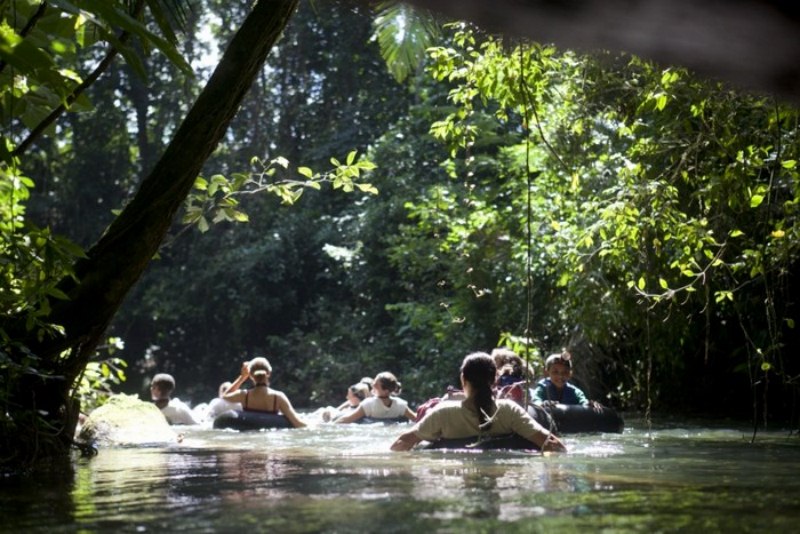
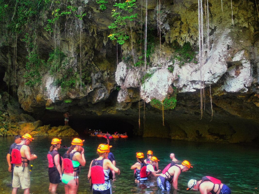
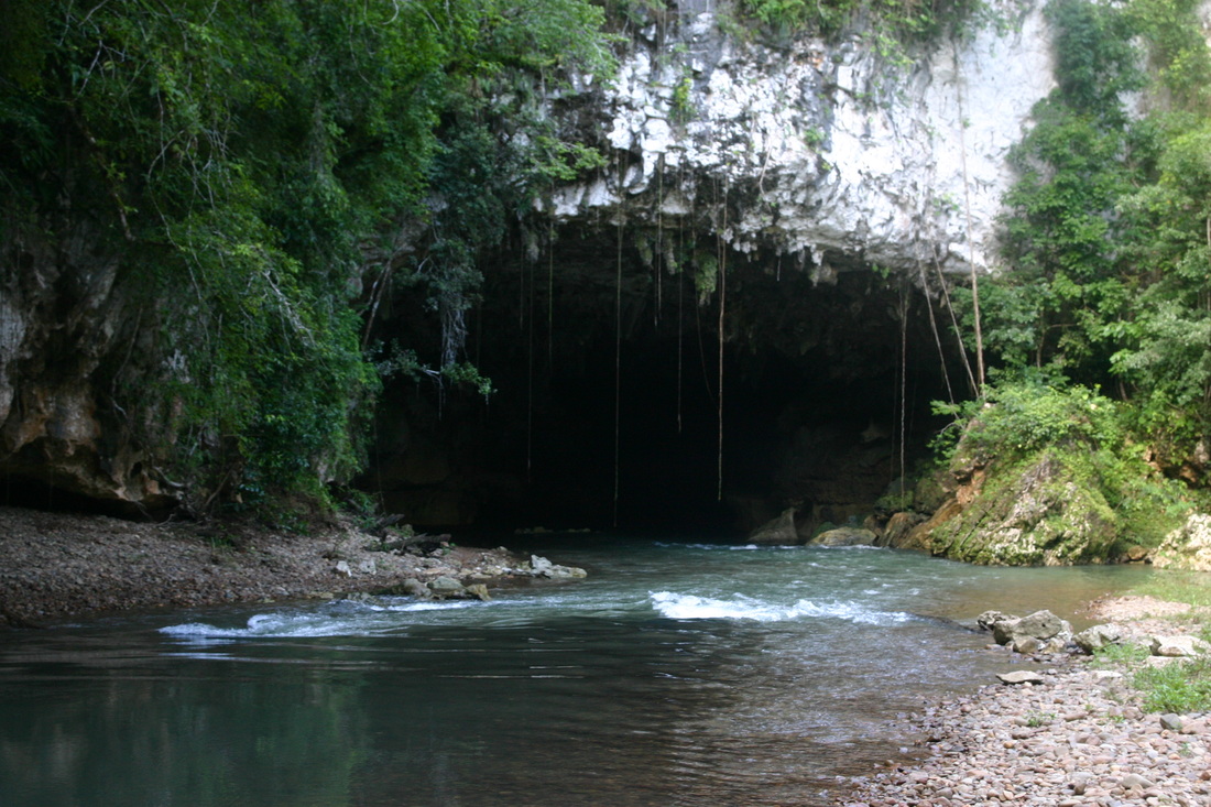
Most travelers end up doing the shorter cave tubing tour through the last 3 caves of the entire 5 cave system. After a quick hike along the jungle you’ll reach the point in the river that leads into the first cave. The water is crystal clear with hues of blue and green that just invite you to jump in. The current in the river will glide you along this unforgettable experience. Some segments of the river even have a few light rapids that add a little adrenaline to the tour. Along the way you’ll pass lush jungles and vine-draped cliff walls. As you enter the pitch dark caves only your head lamp will light your way illuminating cathedral chambers and geological cave formations. Inside one of the caves the guide will have everyone turn their headlights off. It’s an eerie feeling gliding along on your inner tube in absolute darkness. At this moment you really understand why the Maya believed caves were the window into the underworld.
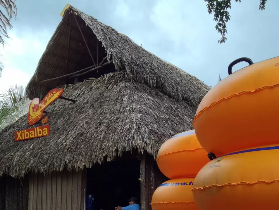
There are 2 access points to the 3 caves for the shorter cave tubing tour. The first is on private property that used to be a jungle resort named Jaguar Paw. They were one of the first companies to start offering cave tubing tours to cruise ships. This is why cave tubing tours are sometimes referred to as “Cave Tubing at Jaguar Paw”. The property was sold and is now Chukka/Bakabush Adventures who specialize in shore excursions for cruise ships. As this tour became more popular freelance tour guides wanted an easier way to access the caves rather than going through private property. As a result, the Institute of Archeology opened a second access point to the caves and this is where the majority of tour operators and guides will take you to begin your cave tubing tour.
There are two major entry points along the Cave Branch River to go cave tubing.
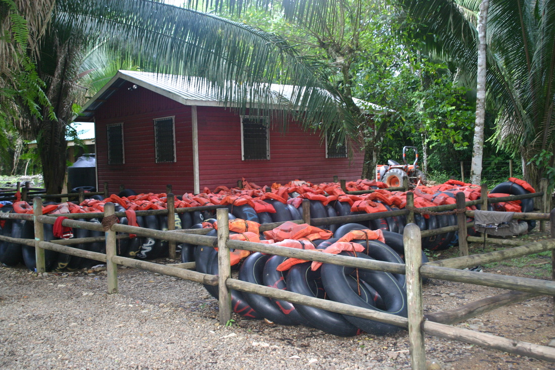
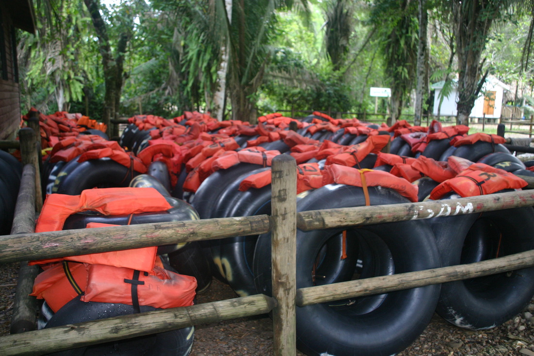
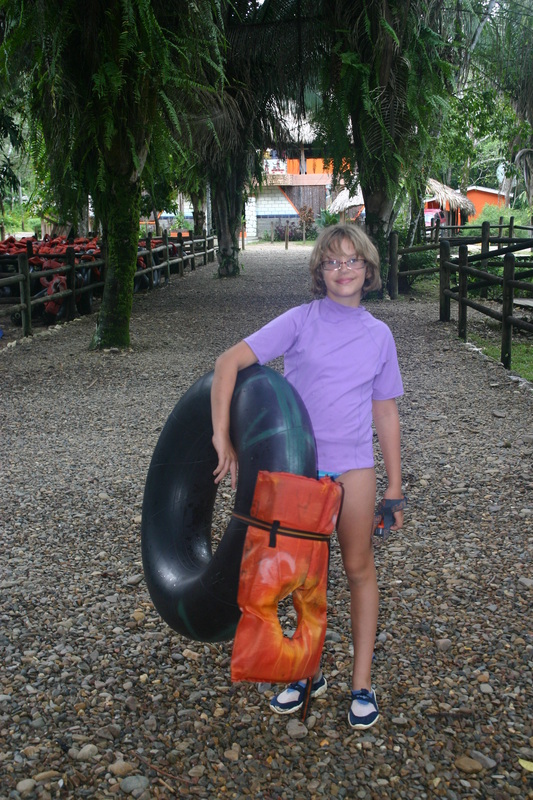
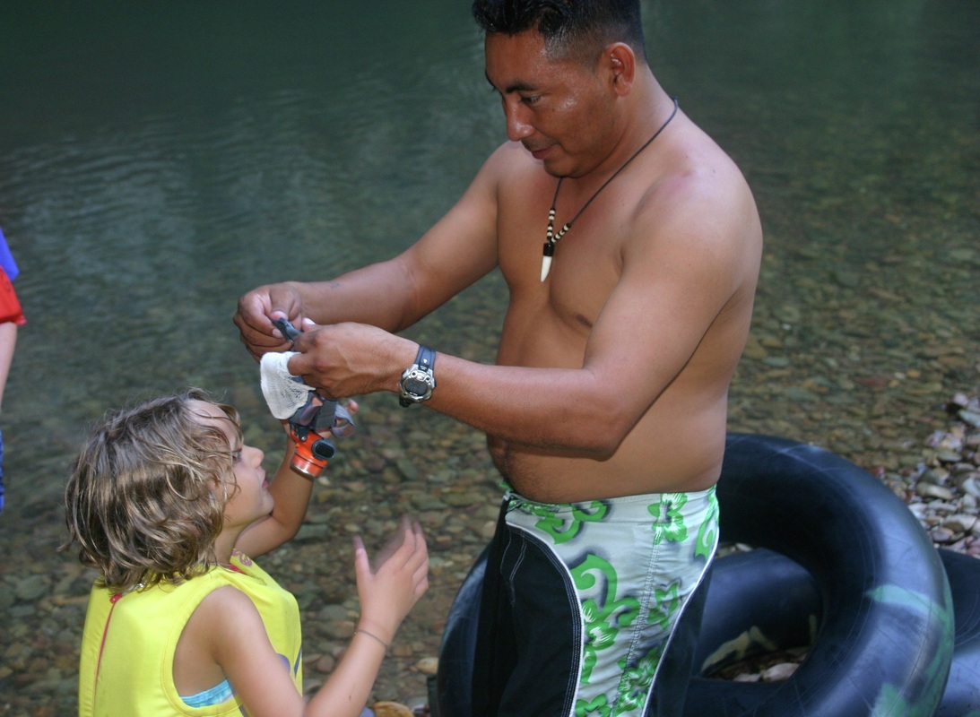
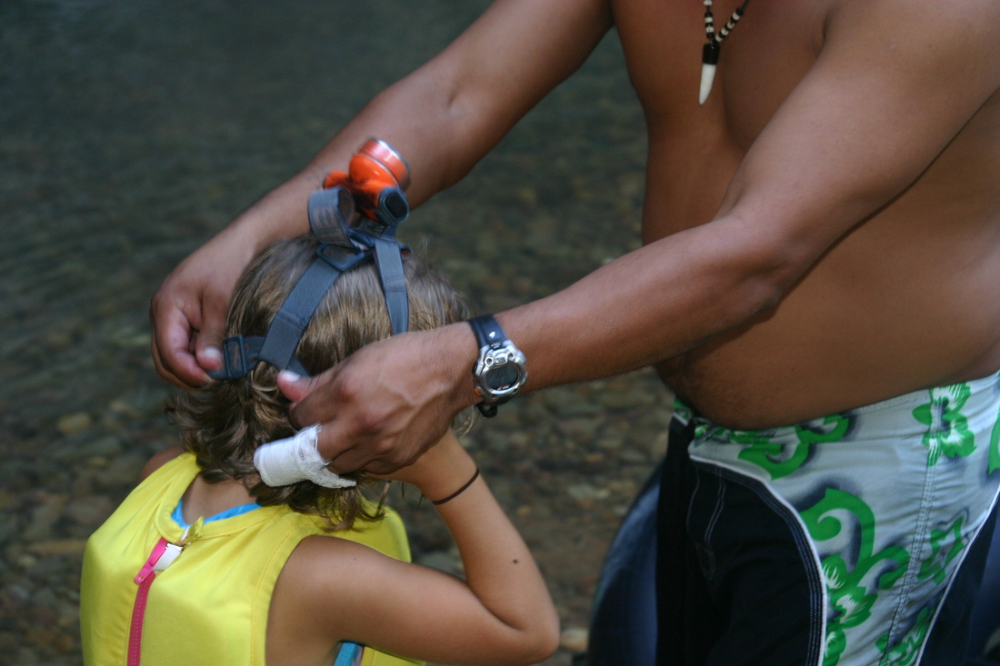
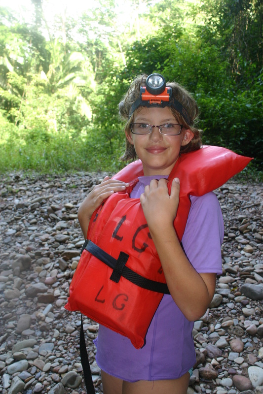
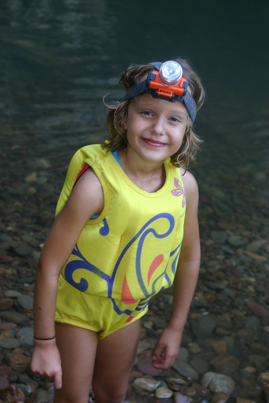
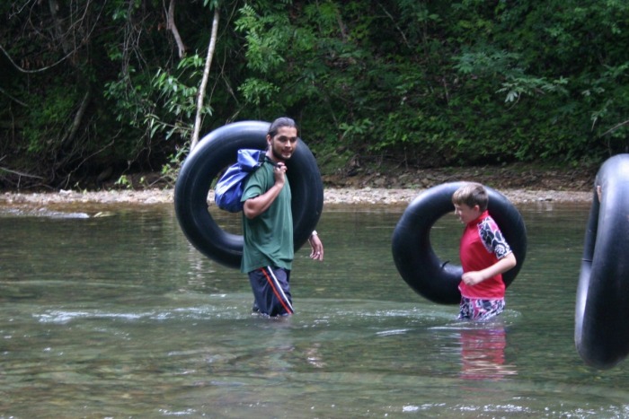
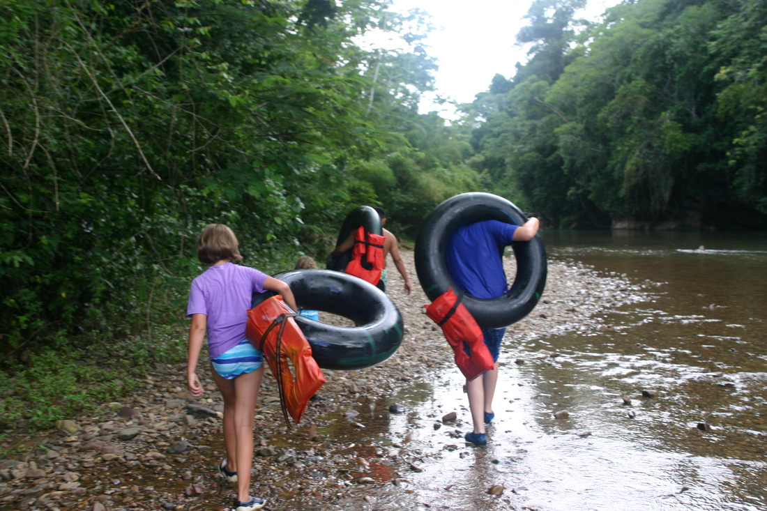
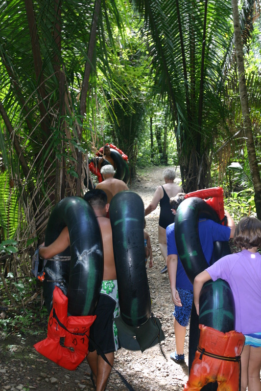
Depending on the tour you choose (either way, you'll have to hike upstream to a put-in point), and then begin your leisurely float down the river through one to five caves. You will be equipped with a life vest, helmet, headlamp and an inner tube. We recommend bringing along swim shoes. At some point during the tour, you may want to shut off all your headlamps, just to see how dark-dark is in a cave. For just a moment, you'll experience the spooky sensation of floating in total darkness, wondering where the walls, ceilings and outlet are.
When you hear about Cave Tubing in Belize it refers to a small part of the vast Caves Branch River Cave System. Specifically, it refers to a segment of the Caves Branch River that flows continuously through 5 different caves. The river flows unbroken through each cave tunnel, like a freeway you drive through. Except instead of a car, you’re on an inner tube floating along the river through long cathedral like caves. There are other river-caves in Belize that you can float on an inner tube in, although only this series of five caves, can you continually float through all caves in an unbroken channel.
This unique river-cave system is called Nohoch Che’en Caves Branch Archaeological Reserve and it is managed by the Institute of Archeology which is a part of the National Institute of Culture & History. Whether you’re visiting on a cruise ship and doing a cave tubing cruise shore excursion or are staying in a nearby resort doing a cave tubing tour, you’re in for a memorable experience. It’s a very easy and accessible tour that anyone can do. Over the years both young and old, as well as everyone in between, has gone cave tubing! The river gets a bit low or high during the dry and wet seasons respectively, but the tour can be done year round. It’s only after a big rainstorm when the river overflows that it’s not possible to do this tour.
Most travelers end up doing the shorter cave tubing tour through the last 3 caves of the entire 5 cave system. After a quick hike along the jungle you’ll reach the point in the river that leads into the first cave. The water is crystal clear with hues of blue and green that just invite you to jump in. The current in the river will glide you along this unforgettable experience. Some segments of the river even have a few light rapids that add a little adrenaline to the tour. Along the way you’ll pass lush jungles and vine-draped cliff walls. As you enter the pitch dark caves only your head lamp will light your way illuminating cathedral chambers and geological cave formations. Inside one of the caves the guide will have everyone turn their headlights off. It’s an eerie feeling gliding along on your inner tube in absolute darkness. At this moment you really understand why the Maya believed caves were the window into the underworld.
There are 2 access points to the 3 caves for the shorter cave tubing tour. The first is on private property that used to be a jungle resort named Jaguar Paw. They were one of the first companies to start offering cave tubing tours to cruise ships. This is why cave tubing tours are sometimes referred to as “Cave Tubing at Jaguar Paw”. The property was sold and is now Chukka/Bakabush Adventures who specialize in shore excursions for cruise ships. As this tour became more popular freelance tour guides wanted an easier way to access the caves rather than going through private property. As a result, the Institute of Archeology opened a second access point to the caves and this is where the majority of tour operators and guides will take you to begin your cave tubing tour.
There are two major entry points along the Cave Branch River to go cave tubing.
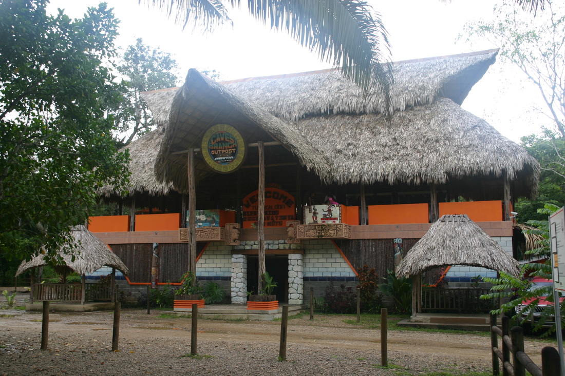
- Cave Branch River Outpost (Operates the shorter cave tubing tour, through the last 3 caves)
- Cave Branch Adventure Company (Operates cave tubing through all 5 caves)
Depending on the tour you choose (either way, you'll have to hike upstream to a put-in point), and then begin your leisurely float down the river through one to five caves. You will be equipped with a life vest, helmet, headlamp and an inner tube. We recommend bringing along swim shoes. At some point during the tour, you may want to shut off all your headlamps, just to see how dark-dark is in a cave. For just a moment, you'll experience the spooky sensation of floating in total darkness, wondering where the walls, ceilings and outlet are.
Cave Tubing at Nohoch Che’en Caves Branch Reserve
Just about every travel writer out there (who has experienced Caves Branch River tubing) will tell you, it reminds them of sailing in and out of big chunk of Swiss cheese. One minute you're in the sunshine and the next minute you are in the shadows of a cave. This surreal experience kicks in, when everyone turns off their headlamps, and you get to experience the "pitch-black" darkness of the cave around you. This is truly something fun to do for the whole family, and can be experience by all ages.
Just about every travel writer out there (who has experienced Caves Branch River tubing) will tell you, it reminds them of sailing in and out of big chunk of Swiss cheese. One minute you're in the sunshine and the next minute you are in the shadows of a cave. This surreal experience kicks in, when everyone turns off their headlamps, and you get to experience the "pitch-black" darkness of the cave around you. This is truly something fun to do for the whole family, and can be experience by all ages.
Why should I consider going cave tubing in Belize?
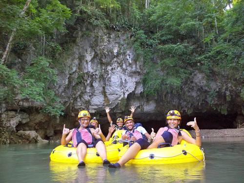
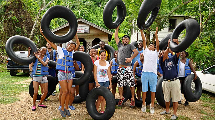
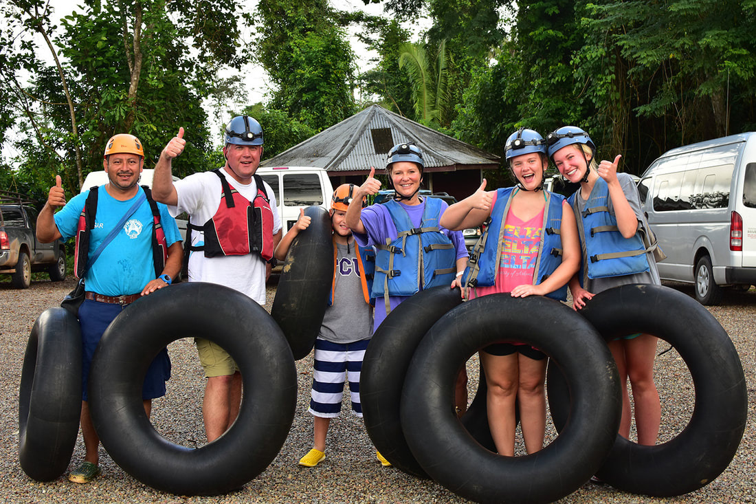
No matter how many excursions you book during your stay in Belize, this adventure is unique and deserves your attention. Imagine settling into an oversized rubber inner tube and floating down a river without a care in the world–until you disappear into caves where strange and exotic Mayan rituals were held thousands of years ago. Cave tubing is one of Belize’s main attractions and if you specify Nohoch Che’en Caves, you can pick and choose from (2 to 5) different caves to go through. The more adventurous souls insis on doing all five. You're perfectly safe in the company of other travelers and an experience licensed guide. No worries about the cave darkness, everyone is outfitted with life vests, helmets and headlamps. Mother Nature has no dress code here, but be forewarned - you’re likely to get wet.
No matter how many excursions you book during your stay in Belize, this adventure is unique and deserves your attention. Imagine settling into an oversized rubber inner tube and floating down a river without a care in the world–until you disappear into caves where strange and exotic Mayan rituals were held thousands of years ago. Cave tubing is one of Belize’s main attractions and if you specify Nohoch Che’en Caves, you can pick and choose from (2 to 5) different caves to go through. The more adventurous souls insis on doing all five. You're perfectly safe in the company of other travelers and an experience licensed guide. No worries about the cave darkness, everyone is outfitted with life vests, helmets and headlamps. Mother Nature has no dress code here, but be forewarned - you’re likely to get wet.
|
When is the best time to go?
The best time to go cave tubing in Belize is during the dry season, between the months of December and April, when there are fewer chances of heavy rains. You can still go cave tubing during the rainy season, as it doesn't rain all the time. It's just that you have to keep an eye on periods of heavy rain (to do this tour), because of rising water levels inside the caves. An experience guide, will know all about this and can advise you accordingly. While the river rises and falls with seasonal changes, for the most part, you can cave tube all year long. What is the best way to experience cave tubing? Since this cave system is managed by Belize’s Institute of Archaeology, a single tubing experience offers a splendid variety of sensations to tickle your senses. From the soothing ride to the smells and sounds that follow tubers in and out of caves to the quick hike through jungle to the first cave entrance, marvel at the changing colors of the river and occasional elevation bumps loved by kids. Thanks to your helmet light, time spent at the Place of Fright won’t scare you. Can’t get enough thrills? Add a forest canopy zip line run to your itinerary. |
Where is Nohoch Che'en & Cave Branch River located?
The Nohoch Che'en Caves Branch Archaeological Reserve is located on an unnamed road off the Hummingbird Highway. It is about 30 minutes away from Belmopan City and one hour from San Ignacio, Cayo. What is the best way to get to Cave Branch? Getting to Nohoch Che'en is relatively easy. If you have a personal vehicle or a rental, you can easily drive to the site. You can also travel there by public bus - just be on the lookout for the sign to get off the bus. However, if you have booked this tour with a licensed tour operator, your guide will be picking you up and dropping you off. Although if you're driving (from Belmopan), travel George Price Highway an hour to Mile 37. Drive 6 miles to the reserve entrance. |
Cave Branch River Outpost
Riddled with holes in the ground and caverns under the earth, Belize boasts one of the largest cave systems in Central America. Belize is home to over 900 Maya sites, covering eight thousand square miles of Earth. As you could imagine that is a lot to excavate (luckily though), not all these “sites” are large ruined/abandoned temples. Quite a number of these sites includes small village remains and underground caves.
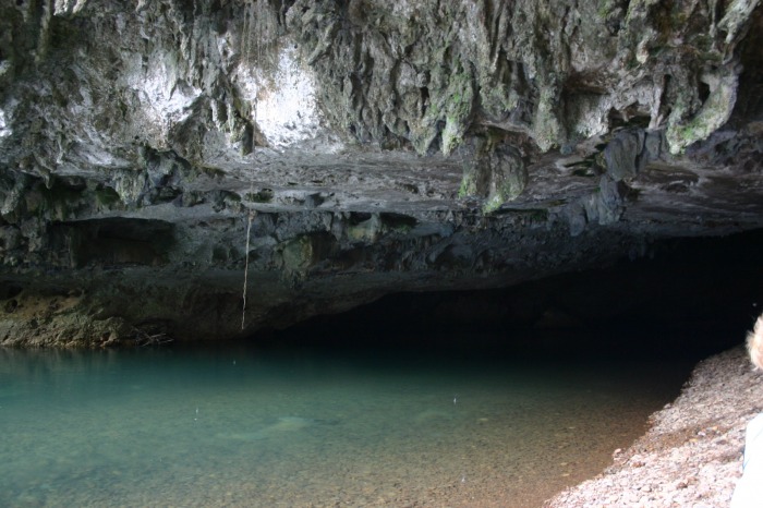
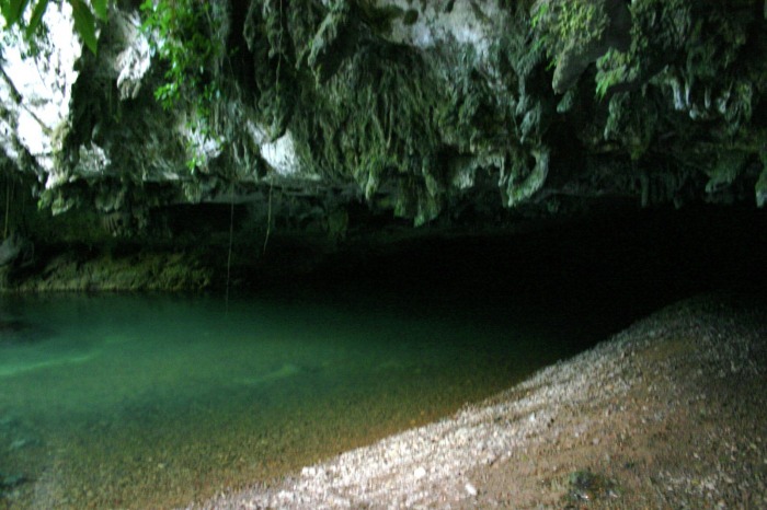
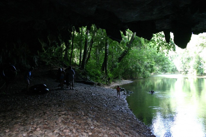
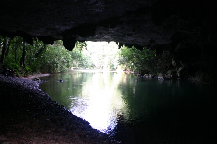
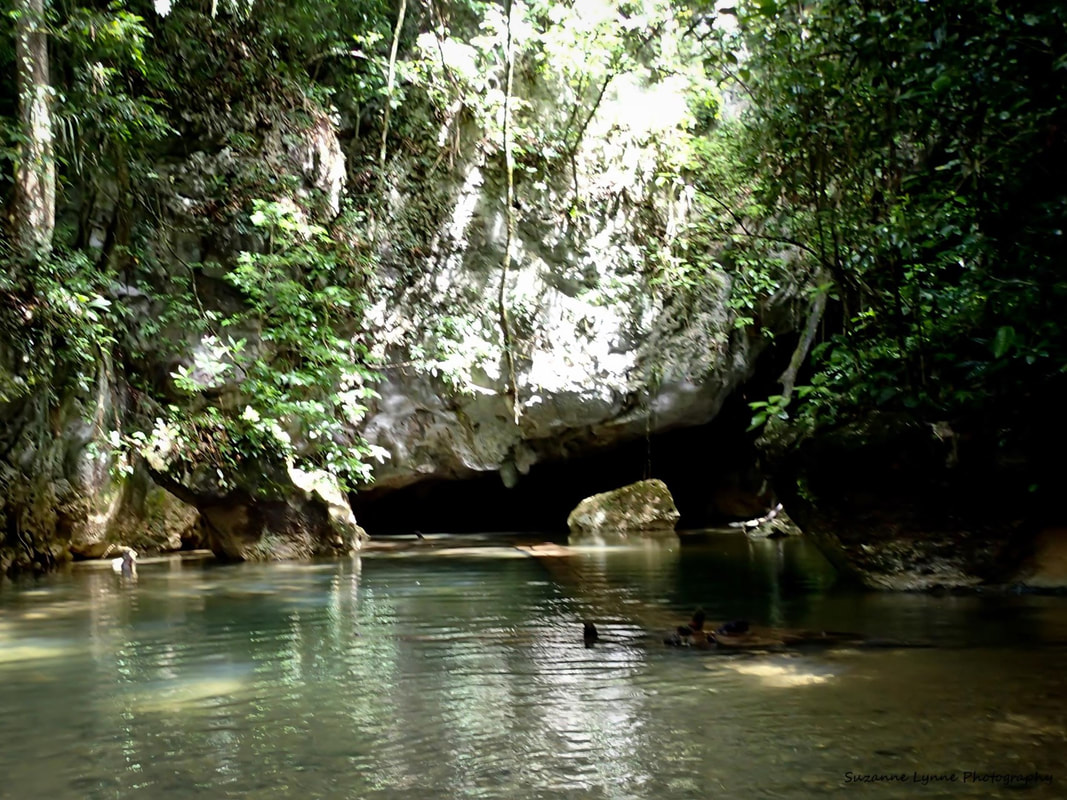
Floating in an air-filled tube quietly down the stream and through limestone caverns has the potential to be one of the most serene experiences a person can have in Belize. As you make your way slowly from the mouth of a cave and through its inner tunnels you’ll be struck by the stark lack of light within.
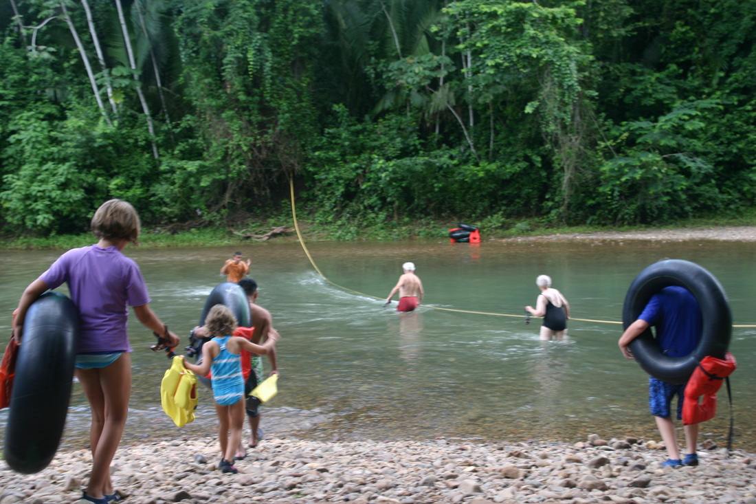
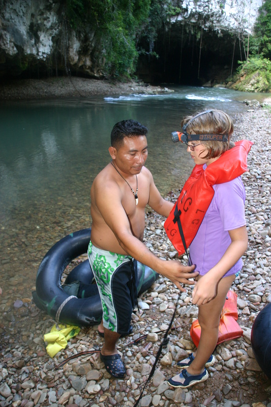
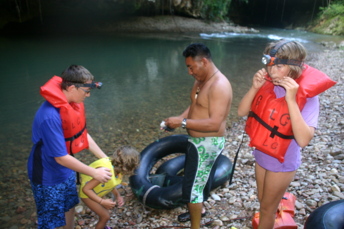
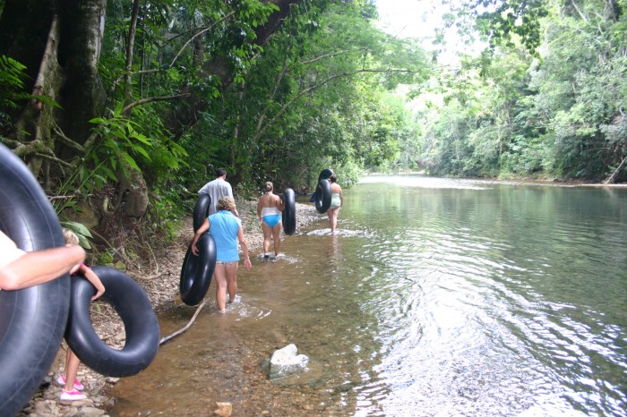
After hiking for some time, you will arrive at a section of the Cave Branch River that must be crossed. The river typically only goes up to people's ankles, which makes it easy to cross. This crossing signals that you are near the entrance of the cave and are about to start cave tubing. Once you arrive, the first thing you'll want to do is take a dip in the river, the water is so refreshing after the hike. Before entering the cave, your guide will brief you on the caves, safety protocol, and what you should expect to see.
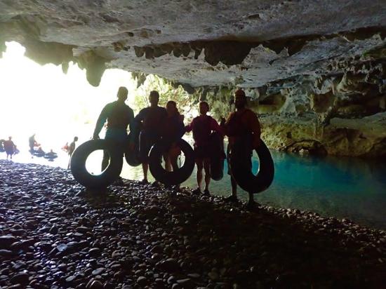
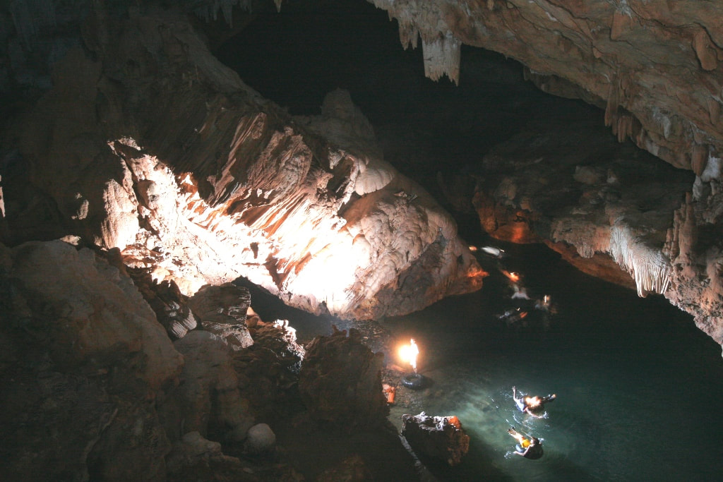
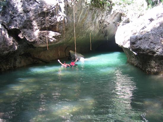
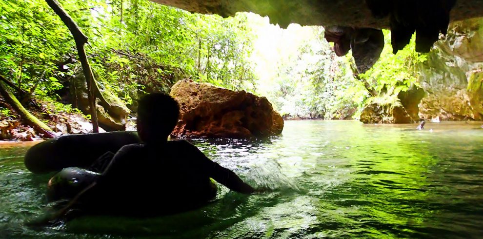
As you float further into the cave, darkness will surround you. Fortunately, your headlamps will alleviate some of this darkness and help to guide you along the river's course. Throughout the cave (as you float along), you will see various stalactites, stalagmites, broken pieces of pottery, and other ancient Mayan artifacts. Once deep inside the cave, your guide will prompt you to turn off your headlamps for about two minutes. You'll be left floating in complete darkness, a feeling that is both exhilarating and spooky. Then before you know it, you'll see a glimpse of sunlight at the end of the cave, signaling that your tour is about to end.
Floating in an air-filled tube quietly down the stream and through limestone caverns has the potential to be one of the most serene experiences a person can have in Belize. As you make your way slowly from the mouth of a cave and through its inner tunnels you’ll be struck by the stark lack of light within.
After hiking for some time, you will arrive at a section of the Cave Branch River that must be crossed. The river typically only goes up to people's ankles, which makes it easy to cross. This crossing signals that you are near the entrance of the cave and are about to start cave tubing. Once you arrive, the first thing you'll want to do is take a dip in the river, the water is so refreshing after the hike. Before entering the cave, your guide will brief you on the caves, safety protocol, and what you should expect to see.
As you float further into the cave, darkness will surround you. Fortunately, your headlamps will alleviate some of this darkness and help to guide you along the river's course. Throughout the cave (as you float along), you will see various stalactites, stalagmites, broken pieces of pottery, and other ancient Mayan artifacts. Once deep inside the cave, your guide will prompt you to turn off your headlamps for about two minutes. You'll be left floating in complete darkness, a feeling that is both exhilarating and spooky. Then before you know it, you'll see a glimpse of sunlight at the end of the cave, signaling that your tour is about to end.


Cave Branch Adventure Company (River of Caves)
RIVER OF CAVES (7) Miles of Cave Tubing (5 Caves)
Cave Branch - This is where it all started! Ian Anderson's first and still Belize's longest and most spectacular "River of Caves" cave tubing float...over 7 miles underground. Enter the exciting world of rivers disappearing into the underworld as you float on inner tubes with only your headlamp to light your way. Floating past side windows that filter the jungle light through the mist as you swirl around stalagmites jutting from the river and stalactites looming from above. Float past underground waterfalls then into the crystal cathedral, a spiritual center to the ancient Maya. Since Ian introduced cave tubing to Belize tourism, cave tubing has become Belize's most popular adventure trip. The original and full 7 mile "River of Caves" tube float is only available through the Cave Branch Adventure Company.
Located in Western Belize, Caves Branch is part of a cave system that is made up of three caves: Petroglyph, Waterfall and Footprint. These names were given to the caves from the objects you’ll see inside. This cave system was formed by the Caves Branch River and made mostly from limestone. Limestone is made either from biological substances such as mollusks or corals, or can be precipitated directly from seawater and is easily dissolved. It’s a very scenic spot and locals love to visit the caves for bathing.
- Petroglyph Cave - Situated on the property of Ian Anderson's Cave Branch Jungle Lodge, the cave features an ancient rock drawing from about 300 to 900 A.D.
- Waterfall Cave - Situated on the property of Ian Anderson’s Caves Branch Jungle Lodge, the cave features about six different waterfalls and is the 2nd most exciting and popular cave adventure in the country. The cave is a 45 minute hike through the rain forests from the starting point of the expedition. Once inside the cave another 45 minute hike though narrow passages, past enormous crystal formations and walled dams brings you to the start of a series of thundering waterfalls which are conquered with the help of expert guides. This amazing attraction will leave you gasping for more and is one of the unforgettable adventures that Belize offers!
- Footprint Cave – This cave is located within the property of Ian Anderson’s Caves Branch Lodge and while it offers a short version of cave tubing, it also allows visitors to hike into the hidden chambers and view ancient artifacts and fire pits. There are embedded footprints on the walls of the Footprint cave.
- Nohoch Che’en Caves - Cave tubing in Belize is done at Nohoch Che'en Cave, which is most commonly known as Caves Branch or Jaguar Paw. The cave is located near Belmopany, in the district of Cayo.


Xibalba - The Mayan Underworld
Xibalba - Mayan ancestors believed the caves were the entrances to Xibalba (the underworld), the dwelling place for the god of death. Caves were used for religious ceremonies, bloodletting and sacrificial offerings. It was also a place where the dead found a resting place. Most caves in Belize were formed thousands of years ago when seeping rainwater and rivers flowing underground found their way out. Most caves are formed from limestone and many of them have underground rivers flowing through them.
Over a thousand years ago the Mayan inhabitants left the caves one by one. In time, these sites became abandoned and forgotten, deemed too dangerous for day to day life and too dark to ever be comfortable for human eyes. It’s difficult to ascertain exactly how old many of these cave formations are. Many of the artifacts left in them have since become calcified, encased in limestone sediments and fused with the cave-scape around them. Many, if not all the artifacts found therein are permanently fixed to their resting place. It is also difficult to determine whether the caves with no artifacts were used at all or perhaps for different purpose.
Many of the caves are found deep in the rain forests of Belize and from the mouth of caves a vapor cloud can be seen at the entrance. To the ancient Maya this seemed to signify where clouds originated. The gods lived in the underground chambers and the Maya held some of their most sacred rituals in many of Belize’s caves.
Relics, pottery, obsidian knives, sacrificial fire pits, ashes, fire wood, carvings and human remains can be found and viewed today in many of these caves. Some of Belize’s caves feature chambers so deep inside that they take 45 minutes to 1 hour walking to reach them. Other caves hold some of Belize’s most amazing attractions such as waterfalls, sky lights and merging rivers.
Karst Landscaping of Belize
Off the Hummingbird Highway, is the spiraling network of tunnels and limestone rooms comprising of 36 "crystal" caves with enormous vaults of crystallized columns and statuary. Much of the geological structure of Belize is porous karst limestone. This makes it ideal for the formation of underground caves and rivers, and the southern portion of Belize is dotted with them. Although many caves have been known for years, new ones - including some of the most extensive systems in the whole of Central America - are still being explored.
The Cave Branch River is a gently flowing body of water coming down off the Mountain Pine Ridge. It really should be called a creek in most places. However, what makes the Cave Branch River unique is the fact that it flows in and out of a series of long limestone caves that are easily navigable in an inner tube or kayak.
From the Mountain Pine Ridge, the Cave Branch River descends into the valleys of the Sibun Hills and joins the Sibun River. On its course, it passes through green forests that hide white cliffs under a blue sky. The basalt and granite that form the Mountain Pine Ridge is the result of volcanic activity during the Paleozoic Era.
It wasn't until the Cretaceous Period, that dinosaurs roamed the great continents at this time but the rest of Belize was slowly forming below the sea. For thousands of years a reef surrounded the limestones of the Maya Mountains. The layer is 1,000 to 2,000 meters thick in some places. Eventually the sea level fell and the mountains of Central America pushed their way upward to put a slender waist between two continents. As the Cretaceous Period ended, wind, rain, and faulting have cut the Maya Mountains into the face of Belize.
The foothills of these mountains resemble rolling hills covered in a green blanket but a close look reveals something else. Rugged describes the hills from the headwaters of the Caves Branch between Coma Cairn and Baldy Sibun to its link with the Sibun River. The catchment basin is only 88 square km but a substantial river pours out of this bowl. All along its course, the limestone of the hills and valleys pirates the surface water to form underground streams that feed the Caves Branch. The Caves Branch itself flows for only 10 km before it is also swallowed by the limestone hills though which it has forced a channel to meet the Sibun. Where the river flows on the surface, it has cut banks as much as 10 meters deep into the limestone and it protects itself from further piracy from the limestone below by accumulating cobble, gravel and shale that has cemented into a non-porous bed.
The valley which the Cave Branch has carved is only 2 km wide and the steep sided hills which are more like cliffs averaging 30 meters in height. Erosion has isolated the hills from each other and cut them into many shapes and sizes so to climb one hill, one must descend into the valley to ascend the next. Geologists call this limestone terrain "cockpit karst". The most effective way to hike the terrain is to travel through the narrow an winding valleys between these hills. The hilltops are nearly bare rock and are deeply fissured. The slopes of these hills are really short cliffs; one set on top, the other all the way to the top. Trees on the way up manage a precarious toe-hold and are easily buffeted down during high winds. During heavy rains, hundred of small streams, some lasting a mere four hours, flow down the hillsides and the valley below. Water which pericolates into these hills form more enduring underground streams and over the milennia, they have discovered thousands of vases, into the landscape.
Since the 17th century when Europeans arrived to log the forests, the caves have been used as shelter from the rain and cold by the loggers and the chicleros and hunters who followed. These days rural Belizeans may picnic in the mouths of these caves and more unscrupulous visitors hunt pre-Colombian artifacts the Mayas left behind. The Mayas were the first to venture into the caves. The most renown in the area is the Petroglyph Cave with its hieroglyphic texts on the walls. Possibly all of these caves contain pottery, pottery shards and even burials. The Mayas had a special reverence for caves since their entrances were considered the entrances to Xibalba, their Underworld.
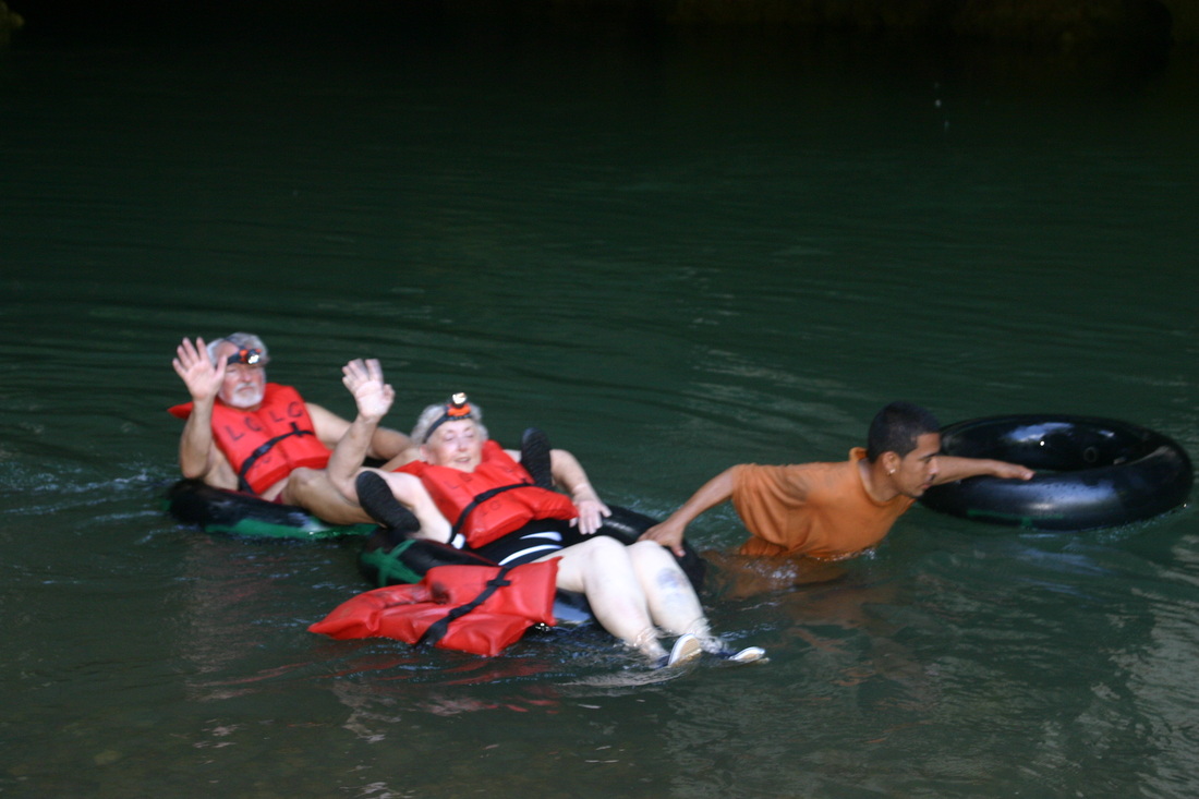
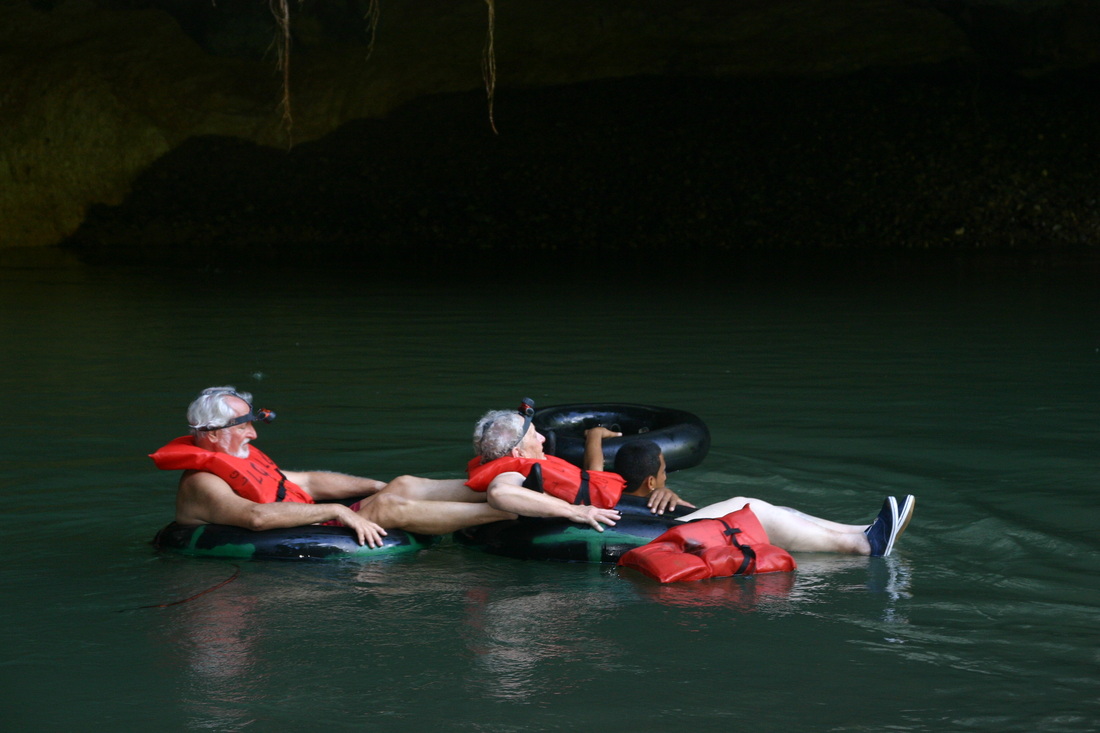
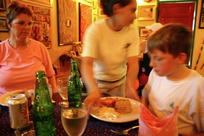
Fun For The Entire Family


KNOWING RIVER CONDITIONS
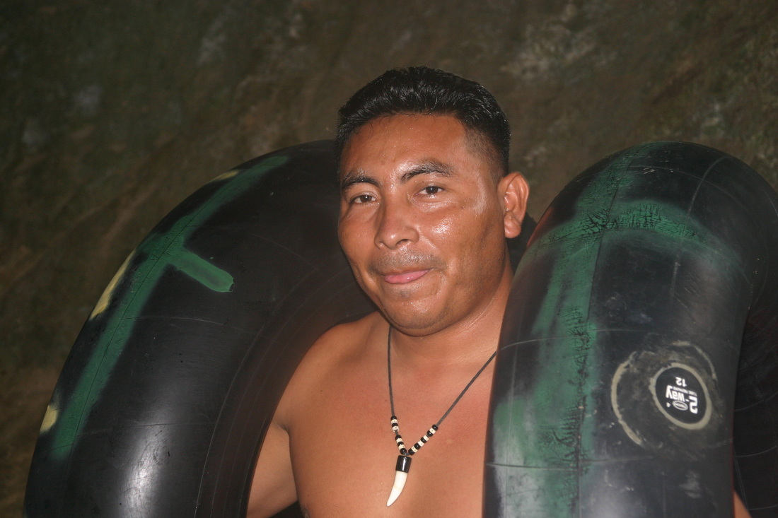
A trained professional guide, knows and understands river conditions. Their training has taught them the critical behavior of the river, especially as it relates to rising water (when it rains), and how this can affect the conditions inside the caves.
After it rains, seasoned licensed guides are the first to go in and inspect the water levels as they recede inside the caves. A park warden accompanies them, so this information can be passed along to the main office, and other companies can benefit. All guides (for the Belize Government), are licensed tour guides and are certified in first aid and CPR (cardiopulmonary resuscitation) as required. They are very well trained, and most are in the caves every day, if not once a week. We stay aware of weather conditions, and when there are rains that flood the caves (which doesn't happen often), we alter tours for safety reasons.
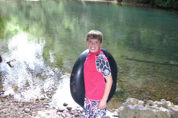
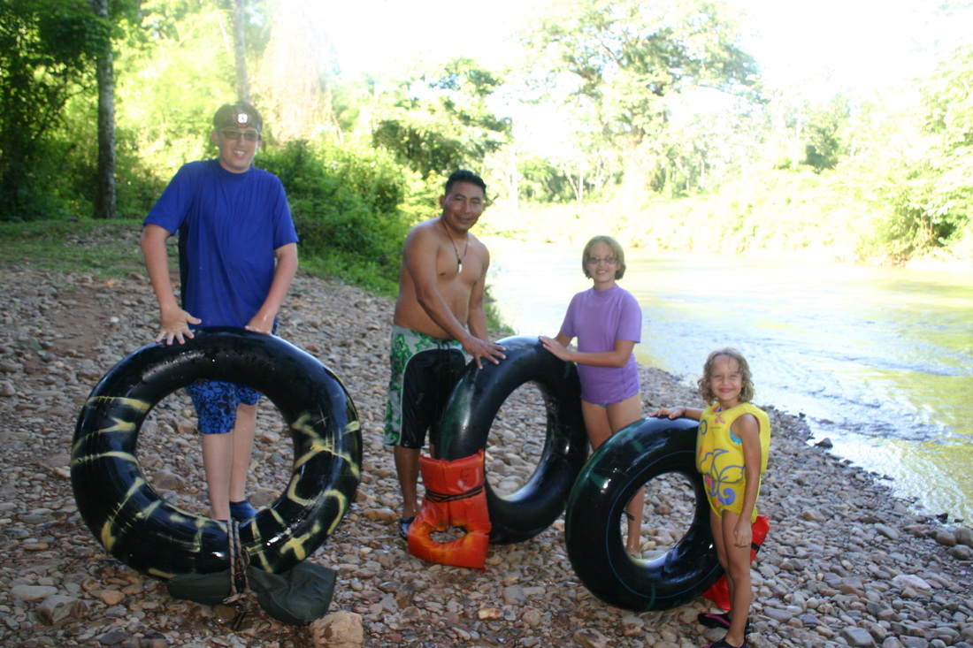
This is an adventures that can be enjoyed by all ages. The important thing is that everyone feel comfortable and safe. If someone needs to go a little slower or have their inner tube carried for them, our guides will assist.
A trained professional guide, knows and understands river conditions. Their training has taught them the critical behavior of the river, especially as it relates to rising water (when it rains), and how this can affect the conditions inside the caves.
After it rains, seasoned licensed guides are the first to go in and inspect the water levels as they recede inside the caves. A park warden accompanies them, so this information can be passed along to the main office, and other companies can benefit. All guides (for the Belize Government), are licensed tour guides and are certified in first aid and CPR (cardiopulmonary resuscitation) as required. They are very well trained, and most are in the caves every day, if not once a week. We stay aware of weather conditions, and when there are rains that flood the caves (which doesn't happen often), we alter tours for safety reasons.
This is an adventures that can be enjoyed by all ages. The important thing is that everyone feel comfortable and safe. If someone needs to go a little slower or have their inner tube carried for them, our guides will assist.
YOUTUBE VIDEO CLIPS OF CAVE TUBING IN BELIZE
|
|
|