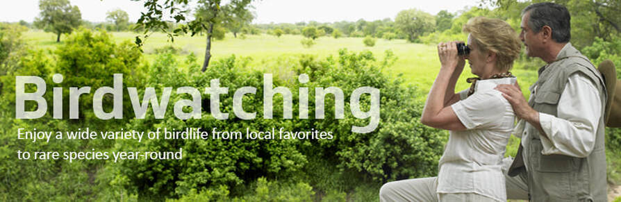
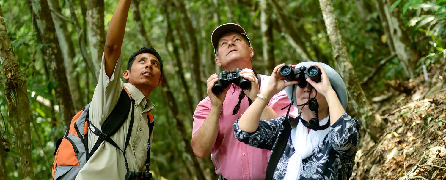
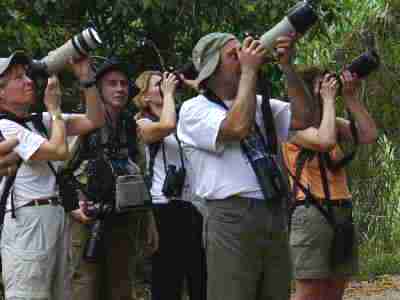
BIRDING IN BELIZE
|
Because of its extensive protected forests, varied wetland habitat, and location on a major migratory route, Belize is a mino mecca for both novice and experienced birders, who arrive throughout the year and from all over the world. The Belize Audubon Society (www.belizeaudubon.org) reports 587 recorded bird species in Belize, about 20 percent of which are migrants from other parts of North America. The Belize Audubon Society (BAS) helps manage many of the country's wildlife reserves and maintains updated checklists and field guides. Always check with BAS for the latest sightings, and you can purchase several bird guides in the central BAS office in the historic Fort George area of Belize City.
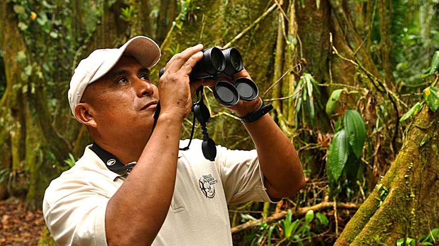
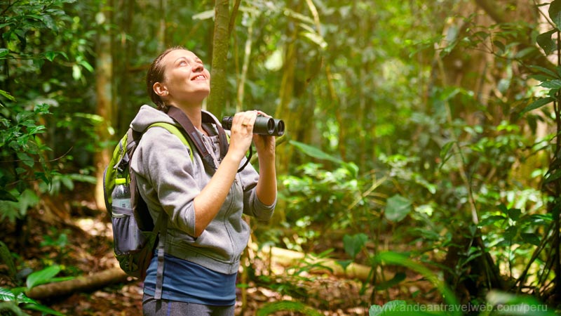
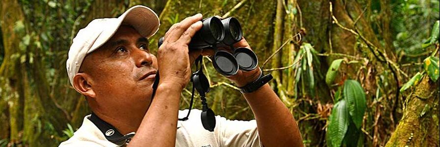
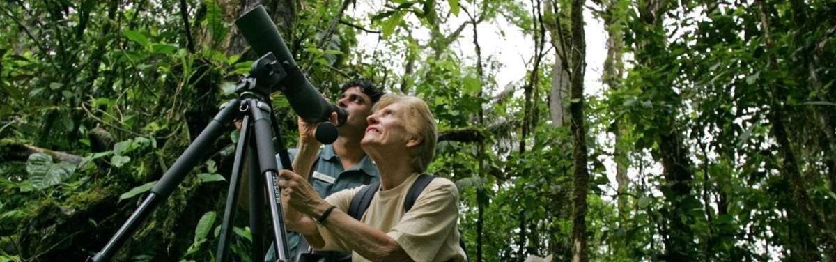
A number of lodges throughout the country cater specifically to birders. A sure sign is if they have downloadable bird checklists on their websites. Another is whether or not they employ guides; many inland resorts have brilliant Belizean birders on their staff for daily sunrise walks and other activities. Belizean park rangers also generally have excellent bird identification skills, notably Israel Manzanero, who works at St. Herman's Cave and Blue Hole National Park; his knowledge is legendary in birder circles. Twitchers on a serious mission (motmot or death!) can choose from several bird-centric tour operators; this is for those who'd rather let someone else (someone who knows where the birds are) handle the logistics of a countrywide tour, so you can keep your eyes glued to the binocs. Bring binoculars; wear boots, a lightweight long-sleeve shirt, and lightweight trousers; and carry a copy of Birds of Belize by H. Lee Jones, illustrated by Dana Gardner. For details about specifics you're likely to encounter, or to participate in the annual Christmas bird count, consult the Belize Audubon Society's website, particularly the "Birds of Belize" section. |
WHERE TO STAY
Bird Friendly 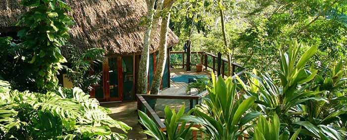
Chaa Creek Eco Lodge - Cayo District
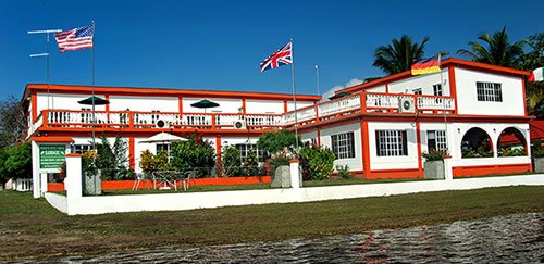
Birds Eye View Lodge - Crooked Tree Village

|
Birds are Everywhere
Birds are everywhere in our lives. Can you think of a day that went by without seeing or hearing a bird? As many as 587 birds have been recorded in Belize, of these, approximately 20 percent are migrants from North America. Every year new species are being documented. Eight new records were accepted in 2007, including the Crested Caracara, Canada Goose, and Spot-breasted Oriole.
Belize is an ideal setting for bird watchers with many birding hotspots. In addition, six Important Bird Areas (IBAs) have been identified in Belize, of which portions are located within protected areas, including those co-managed us. The tropical forests, savannahs, numerous cayes, wetlands, and coastal plains of Belize offer a myriad of habitat to many birds. Nearly half of our nation’s land and adjacent waters are protected under forest reserves, marine reserves, wildlife sanctuaries, national parks and other protected area designation. With English as the official language, many visitors from abroad converse easily with local guides.
Birds of Belize (University of Texas Press) by H. Lee Jones, illustrated by Dana Gardner is a must have for birders. Published in 2003, this is the first complete guide to the identification of all to the birds of Belize. This book is available for purchase at our gift shop in Belize City and our park visitor centers.
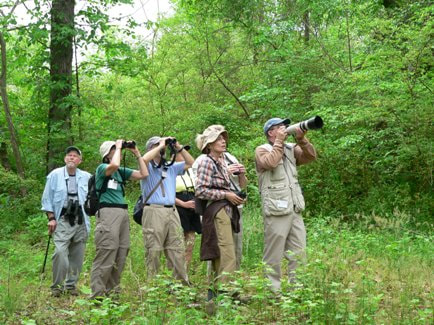
GROWING INTEREST IN BIRDER'S
A growing number of hotels and tour companies in Belize are catering to the special needs and interests of birders, and a few are targeting birders specifically. You'll find nature trails recorded species lists, and viewing platforms at many locations throughout the country, particularly among the Cayo District lodges.
The first annual Belize Bird-Fest was held October of 2018, under the sponsorship of the Belize Audubon Society. Northward migration peaks in early October and rare transients can be spotted along with resident birds. Itineraries take birders to reef, wetland, savannah, and forest habitats.
The first annual Belize Bird-Fest was held October of 2018, under the sponsorship of the Belize Audubon Society. Northward migration peaks in early October and rare transients can be spotted along with resident birds. Itineraries take birders to reef, wetland, savannah, and forest habitats.
|
When is the best time to go birding in Belize?
Throughout the year are joined by migratory birds that are escaping the harsh North American winters, and during the Belizean summer months, which can be rainy, other migratory birds come from South America. The majority of birders and organized tours come to Belize from January to April, however, this may have more to do with the fact that it is the tourism high season (Belize's dry season), than this being the best time for birding in Belize. BIRD WATCHING LOCATIONS
CROOKED TREE WILDLIFE SANCTUARY
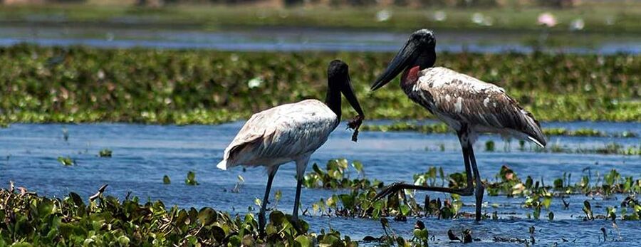
Take a guided boat tour of these vast wetlands, host to a spectacular variety of wading birds, especially during the dry season (March through May). This is the last Central American stronghold of the jabiru stork - the tallest flying bird in the Americas, which can reach five feet in eight, with up to a 11-foot wingspan. LAMANAI ARCHAEOLOGICAL ZONE Enjoy the extensive river and lake sections as you travel to and from the jungle-encrusted, bird-choked ruins of Lamanai. All four species of trogon found in Belize can be seen here, along with many woodcreepers and woodpeckers. Be sure to watch for both blue-crowned and tody motmots, which burrow into unexcavated ruin walls to nest. MOUTAIN PINE RIDGE FOREST RESERVE Overlapping microclimates and habitats are favored by several species of extremely rare raptors, including the rare orange-breasted falcon, which nests near Thousand-Foot Falls. At the Caracol ruins, you can spot a keel-billed motmot, especially in March and April. COCKSCOMB BASIN WILDLIFE SANCTUARY At Belie's preeminent birding destination, beginners will be overwhelmed by the abundance of wildlife and serious birders have a shot at a "big day" spotting 100 species in a single day. Some of the less traveled trails, like the Antelope or Gibut Loops, may give you the chance of spotting a pheasant cuckoo. Also, swarms of army ants attract ground dwelling species, such as tanagers and woodcreepers. THE NORTHERN CAYES - Ambergris Caye & Caye Cauler The mangroves and littoral forests of Caye Caulker and Ambergris Caye are disappearing, but these island are still a stopover for many migratories, plus theya re home to several threatened and endangered native species. Be sure to make a pilgrimage to the red-fotted booby colony on Half Moon Caye National Monument. RED BANK VILLAGE This small Maya settlement in southern Belize is the annual destination of one of Belize's last scarlet macaw populations (January through March). In March and April, various hawks can be seen over the peaks around the village, including swallow-tailed and plumbeous kites; the apolmado falcon lives in the surrounding pine savanna. AQUACALIENTE WILDLIFE SANCTUARY In Toledo District, near the village of Laguna, this reserve features breeding colonies of unique wading birds, as well as other species found no where else in Belize; most can be sighted within a half-hour drive from Punta Gorda. CARACOL ARCHAEOLOGICAL RESERVE Located in Mountain Pine Ridge, Caracol Mayan Ruins is one of the last outposts where the Keel-billed Motmot, a globally vulnerable sepcies is relatively common. Other notable birds seen at Caracol include the Ocellated Turkey, the Crested Guan, and the Great Curassow. While admiring the largest Maya site in Belize, you will also likely see colorful toucans and trogons. MAYFLOWER BOCAWINA NATIONAL PARK Adjacent to the Cockcomb Basin Wildlife Santuary, the Mayflower Bocawina National Park has over 7,000 acres of pristine lowland and highland rainforest. Along with offering tons of biring opportunities, the park is a great location for exploring mountains, waterfalls, walking trials, swimming holes, and Maya archeological remains. ST. HERMAN'S BLUE HOLE NATIONAL PARK Located just 12 miles south of Belmopan City, along the Humingbird Highway, the Blue Hole National Park hosts 575 acres of jungle waiting to be explored. The park is know for the popular sapphire-colored cenote and St. Herman's Cave, however, less explores are the well-maintained trails that makes bird watching very accessible. HALF MOON CAYE NATURAL MONUMENT Declared a crown reserve bird sanctuary in 1928, the Red-Fotted Booby colony of Half Moon Caye is the oldest site for wildlife protection in Belize. Half Moon Caye's population, an estimated 4,000 birds, is made up almost entirely of white morphs with black on the trailing edge of the wings. |
BIRDS OF BELIZE
Anis & Cuckoos
Antbirds, Antthrush, Spinetail Blackbirds & Cowbirds Boobies, Pelican, Cormorants Caprimulgios & Potoo Curassows & Quans Doves & Pigeons Ducks Eagles Elaenias & Tyrannulets Falcons & Forest Kites Foliage Gleaners, Leaftossers Flycatchers Gnatcatchers & Jays Grebes & Northern Jacana Gulls Hawks & Osprey Herons, Bitterns Honeycreepers & Euphonias Hummingbirds Kingbirds Kingfishers Manakins, Becards, Tityras Orioles Owls Parrots Plovers Quails & Tinamous Rails & Crakes Saltators & Grosbeaks Sandpipers Seedeaters & Buntings Sparrows & Finches Stilt, Avocet & Oystercatchers Storks, Egrets, Ibises Swallows Tanagers Terns Toucans Trogons, Motmots & Puffbirds Vireos Vultures Warblers Waxwing & Thrushes Woodcreepers Woodpeckers Wren's |
PROTECTED AREAS
Protected Areas allow birds to flourish and multiply.
Blue Hole National Monument
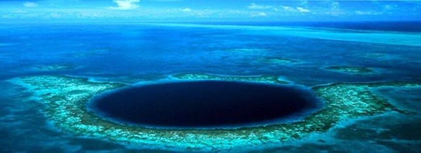
The Blue Hole, also known as The Great Blue Hole, is a stunning jewel set in a ring of corals. Measuring 1,000 feet across and approximately 450 feet deep, it is the world’s largest blue hole in the ocean. Divers descend into the Blue Hole’s tranquil abyss to see geological wonders and fascinating marine life. Giant stalactites, dripstone sheets, and columns are located in the Gallery at the southern rim of the Blue Hole. These structures formed in a dry cavern above sea level during glacial periods. Jacques Cousteau revealed the secrets of the mysterious Blue Hole to millions of viewers in 1971 through the television series The Undersea World of Jacques-Yves Cousteau. Today, dive boats follow the way of the famous Calypso to explore one of the world’s best destinations for scuba diving.
The History of Blue Hole Natural Monument - The Blue Hole has been able to provide a wealth of information on the geological history of the Lighthouse Reef Atoll, supporting theories of changing sea level and of a southward tectonic tilt during the Pleistocene, as indicated by the spiral patterning and tilting of many of the stalactites within the hole. Studies of one of the stalactites collected by the Cousteau team in 1977 show that the most recent transition from exposure to air to submersion in a marine environment took place during the period 11,500 to 10,200 BC, with a steady increase in sea level during recent geological time, inundating the Atoll with sea water [Jones et. al., 2000]. The United Nations World Heritage Committee formally adopted seven marine protected areas along the Belize Barrier Reef and its adjacent atolls as a World Heritage Site under UNESCO at their meeting in Merida, Mexico on December 4th, 1996. The Blue Hole Natural Monument is part of the Belize Barrier Reef Reserve System World Heritage Site. At the launching of the Belize Audubon Society’s 30th anniversary celebration in 1999, and agreement was signed between the Belize Audubon Society and the Government of Belize to co-manage BHNM.
Anchoring and Mooring at the Blue Hole Natural Monument
- There are three (3) permanent mooring buoys within the Blue Hole and designated anchoring sites around the perimeter of the Blue Hole.
- All mariners are required to contact Half Moon Caye park rangers prior to mooring or anchoring in order to get the GPS coordinates.
- Boat captains of vessels larger than 55 feet with a draft of 7 feet or greater, are required to contact Half Moon Caye park rangers in order to get the navigational way points.
Half Moon Caye Natural Monument
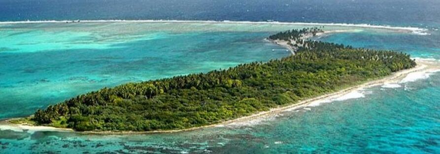
The Half Moon Caye Natural Monument (HMCNM) is located at the southeast corner of Lighthouse Reef Atoll. Lighthouse Reef Atoll is the furthest of Belize’s three atolls from the mainland, and one of only four such atolls in the Western Hemisphere. The atoll is an asymmetric rimmed platform, entirely surrounded by a fringing reef rising to the surface. Inside this fringing reef is a lagoon speckled with hundreds of coral patches which is known for its high density and diversity of corals and fishes.
The History of Half Moon Caye Natural Monument
It all started with the Boobies! In 1928, the western end of Half Moon Caye was gazetted as a crown reserve bird sanctuary under the Crown Land Ordinance to protect the habitat of the Red-footed Booby (Sula sula), making it Belize’s oldest site for wildlife protection.
In 1971, the Belize Audubon Society successfully lobbied the Government of Belize to expand the Reserve by acquiring five private lots on Half Moon Caye. Dr. Craig MacFarland of Centro Agronomico Tropical de Investigacion y Enseñanza (CATIE) acquired funding from conservation societies to purchase additional private lots. On October 20, 1979 the Crown Reserve was expanded to include the entire caye and part of the surrounding sea and reef. Under the National Parks System Act of 1981 Half Moon Caye comprising of 41.5 acres was designated a Natural Monument on March 4, 1982, together with 9,658.5 acres of its surrounding waters. It was the first protected area in Belize to be designated under this legislation.
The United Nations World Heritage Committee formally adopted seven marine protected areas along the Belize Barrier Reef and its adjacent atolls as a World Heritage Site under the United Nations Educational, Scientific and Cultural Organization (UNESCO) at their meeting in Merida, Mexico on December 4, 1996. Half Moon Caye Natural Monument is part of the Belize Barrier Reef Reserve System World Heritage Site.
Significant Features of Half Moon Caye Natural Monument - The Half Moon Caye Wall is a well known dive site described as “6,000 feet of vertical abyss”. This exquisite wall is unparalleled anywhere else in the world and provides a unique diving opportunity. Divers will be able to see a diversity of marine life in spur-and-groove canyons including corals, garden eels, and some of the most spectacular sponge formations. Larger pelagics such as eagle rays, sea turtles and groupers are often seen swimming in the blue.
The littoral forest primarily made up of the orange-flowered Ziricote tree, found on the western part of HMC, represents a small, endangered and fragile habitat that grows according to soil type and height above sea level. It supports what is considered the only viable breeding Red-footed Booby colony in the western Caribbean. The Booby colony supports the forest’s stability by providing guano as fertilizer. The colony can be viewed from an observation platform located in the littoral forest. The littoral forest also provides valuable habitat for other birds and reptiles. The endemic Island Leaf-toed Gecko (also known as the Belize Atoll Gecko) and Allison’s Anole are two lizard species of special interest because of their very restricted distributions.
The South eastern part of the island is an important sea turtle nesting ground. Every year the Loggerhead, Hawksbill, and Green turtles, all endangered species, go ashore to lay clutches of eggs. The marine turtle nesting and hatching season commences in May and usually ends in November. During this period the nesting ground is demarcated to prevent nest disturbance.
Getting There - Half Moon Caye Natural Monument of Lighthouse Reef Atoll is located 55 miles east of Belize City. Several PADI dive operators visit Half Moon Caye Natural Monument out of San Pedro, Caye Caulker, Hopkins, or Belize City. There are also charter services throughout the country, live-aboard dive ships, as well as island lodges that provide packages that get you there.
St. Herman's Blue Hole National Park
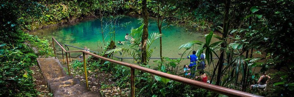
At St. Herman’s Blue Hole National Park (SHBHNP) there are unique geological features that can be found within 575 acres of forest rich with wildlife. The main attractions in this park, namely the St. Herman’s Cave and the Blue Hole, are connected by an underground stream. Visitors can walk 200 yards into the cave entrance unguided or can hire a guide to traverse the cave completely, seeing beautiful speleothems and Mayan artifacts. After a guided tour through St. Herman’s Cave, you can float peacefully back to the entrance of the cave on an inner tube.
The Blue Hole is a cool and refreshing place for an afternoon swim. It was formed by the collapse of an underground limestone cave. In this case, the river running through the original cavern still flows through the cave system, and forms a sapphire-colored pool at the bottom of the cenote. The depression measures about 100 feet deep and 300 feet in diameter, with the actual Blue Hole at the depression’s base having a depth of about 25 feet.
For a more extreme adventure, visit Mountain Cow Cave (also known as Crystal Cave). A guided exploration into this spectacular cave system will take you through huge caverns adorned with crystalline formations. Mayan shamans and priests once journeyed into this underworld known as Xibalba, to perform sacred rituals.
The History of St. Herman’s Blue Hole National Park
As far back as 1965, the site’s cave was recognized for its tourism potential. Part of the site was proposed as a National Park by James A. Waight in 1968 and the entire site was proposed as a National Park by FAO (1978).
The Government of Belize having acquired part of the site in the 1960s and the remainder in the 1970s, declared it as Blue Hole National Park on November 23, 1986.
In 1988, funds from the MacArthur Foundation were used to construct a retaining wall to prevent erosion around the concrete stairway and a trail way was made from Blue Hole to the opening of St. Herman’s Cave. The visitor center was opened on May 8th, 1996.
To avoid confusion with the Blue Hole Natural Monument (at sea), the park’s name was changed to St. Herman’s Blue Hole National Park in 2005.
Getting There - St. Herman’s Blue Hole National Park is located twelve miles southeast of Belmopan on the right side of the beautiful Hummingbird Highway. The park has two entrance areas with parking. At the St. Herman’s Cave entrance, you will find a picnic area, visitor center, gift shop, and trail heads. The second entrance provides easy access to the Blue Hole, a picnic area, restrooms, changing rooms as well as other trails. Buses traveling on the Hummingbird Highway can stop to allow visitors to get off at either entrance.
Cockscomb Basin Wildlife Santuary (CBWS)
Cockscomb Basin Wildlife Sanctuary (CBWS) is recognized internationally as the world’s first jaguar preserve. It is also known for its spectacular waterfalls, mountain views, nature trails, and rich diversity of neotropical birds. The tracks of wildcats, tapir, deer, and other wildlife are often seen on hiking trails or along the bank of South Stann Creek. Plan an extended visit so that you can appreciate all that Cockscomb has to offer. The park has cabins and campgrounds for overnight visitors. Please visit our accommodations page for more details.
People who understand the value of Cockscomb Basin Wildlife Sanctuary know that it is much more than a natural area set aside for jaguars. The area was also designated to protect the upper watersheds of important river systems that deliver ecosystem services to people. Cockscomb has two distinctive basins, which are separated by a ridge of land. The East Basin drains into South Stann Creek and the West Basin drains into Swasey River, a tributary of Monkey River. In the Maya Mountain extension of the Sanctuary is Trio Branch, this ultimately drains into Monkey River Watershed.
Cockscomb Basin Wildlife Sanctuary is a reservoir for biodiversity. Hundreds of species of plants with exotic leaves and flowers, colorful insects, singing birds, furry mammals, scaly reptiles, and wide-eyed amphibians live in this complex tropical forest community. Each one has a function that serves the community as a whole. Each one is adapted to the conditions that make the community unique. The mosaic of ecosystems in this rugged landscape suggests the limited extent of our knowledge of the Sanctuary’s biodiversity.
The forest at Cockscomb is a tropical moist forest. Warm temperatures and high rainfall with very little wind make the forest humid all the time. Tropical moist forests are found at a greater distance from the equator where rainfall and day length vary seasonally. They are distinguished from equatorial rainforests by a cooler dry season (February to May – although this may differ from year to year with the rains). It is still very wet- with about 100 inches of rainfall every year; rainfall in the Basin is higher, making it one of Belize’s wetter areas.
Tropical forests are disappearing at an alarming rate. Not only does this negatively impact the plants and wildlife, but the water cycle itself is disrupted, and the consequence is increased erosion because there is no vegetation to act as a “buffer” to hold the water in the plants and soils. We must carefully protect what is left because humans are members of the forest community with the power to conserve or destroy it.
The History of Cockscomb Basin Wildlife Sanctuary - In the early 1980’s, concern for the jaguars of Belize was raised from two different places. James Hyde, Permanent Secretary for the Ministry of Natural Resources had been approached by a concerned citrus farmer who had encountered jaguars in his orchard. At the same time, Archie Carr III, Assistant Director of the International Division of the New York Zoological Society, ran across references to jaguars in Belize in hunting magazines. He was in contact with Dora Weyer and asked if BAS would like a study of jaguars in Belize. Alan Rabinowitz, a graduate student at the time, was commissioned to determine the jaguar population.
Through Dr. Alan Rabinowitz’s ecological study conducted between 1982 and 1984, it was observed that the Cockscomb Basin contained the highest density of jaguars ever recorded. Therefore, in 1984, the area was initially declared a forest reserve with a “No Hunting” ordinance to protect the large jaguar population and other wildlife that make this place their home. However, after much concern that the Cockscomb Basin Forest Reserve was not protecting the jaguars’ habitat, a small portion of the Reserve was declared a wildlife sanctuary on February 26, 1986.
Ignacio Pop and his son, Pedro, were hired as the first wardens. On February 6, 1988, His Royal Highness Prince Philip, International President of the World Wildlife Fund, visited Cockscomb Basin Wildlife Sanctuary. He presented an award to Ignacio Pop and planted a mahogany tree.
Over the years, the Sanctuary has expanded from 3,600 acres to 128,000 acres. The Maya Mountain extension in the south connects Cockscomb with Bladen Nature Reserve. This makes a continuous corridor of protected areas totaling 250,000 acres.
Getting There - Cockscomb Basin Wildlife Sanctuary is located off the Southern Highway, approximately 20 miles south of Dangriga. Entrance fees can be paid at the Maya Center Women’s Group Gift Shop or at the Cockscomb Basin Wildlife Sanctuary Office, located 6 miles from Maya Center Village. From here, the actual park is six miles down an unpaved road. Visitors can drive, hike into the park (roughly 2 hours), or hire a local taxi from the village.
Public Transportation - Buses leaving from Belize City and Dangriga Town enroute to Punta Gorda Town can stop at Maya Center Village, if requested (about 3.5 hrs). All buses stop in Dangriga Town before proceeding south.
Flights are available from Belize City to Dangriga Town (Maya Island Air or Tropic Air) and take approximately 20 minutes. From Dangriga you can either hire a taxi to Cockscomb or take a bus to Punta Gorda Town and ask to stop at Maya Center Village.
Crooked Tree Wildlife Santuary
Crooked Tree Wildlife Sanctuary (CTWS) contains a mosaic of wetland and terrestrial habitats, which make it one of the best birding destinations in Belize. From the commonly seen Northern Jacana to the elusive Sungrebe, Crooked Tree offers an enjoyable experience for birders of any skill level. With 16,400 acres of lagoons, creeks, logwood swamps, broadleaf forest and pine savanna, you will be sure to see a wide array of wildlife. The Sanctuary protects globally endangered species including the Central American River Turtle (locally known as Hicatee), Mexican Black Howler Monkey, and Yellow-headed Parrot.
Crooked Tree is recognized as a Wetland of International Importance, especially as waterfowl habitat, under the Ramsar Convention on Wetlands. During Belize’s dry season many resident and migratory birds find refuge in the lagoons. Each year, on February 2nd, the Belize Audubon Society celebrates World Wetlands Day in the buffer communities of CTWS. A key to the conservation success of this globally significant wetland, is local community involvement.
The Jabiru stork is Crooked Tree’s most famous resident. Belize has the largest nesting population of these great birds in all of Central America. Jabiru storks arrive in November to nest in the lowland pine savannas. Two pairs of Jabiru storks are known to nest within the Sanctuary. After the young fledge, in April and May, the birds from the northern and central parts of Belize congregate at Crooked Tree and Mexico Lagoons. When the rains come, the birds leave to return again the following November.
Crooked Tree Village offers visitors a unique Belizean experience. Established around 1750 during the logwood period, Crooked Tree is perhaps the earliest inland European settlement in Belize. This island, in the middle of Crooked Tree Lagoon, is famous for locally grown and processed cashews. The Cashew Festival in May celebrates the many products of the cashew: stewed cashews, wines, jams, syrup, cookies, cake, fudge and of course cashew nuts. Festival go-ers also enjoy live music, dancing, games, storytelling, and friendly people. Accommodations are available for overnight visits and local guides can arrange walking, boating, or horseback-riding tours around Crooked Tree Village.
The Mayas lived in Crooked Tree several thousand years ago as is evidenced by the Chau Hiix Archaeological Site at the south-western corner of Western Lagoon. The site has a central pyramid that rises almost 75 feet above the flat lagoon landscape. Excavations of tombs have turned up beads, containers, blades and ornamental objects that are providing a glimpse into everyday life in one of the last inhabited Mayan settlements. The villagers of Crooked Tree informed the public about the presence of Chau Hiix in 1990. Dr. Anne Pyburn of Indiana University has been conducting research at this site since 1993. Dr. Pyburn called the site Chau Hiix, Mayan for jaguarundi, which inhabit the area. The site can be accessed by boat or canoe.
The History of Crooked Tree Wildlife Sanctuary
In the years before the establishment of the Crooked Tree Wildlife Sanctuary, the area attracted sportsmen in pursuit of legendary tarpon, trophy jaguars, and skies filled with waterfowl. Villagers welcomed the idea of a sanctuary as a way to limit the presence of hunters and to develop an ecotourism industry in Crooked Tree.
In 1971 Alexander Sprunt IV, Head of the U.S. National Audubon Society Field Office, along with Roland C. Clement and Mrs. Bradley Fisk, did an aerial survey of nesting sites for wading birds all the way from Florida along the coast of Mexico to Belize. Along with the Belize Audubon Society Vice President Dora Weyer, they visited Crooked Tree Lagoon in which they were particularly interested in because of its many water birds. As per the request of BAS and with the approval of the Government of Belize, Dr. Sprunt came back in March of 1972 to assess Crooked Tree and make recommendations about its creation as a wading bird reserve. In July he submitted his report and proposal for the establishment of a Natural Area Reserve at Crooked Tree Lagoon.
Jabiru stork protection was the Belize Audubon Society’s first advocacy project. In 1973 the Jabiru stork was added to Belize’s list of protected animals.
Crooked Tree Wildlife Sanctuary, the first Wildlife Sanctuary declared by the Government of Belize, was gazetted on December 8, 1984. On August 22, 1998, Crooked Tree Wildlife Sanctuary was declared Belize’s first Ramsar site based on the wetland’s significance, especially as waterfowl habitat.
Getting There
Crooked Tree Wildlife Sanctuary is just three miles off the Phillip Goldson Highway (Formerly Northern Highway). The junction is located about midway between Belize City and Orange Walk; approximately 30 miles from either direction. Bus services are available (Monday-Saturday) from Belize City to Crooked Tree Village.
Guanacaste National Park (GNP)
Guanacaste National Park (GNP) is a popular getaway, located only two miles from the capital city of Belmopan at the confluence of the Belize River and Roaring Creek. The park’s small size of 50 acres allows visitors to observe wildlife and tropical vegetation readily.
At GNP, it is easy to learn about plants and their traditional uses, fungus farming leaf-cutter ants, or the mini-ecosystem inside a bromeliad. Its habitat is known as a secondary broadleaf forest, which benefits many birds and wildlife, including the shy and secretive “tiger cat” or Jaguarundi and Black howler monkeys.
GNP is a place of natural and cultural features which illustrates the human and environmental interrelationships which has helped to form Belize. Connecting the highlands and the Caribbean coast, the Belize Old River was a major transportation route for the Maya people. Maya pottery and other artifacts were found during trail development and there is a suspected chultun (underground storage chamber) within the park. The river was also used to transport logwood and mahogany to the coast for export to Europe. Prior to its designation, the actual area of the park had been cleared for cattle pasture and was used by locals as a recreation, fishing, and hunting area. Visitors can now enjoy the bird observation deck overlooking Roaring Creek, where trains had once crossed. Lizards can be found basking in the sun at the site of an old quarry. In many ways GNP is symbolic of the balance between people and the environment.
The park was named from a very large and unusually old Guanacaste tree, spared by woodcutters because of its split trunk. This park features several large Guanacaste trees which are known for being one of the largest tree species in Central America with its wide-reaching branches that supports a variety of orchids, bromeliads, ferns, cacti, lianas and vines. The Guanacaste tree is highly prized for its resistance to insects and decay and is a choice timber for making dugout canoes or dories. The La Ruta Maya Belize River Challenge is an annual event held in March, visitors at GNP can cheer on the competing participants as they race by in canoes and traditional dories. This competition is the longest race of its kind in Central America.
Visitors can enjoy various recreational and educational activities throughout the year at GNP. The park provides a picnic area, interpretive displays, two miles of maintained trails, a bird watching deck, and a clean swimming area. It is a perfect environment for a class field trip or family gathering. In addition, join us in December for the Belmopan area Christmas Bird Count to see what winter birds can be found in Guanacaste National Park.
The History of Guanacaste National Park
The area was part of the land bought to build Belmopan and while it was under construction, the area was the back garden of the British site engineer. As a member of the Belize Audubon Society, he was a keen naturalist, and before his departure he zoned it as a reserve in the development plan for the area. Subsequently, it was gazetted in February 1973, under the Crown Land Ordinance as a National Park. Freehold was given to the BAS under the condition that the site be managed as a bird sanctuary or National Park. In 1975, at the request of BAS, its name was changed to Guanacaste Park. For many years, Guanacaste Park was managed by volunteer labor and donated materials. After 1987, there were BAS personnel at the park full time. First, was Peace Corps Volunteer, Matthew Miller, who is now the Director of Monkey Bay Wildlife Sanctuary.
On April 22, 1990 (World Environment Day) Guanacaste was declared a National Park. Villagers from nearby Roaring Creek participated in a Community Workshop in October of 1992. They formed the “Friends of Guanacaste” support group and provided valuable input into the Management Plan for Guanacaste National Park, which was completed in 1993 by a committee headed by Peace Corps Volunteer, Robert Mackler.
An educational display was prepared by Peace Corps Volunteers, Bonnie Gestring and Rebecca Nealy. The Guanacaste Education Center was officially opened on March 18, 1994, and dedicated to Peace Corps Belize in recognition of their volunteer service to the Belize Audubon Society’s Protected Areas Management and Environmental Education Programs.
Getting There
Guanacaste National Park is the most accessible of the Belize Audubon Society managed protected areas; located less than two miles from the capital city of Belmopan at the intersection of the Hummingbird and Western Highways. Buses can be stopped right outside the park.
Victoria Peak National Monument
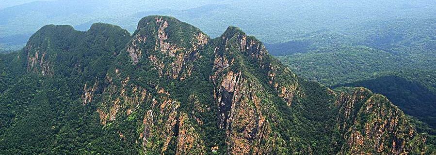
Summiting Victoria Peak is the height of adventure in Belize. Rising abruptly from the lowlands, the jagged Cockscomb Mountains are an impressive mass of rock that is visible from the coast. Victoria Peak is the highest mountain in the range at a height of 3,675 feet and the second highest elevation in Belize.
The Victoria Peak Trail is open during Belize’s dry season, February 1 – May 31. The opening season, however, is contingent on the length of the rainy season which sometimes overlaps into February of the following year. Similarly, although the rainy season technically begins on June 1, it may start early, causing the Victoria Peak to close earlier than usual.
The out-and-back on the Victoria Peak Trail, which is 27 kilometers one-way, is a 3-4 day hiking adventure in the great wilderness of Belize. All hikers must be accompanied by a licensed tour guide (experienced tour guides can be hired from the local communities buffering the Cockscomb Basin Wildlife Sanctuary).
The Victoria Peak Trail begins at the park headquarters of Cockscomb Basin Wildlife Sanctuary. In order to get an early start on the trail, an overnight stay at Cockscomb is recommended. Following an old logging track, the first stretch of trail is mostly flat. After crossing the Sittee River is the 12K camp, where you can enjoy lunch around the picnic table. A lot of hard work, by Trekforce Volunteers, has been put into developing the camping areas along the Victoria Peak Trail. The sites have cookware, so you don’t have to carry extra weight in your backpack. A palapa/shed offers protection from the rain and is an ideal area to set up a medium-sized tent or camping hammocks. Please remember to leave no trace and pack out your garbage. And drink plenty of water; pit latrines are located at each campsite.
Most groups continue to the 19K on the first day, while their energy is still fresh. Jaguar signs and other wildlife activity are frequently seen along the way. The trail becomes more difficult, with a series of up and down grades, with no switchbacks. Among these is the infamous Heartbreak Hill. After a long day of hiking, enjoy the waterfall near the 19K camp.
Summit day is another full day of adventure. You will hike to the top of Victoria Peak and back to 19K camp. Leave your heavy pack at camp and bring a day-pack to carry your essentials. At the base of Victoria Peak, begin scrambling up a rocky stream bed, which leads above the moist tropical forest canopy. Most of the ascent is class 3 hiking and a rope and harness are required to climb a short class 4 rock gulley. See the great expanse of Belize from the summit of Victoria Peak, which offers panoramic views of the surrounding wilderness. On a clear day you can see the beautiful coastline.
Victoria Peak Natural Monument has beautiful and unique flora. As you ascend above tropical moist forest, the vegetation changes to elfin shrubland, characterized by sphagnum moss and a canopy of trees is no more than two to three meters high. At this height, the East Basin of Cockscomb looks like a green carpet of forest stretching as far as the eye can see. Whatever trees are in bloom are easily seen. And just before the summit you will encounter a humid and rich forest environment sheltered by Victoria Peak. The fiery-colored orchid (Epidendrum ibaguense) is another botanical wonder of Victoria Peak. This rarity in Belize only grows at high elevations.
*All individuals/groups interested in hiking Victoria Peak should register early to get all necessary information.
The History of Victoria Peak Natural Monument
The first recorded expedition to the Cockscomb Mountains was led by Governor Roger T. Goldworthy in 1888. From 1927 to 1928, there were three more expeditions into the Cockscomb Mountains. They found that the peak described by the Goldworthy Expedition was not the highest peak, and therefore not Victoria Peak. Clearly, whatever peak the Goldworthy Expedition climbed, the name “Victoria Peak” was given to the highest peak of the Cockscomb Range, in honor of Queen Victoria.
On May 2, 1998, Victoria Peak was declared to be a Natural Monument. Prior to this declaration, Victoria Peak was part of the Cockscomb Basin Wildlife Sanctuary. At the launching of the 30th Anniversary Celebration on February 6, 1999, an agreement between the Belize Audubon Society and the Government of Belize was signed, adding Victoria Peak and Blue Hole Natural Monuments to the list of protected areas managed by the Belize Audubon Society.
Getting There
Victoria Peak Natural Monument can be accessed through Cockscomb Basin Wildlife Sanctuary in the Stann Creek District of Belize. Visit the Cockscomb Basin Wildlife Sanctuary page for more details.